Messy, large system late this week
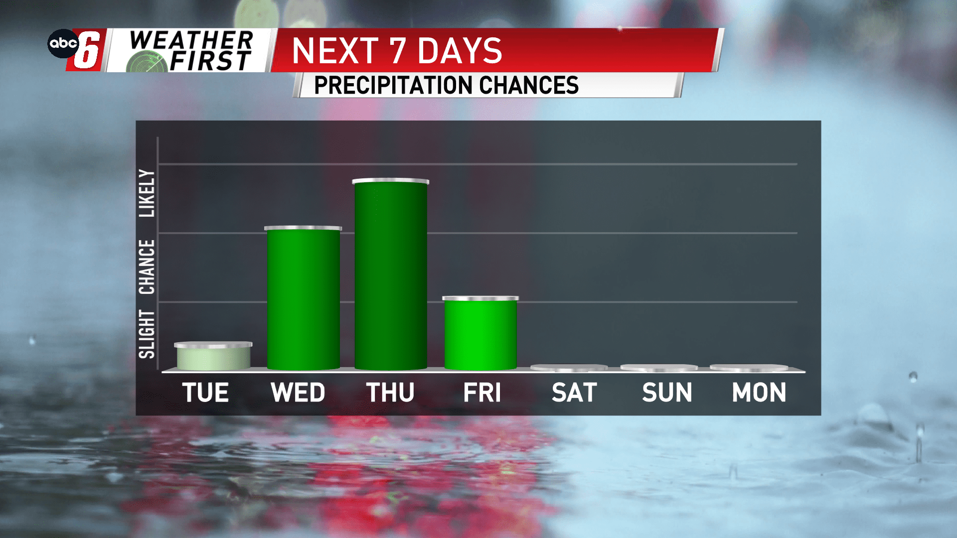
It’ll bring rain chances. It’ll bring warm temperatures, wind but also colder temperatures and even snow too. We’ve got a lot lined up with this upcoming system for Wednesday-Friday.
Let’s talk temps first. They’ll be building up to the mid 60s for both Wednesday and Thursday. That said, there’s a stout breeze in place so it won’t be pristine. A powerful cold front advances through Thursday evening. This will lead to a sudden, sharp drop in temperatures. We’ll go from mid 60s to mid 20s in about 12 hours. Highs only manage about the freezing point on Friday.
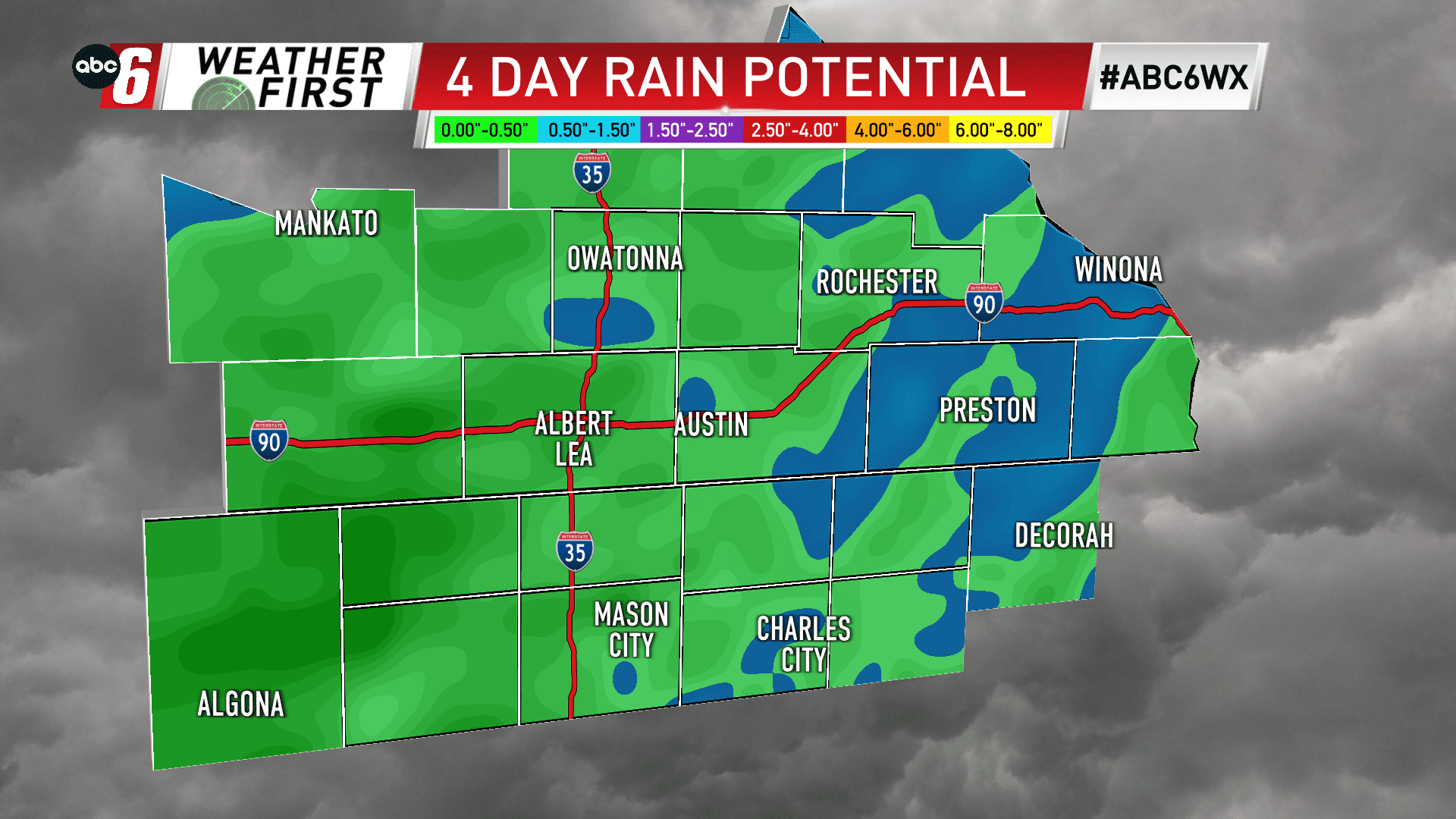
That cold front brings the best opportunity for rain. Thursday afternoon/evening. This is where we’ll pick up the bulk of roughly 1/2″ of rain in the three day stretch. For Tuesday night/Wednesday and again Wednesday night into Thursday, our northern and western edges will have the chance at some widely scattered showers and even a few rumbles of thunder.
Any snow flakes on Friday are minor. A dusting is possible at best. But the wind and cold won’t make that forecast feel any better.
The wind will be strong, gusts around 30-40 mph each day will be potent. Potent in warming and potent in cooling! It’s out of the south initially for Wednesday and Thursday but turns westerly on Thursday night and Friday. Add in a few snow flakes on Friday… it won’t be too pleasant of a day. That said, I don’t expect to receive enough snow for there to be much impact from snow/wind related effects.