Major winter storm impacts in two parts – Part 1
Two parts with this upcoming winter storm trip us up. It’s the second that you’ll want to really be mindful off.
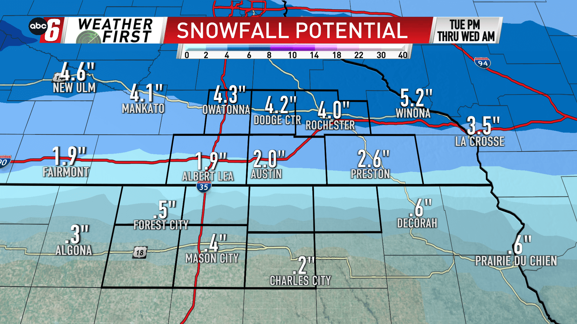
The first, a wave of snow sliding through from Tuesday mid-day to early Wednesday morning will yield anywhere from a dusting south in north Iowa to as much as 5″ along and north of US 14.
A brief break will carry through the afternoon. While the snow may not completely shut off, anything that falls will be minimal. The main band arrives by afternoon/evening from the south. We’ll focus more on that in another post.
This will be a nuisance amount of snow. Higher amounts will fall to our northwest where there’s a Winter Storm Warning in effect for Tuesday and Tuesday night.
A wind will start to increase Tuesday night into Wednesday, eventually gusts will move north of 25 mph into early Wednesday.
The evening commute can expect some snow covered roads and that extending into the overnight. Impacts will be lessened moving south where totals are less.


