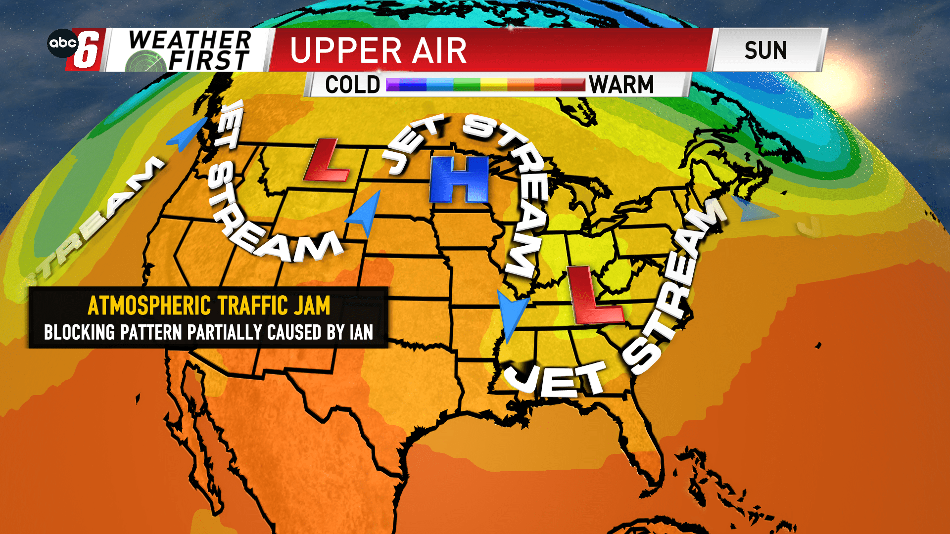
Ian blocks things up
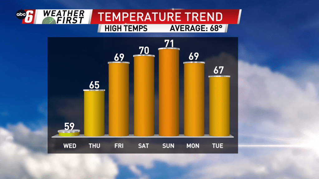
We’ll be stuck with comfortable conditions for the next week to week and a half ahead.
Currently, we have a big ridge of high pressure in control of the Midwest. A cut-off low is developing over the Pacific Northwest and will ultimately settle down over the Mountain West. But it’s Hurricane Ian surging up from the south that will further complicate the upper air pattern.
Each of these features helps induce a stagnant jet stream. It helps promote either the jet stream abandoning to the north due to all of the features mentioned above or winding around these features with a lot of north/south movement. i.e. a blocking pattern.
The prevailing winds normally do move west to east around our latitude but often do have some fluctuation. But to this degree is extreme.
While these blocking features are present we are stuck with what we’ve got. And right now, that’s high pressure and it will mean clear skies and a lot of dry time over the next 10 days.
Temps will be in the upper 60s and low 70s in the stretch.