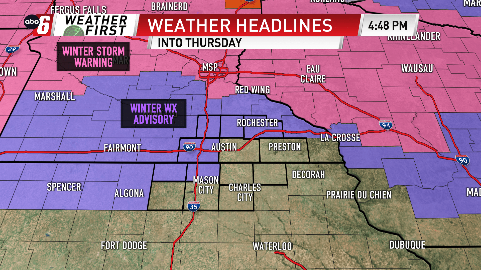
Heavier band of snow in Minnesota overnight
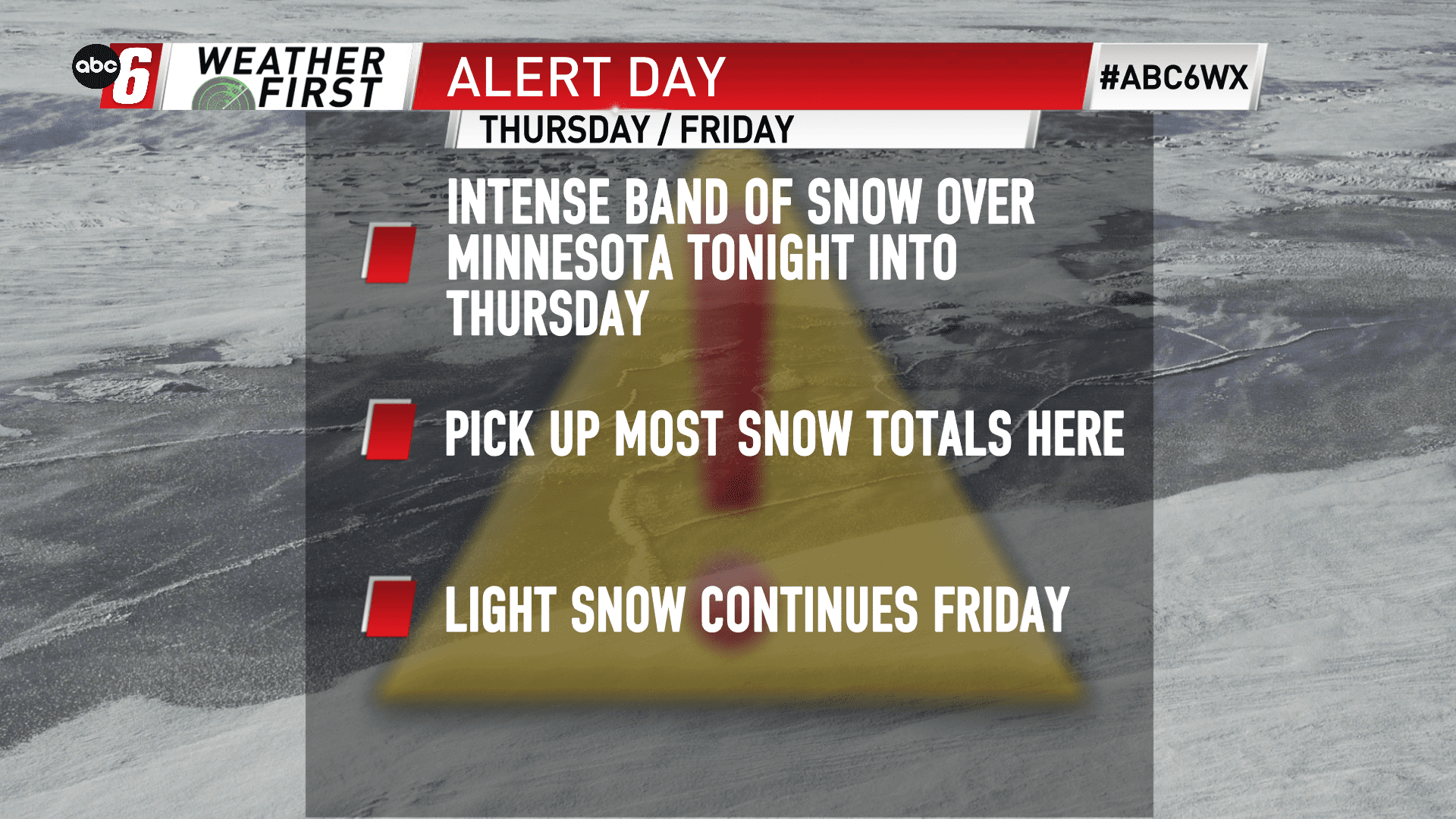
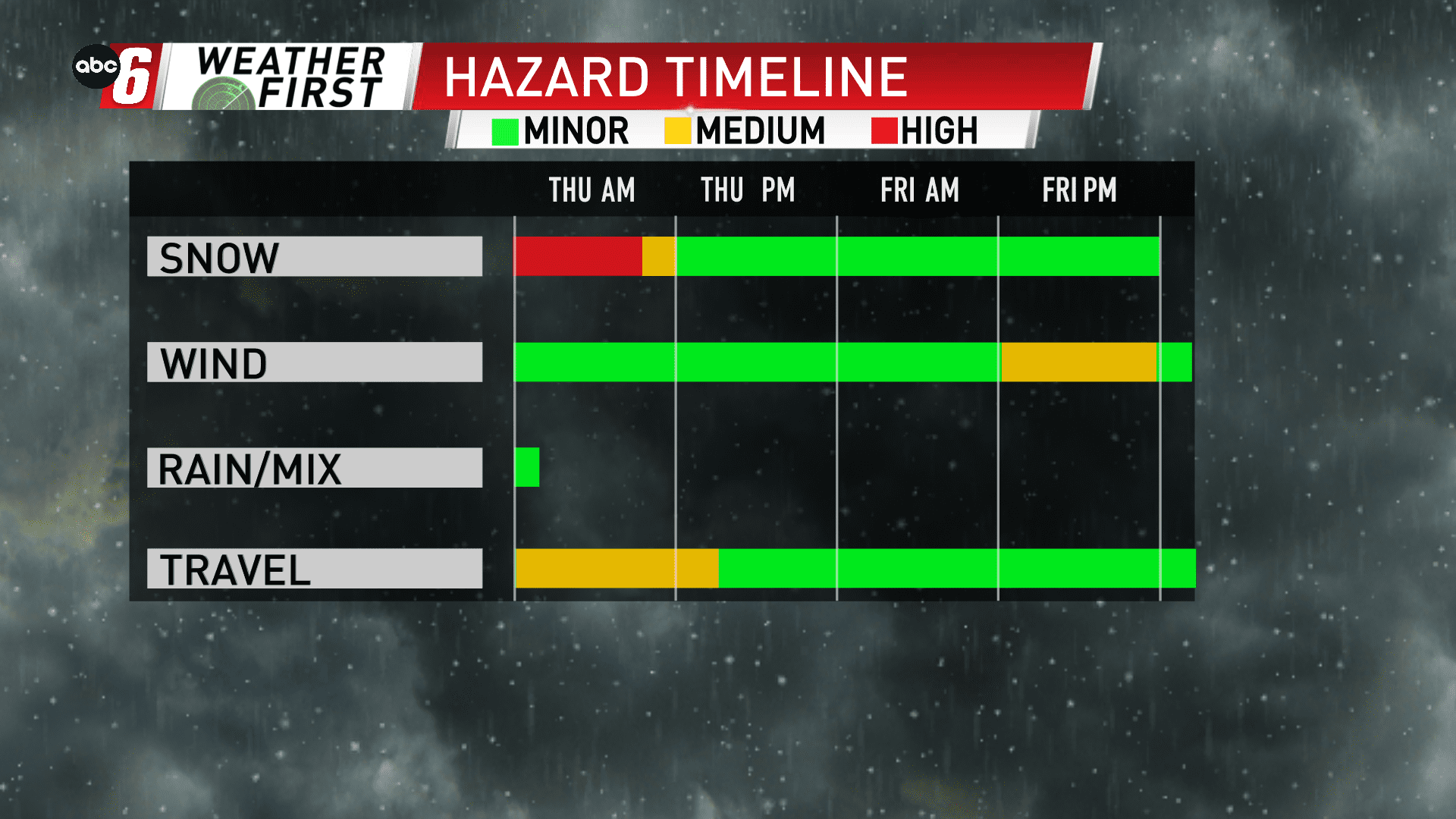
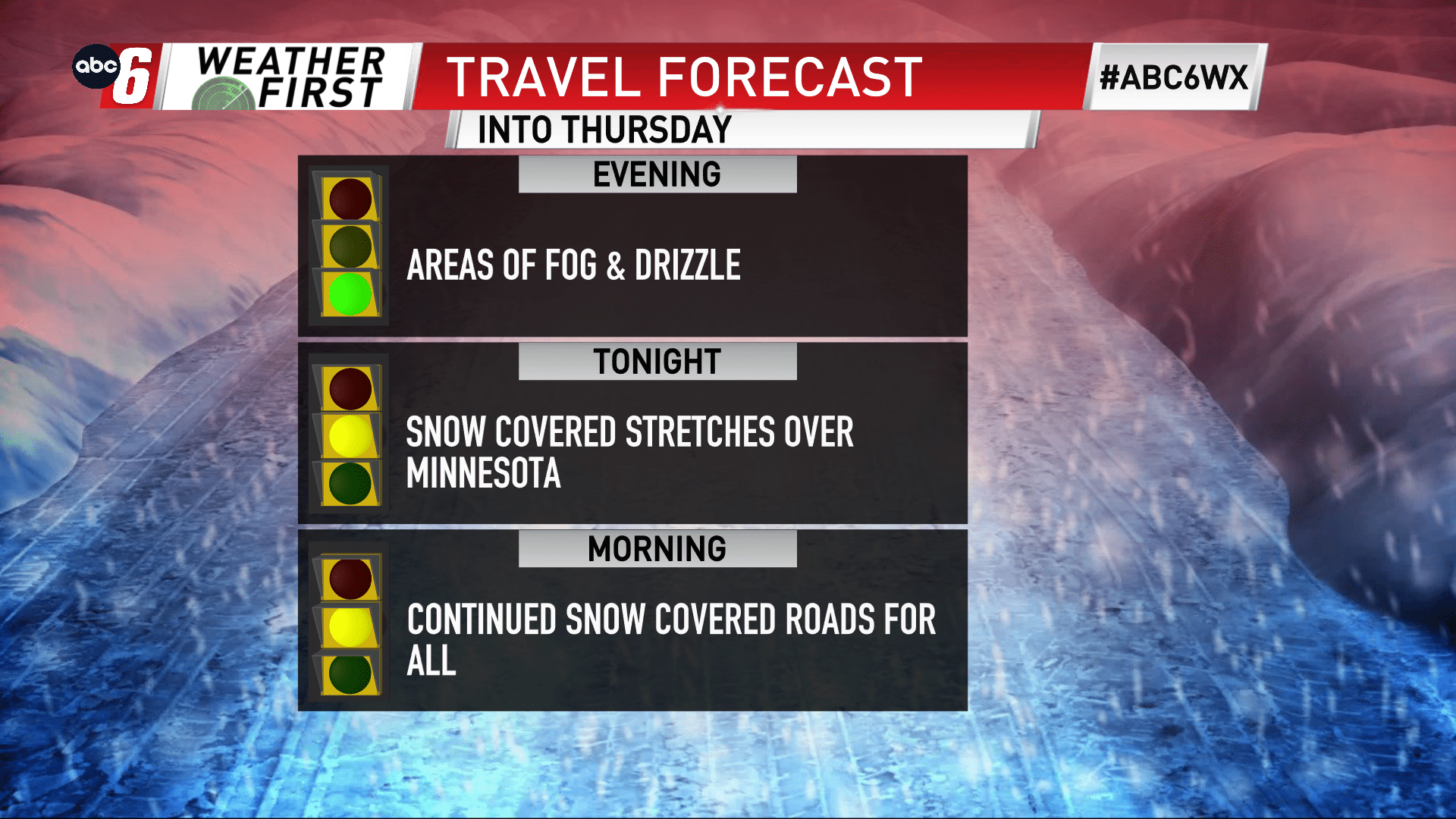
Our strong storm system continues to cycle through the Midwest. Snow looks to arrive over southern Minnesota overnight in a band that will provide some heavier snowfall rates. The difference here, this one will be arriving from the east. It’s backwards from ‘normal’. Either way, we have a steady stream of moisture moving in that may provide some brief pops of 1″ per hour snow rates near US 14 overnight into Thursday morning. But not everyone will see snow. Iowa will be snuffed being held in the dry section of the storm for longer. Totals will range because of this.
The timeframe to watch for this heavier band will be from midnight to 8 AM. Eventually everyone will get into the snow, but by the time Iowa gets into it, the intensity will be lessened.
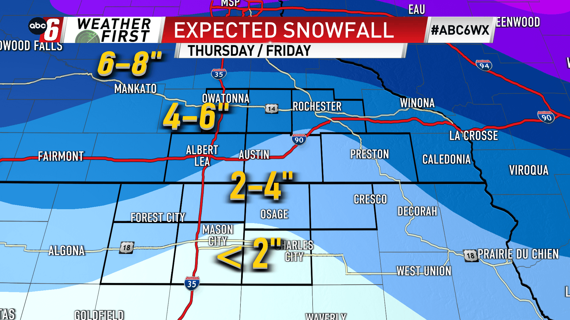
Light snow showers will continue Thursday evening throughout Friday. But the bulk of our snow accumulations will be picked up before this period.
1-6″ is possible across the area. See the breakdown below. The highest amounts some 3-6″ will generally be over the Minnesota side with 1-4″ being generally south of the border.