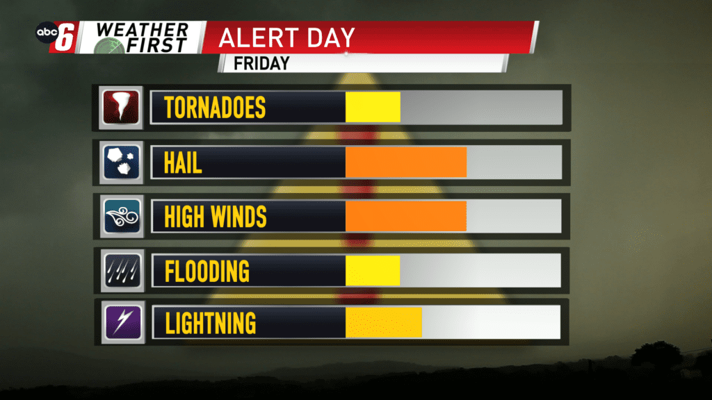
Friday afternoon set up for storms
While rain starts Thursday afternoon and dots the area through Friday morning, the key focal point to the forecast is Friday afternoon.
From 1-6 PM, be weather aware as thunderstorms erupt over the area and race eastward. It is becoming more likely that a warm front splits our area, rising as far north as Forest City to Albert Lea to Rochester. Temperatures will range from 40s to near 70° locally. South of the front has the best opportunity for seeing those strong/severe storms build.
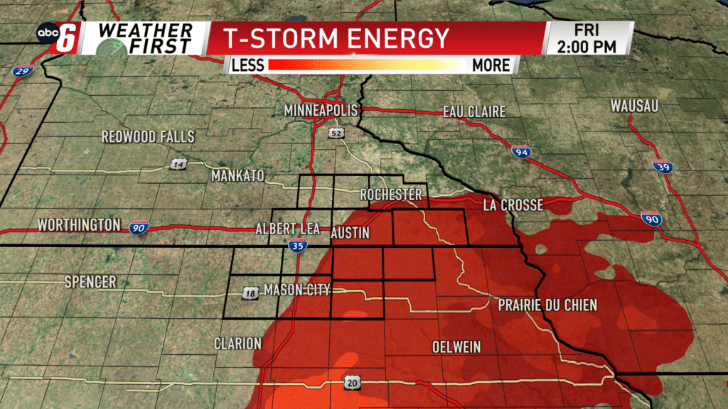
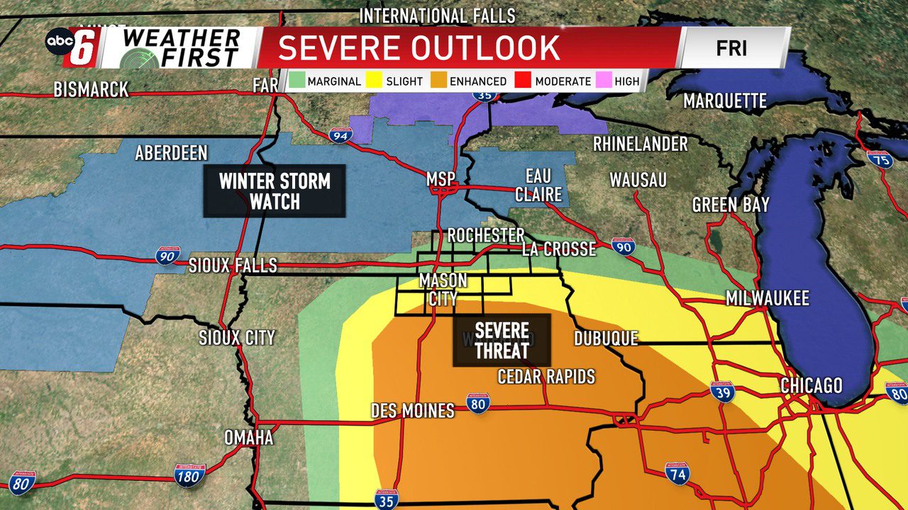
In this early season setup, it doesn’t take a ton of energy to kickstart a threat. This is one of those cases. The best T-Storm energy is south of the state line. This is where a level 3 of 5 “Enhanced Risk” is in place in the Severe Weather Outlook. With the system being so dynamic, storm threats will include wind (primary threat) hail and tornado potential.
Storms will be fairly transient, racing northeastward very quickly with time.