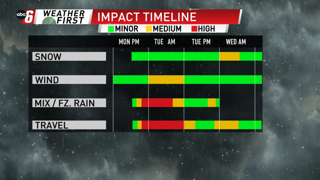
Freezing rain takes over into Tuesday
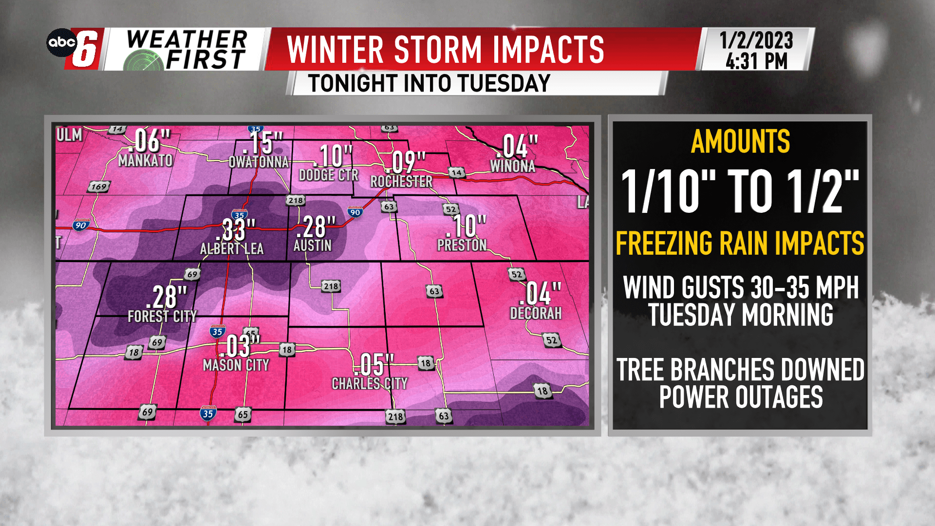
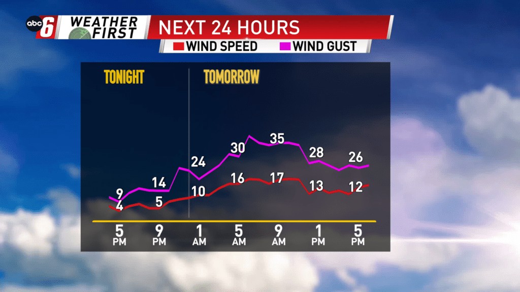
Freezing rain is on the mind for tonight into Tuesday morning. Temperatures tonight into Tuesday morning will be below freezing. With rain falling, icing will occur. Amounts will range from 1/10″ to 1/2″ across our area. Most of the accumulation will occur through mid-day. Add in some stronger wind gusts, 30-35 mph from the NE and it is possible the weight of the ice brings down power lines, causing outages and tree limbs come down too. A slight edge to the higher amounts of icing is expected closer to the I35 corridor.
We’ll enter the dry slot of the storm for the afternoon and evening. While a stray shower/drizzle will be possible, it will be less persistent as the morning timeframe. At the same time, temperatures will warm above freezing after noon on Tuesday. Both aspects will help alleviate some of the worst effects in the afternoon. North Iowa will be the first to warm above freezing, even before noon, and stands to see the least impact locally due to this.