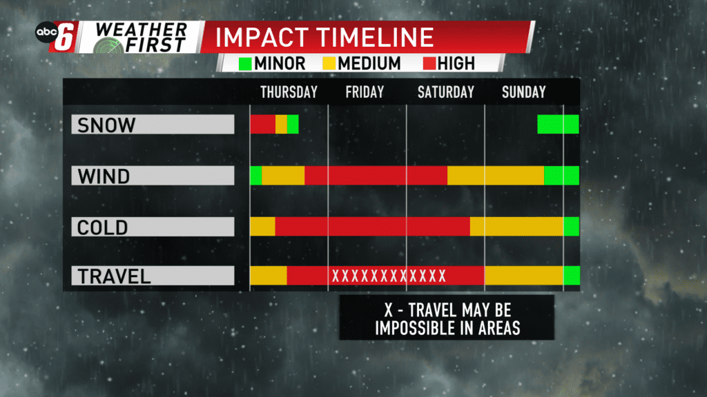
First comes snow, then comes wind

The window to get out of the Midwest south and east is closing quickly.
Snow is falling tonight into Thursday morning. Wrapping up by sunrise, we’ll be looking at widespread amounts in the 3-6″ window with a few slightly outside these bounds. A Winter Storm Warning is in effect for the entire area through Thursday afternoon to account for the snow.
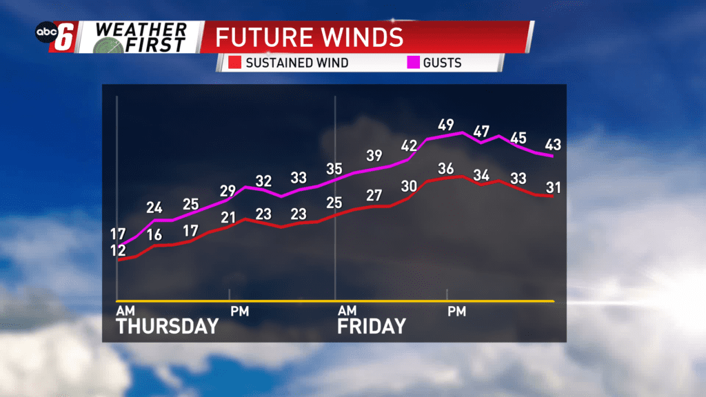
The snow alone will be cause for slowdown on our roads, but travel will still be possible. The wind isn’t a huge factor just yet, but other vehicles may stir up the light, fluffy snow and drop the visibility in traffic so use caution. Wind will change direction to the NW after midnight and start to ramp up as snow is exiting. Wind gusts of 25-40 mph are possible on Thursday. Blizzard conditions, meaning whiteouts, will be possible most prominently in the afternoon and beyond. A Blizzard Warning will take over Thursday afternoon and carry through Saturday morning as wind increases to create whiteout conditions. With 3-10″ of snow already on the ground and an additional 3-6″ coming, there will be more than enough to do damage in this department.
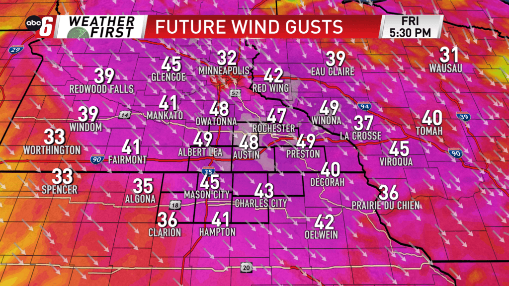
The strongest wind ahead is on Friday. That’s where gusts run 40-50 mph through the day. The worst of the blowing/drifting snow along with whiteouts will be found here.
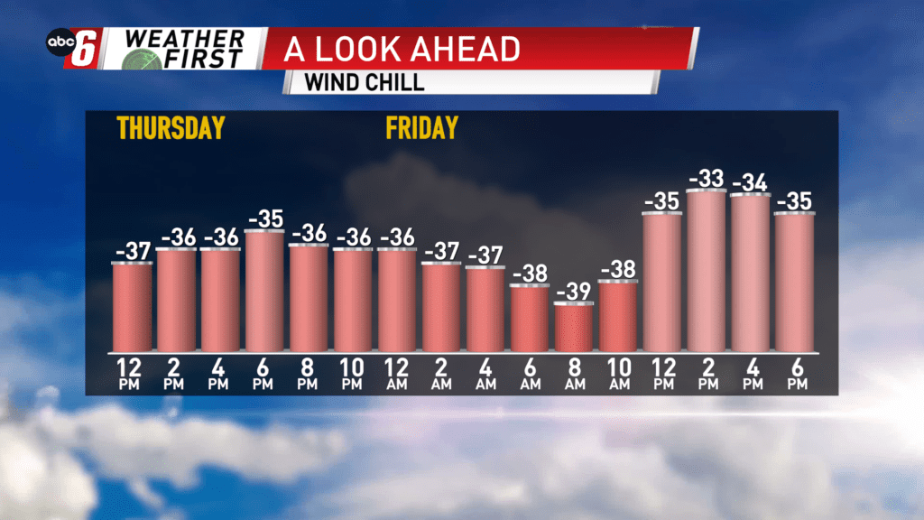
Concurrently with the strongest wind, we have the coldest cold. From Thursday night through Sunday morning, wind chills will run constantly in the -25 to -40° range. Air temps will be below zero constantly through the period too… at times down into the -10s. This is a dangerous scenario considering the impact expected on the travel scene.
Conditions in town may seem drastically different than out of town in wide open, rural areas. Areas away from town will be the hardest hit and where the most dangerous conditions will be observed.
It is possible that some power outages occur due to galloping lines and some trees with added weight of snow on them initially. Plan on having backup power sources and alternate means to stay warm ready in case power is lost.