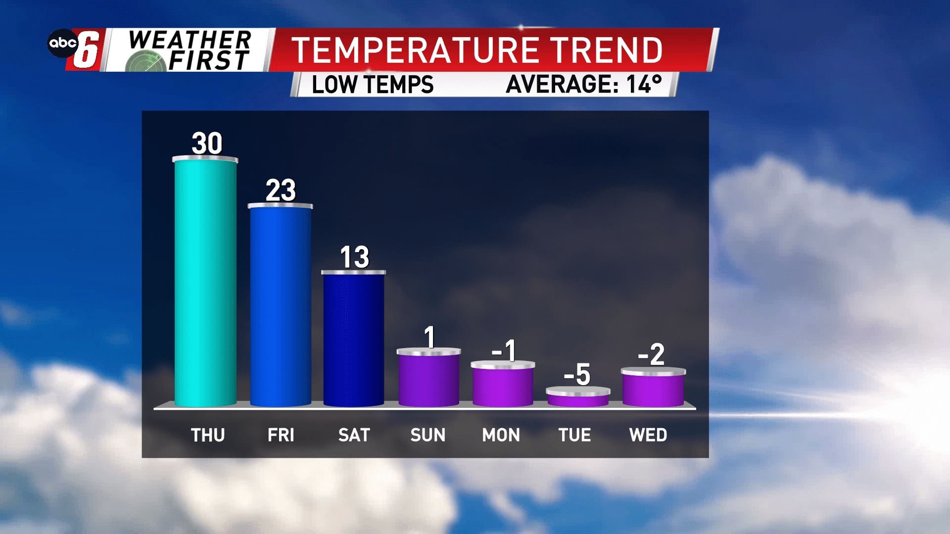
Cooling down this weekend, bitter blast looms
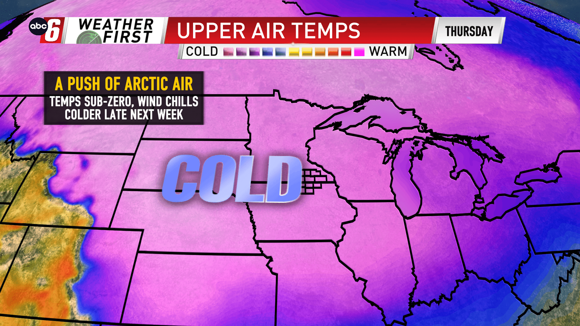
We’ll see the temps begin to slip this weekend but a larger surge of colder air arrives for the end of next week. This pattern should bring temperatures well below normal our way. With the cold setup, temperature forecasting is finnicky at such a distant. The specific temps are greatly influenced by the daily weather factors. As of now we have sub-zero temperatures by night, single digits by day. But it is possible we could be colder than what’s currently advertised if we can catch some clear skies.
Wind does look to be a bit of an issue meaning wind chills and the possibility of blowing snow as we should have a loose snow pack on the ground.
More details will come.
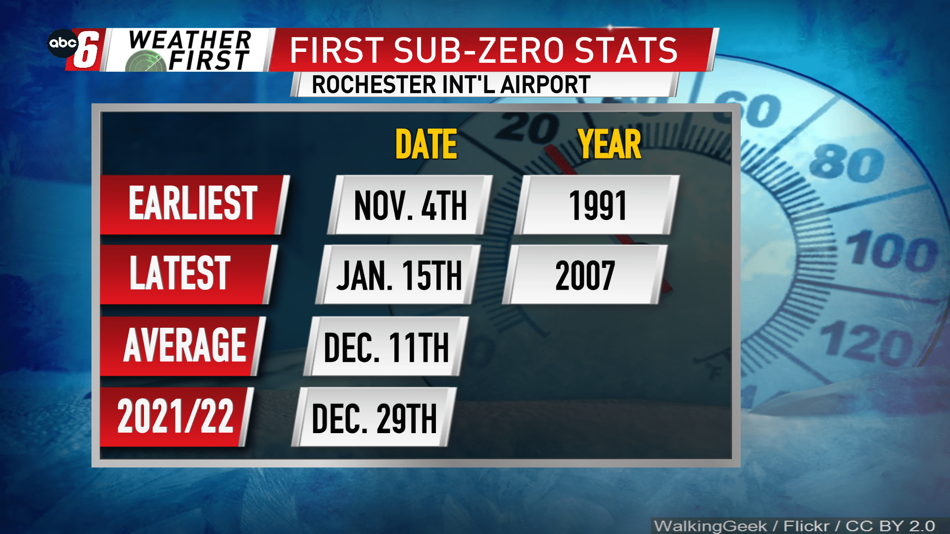
The first widespread sub-zero temperatures of the season may occur as early as Sunday night/Monday morning. This would be about a week behind what is typical to see our first sub-zeros of the season. Last season, we hit that mark for the first time on December 29th at Rochester Int’l.