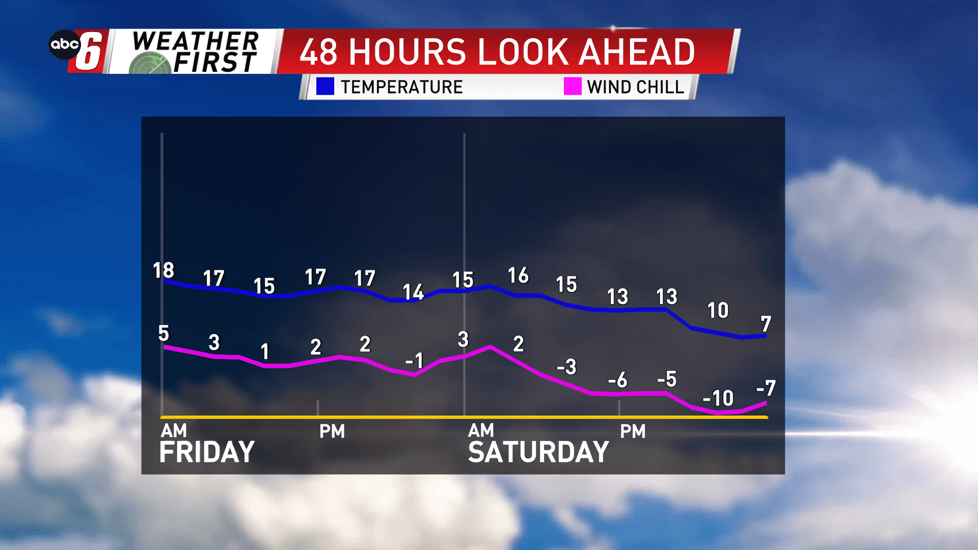
Cold and blustery couple of days
The temps are running nearly stagnant on Friday and Saturday. A sharp northwest wind will help counter effects of daytime warning. Temperature sways will be kept to a minimum of only about 5° each day.
Those winds will be gusting 30-40 mph at times, strongest on Saturday. This means wind chills. They’ll be near zero both Friday and Saturday.
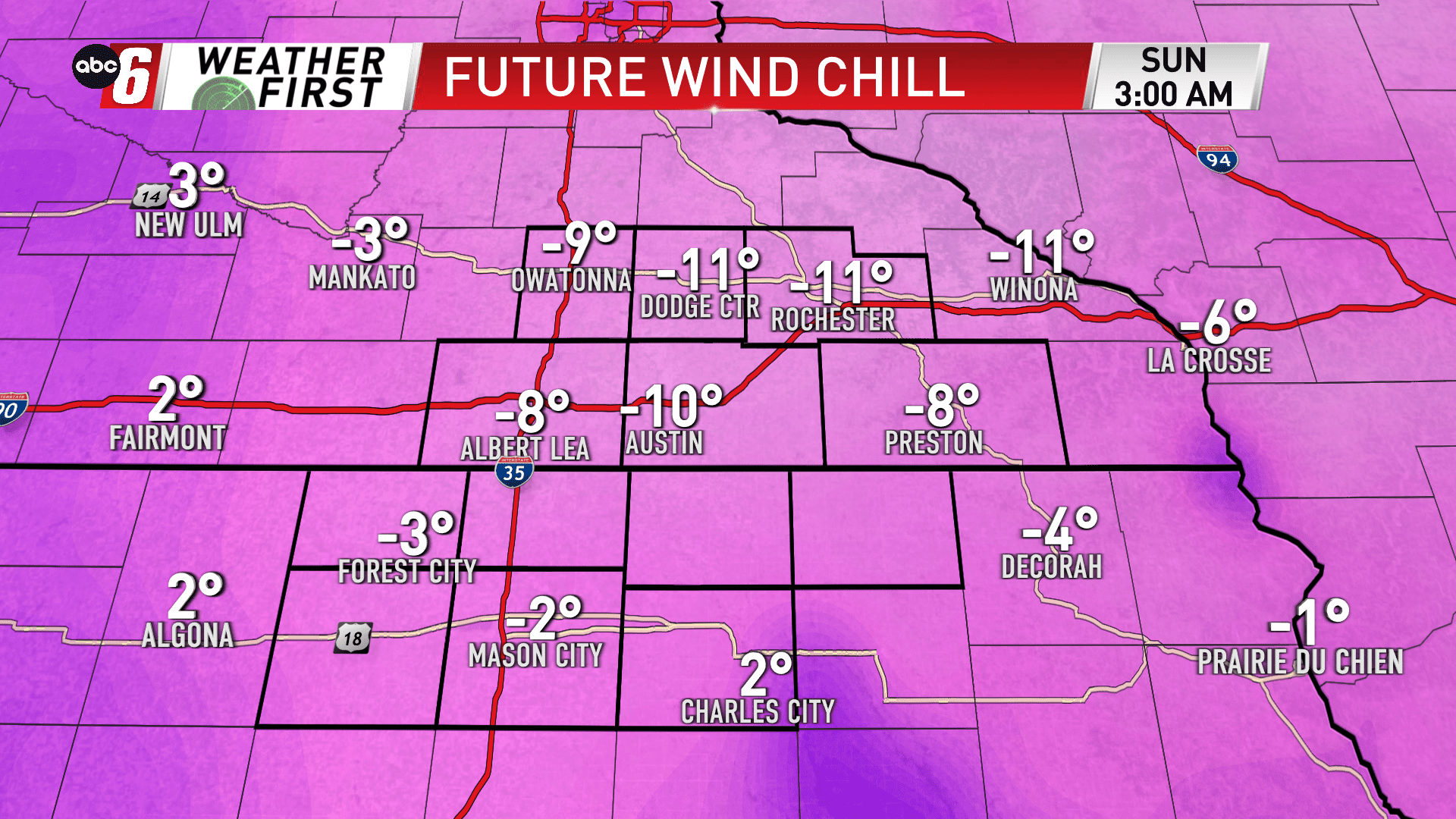
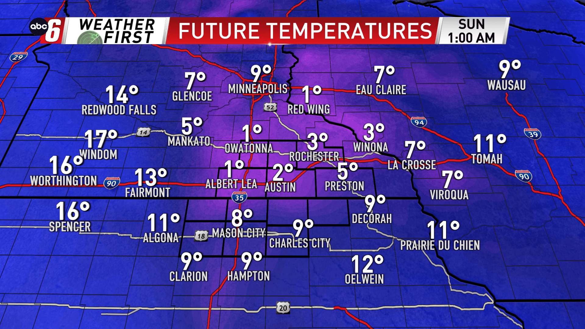
But with some clearing Saturday night, we’re looking at both categories bottoming out. Lows early Sunday morning will dip dangerously close to zero. At this point it looks like we’ll hold short of sub-zero but it certainly is a possibility that we make it there. The record low is 0° set back in 2014. If we don’t make it sub-zero with the temps, the wind chill will surely make up for it. Those marks will slip to the -5 to -15° mark area wide.