Arctic blast to bring frigid temperatures, dangerous wind chills
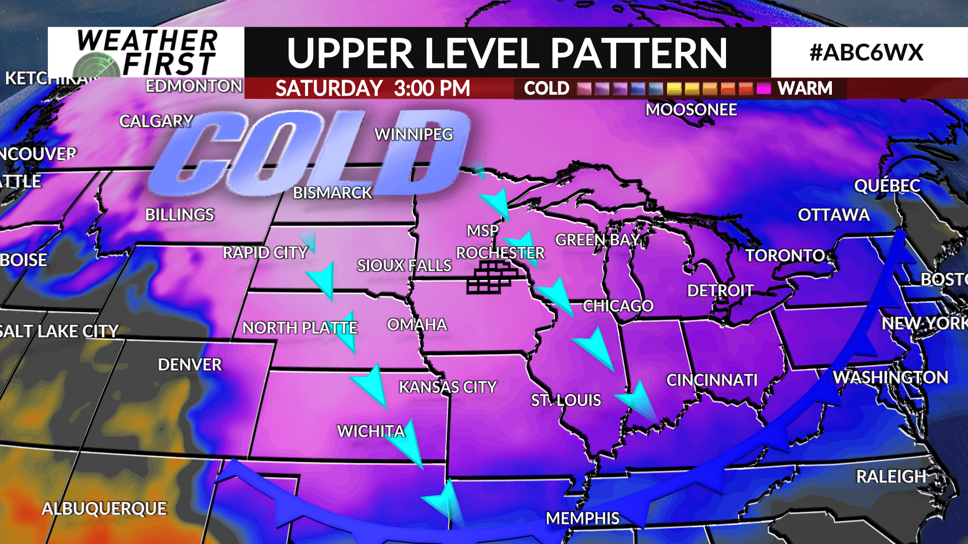
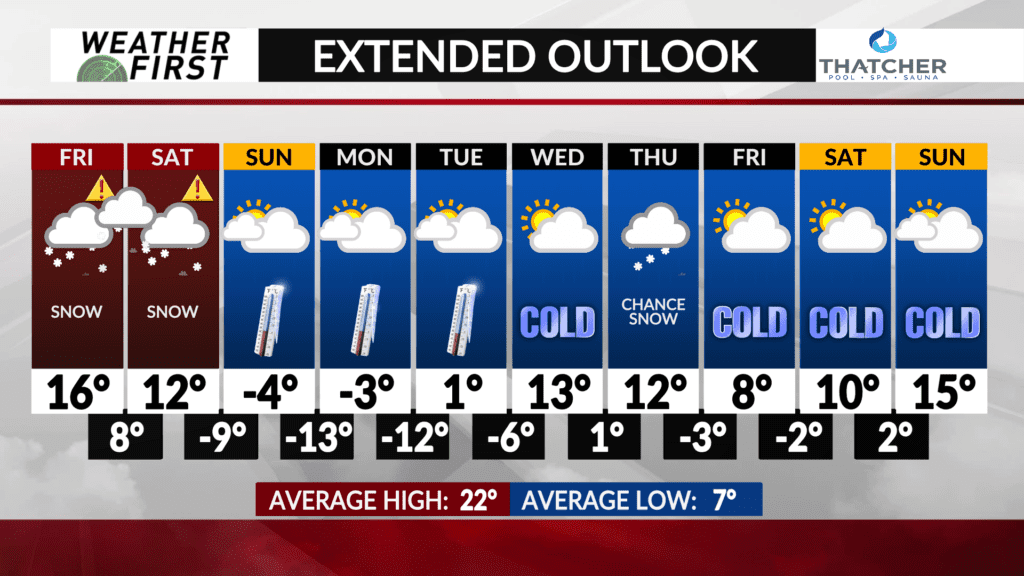
A winter storm that will grip the area heading into the first half of the weekend will exit the area late Saturday as Arctic air makes its way in.
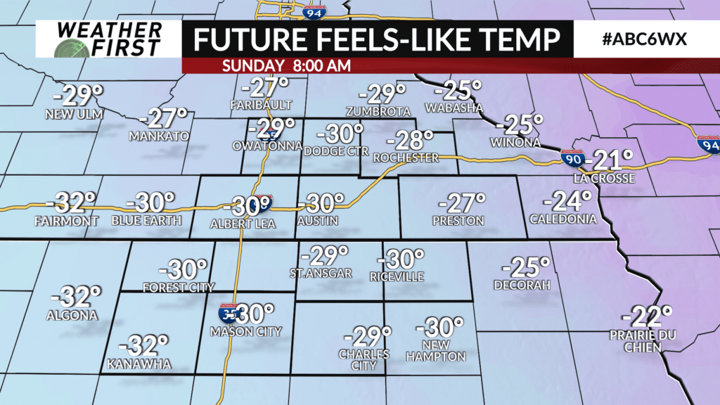
Temperatures will plummet on Saturday night with lows expected to drop into the teens below-zero by Sunday morning. The wind will still be rather brisk and that will lead to wind chills in the range of -25° to -35°.
The Arctic air will be overhead heading into next week as high temperatures may not make it above-zero until Tuesday, and if they do, it will be just barely.
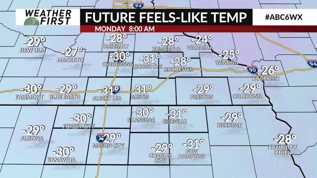
Wind chills are expected to be at dangerous levels once again on Monday and Tuesday mornings.
Temperatures will slowly improve throughout next week as highs return to the single digits and teens above-zero. Meanwhile, night lows will remain in the single digits below-to-above-zero.