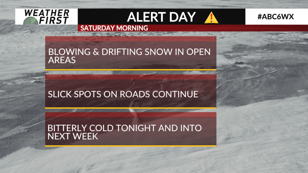
ALERT DAY: Light snow, slippery roads and bitter cold
The winter storm continues to pull away from the ABC 6 Weather First area.
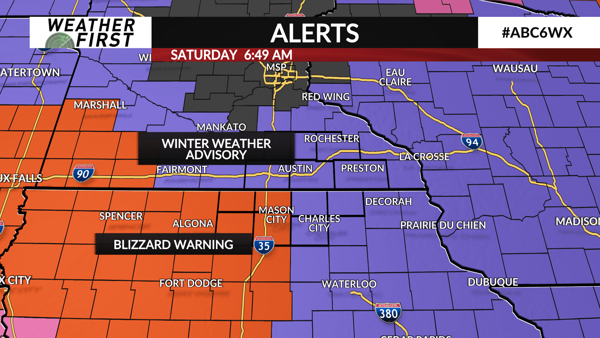
Light snow showers will be possible through Saturday as bitter Arctic air moves in wringing out the remaining moisture as the remnants of the winter storm are still close by. Little, if any additional accumulations is expected.
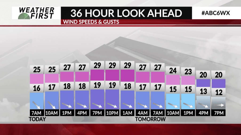
The wind will remain blustery through much of the day and night with gusts up to 30 mph which will lead to blowing and drifting snow making for some slick travel especially in open and rural areas. Elsewhere, road conditions should improve throughout the day.
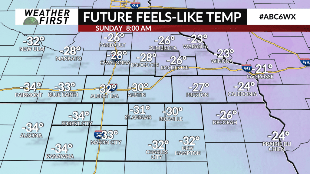
The next punch of winter weather is the cold Arctic air moving in behind this storm system. Saturday’s high temperatures will occur in the morning and will fall to the single digits by Saturday afternoon. Wind chills Saturday will be in the mid-20s below-zero and as cold as 35 below-zero on Sunday.
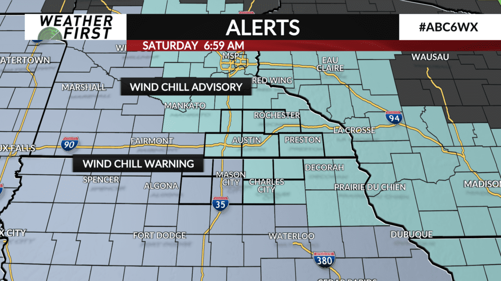
A WIND CHILL ADVISORY is in effect for all of southeast Minnesota and northeast Iowa from Saturday night through Sunday morning and a WIND CHILL WARNING, where wind chills be the coldest, is in effect for areas along and west of I-35 in Iowa.