After the storms… snow
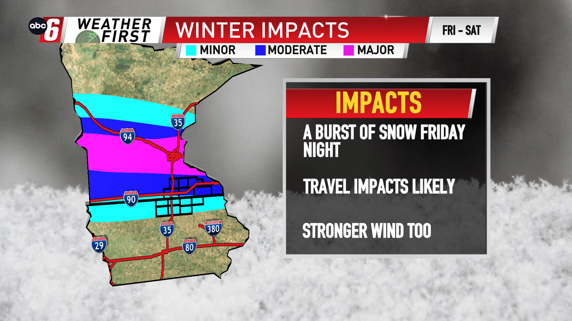
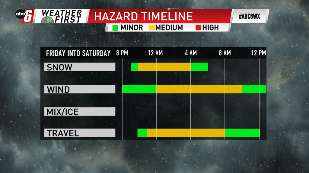
Severe weather is possible Friday afternoon. What shouldn’t go overlooked is the cold side of this system for Friday night into early Saturday morning. Temperatures will sharply fall and eventually accumulating snow takes over.
A band of snow will pelt areas to our northwest where a Winter Storm Watch is in effect. While we’re not included on that, we will catch the tail end of this band as it moves out. In about an 8-10 hour window, we’ll have an opportunity to pick up a few inches of snow on our northern edge. Early indications favors anywhere from a dusting south to as much as 4″ north. Still more is expected in central Minnesota.
Add in a strong wind gusting to 35 mph will complicate the travel scene.
Snow will begin as early as 8 PM and exit by 6 AM to the east.