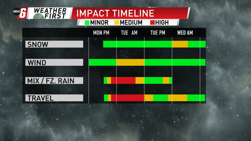
After ice, snow takes over Tuesday night/Wednesday
After our bout with ice on Tuesday, snow takes back over Tuesday night into Wednesday. The transition over Tuesday evening will feature a wintry mixture of everything. But primarily we’ll be gravitating to snow with time.
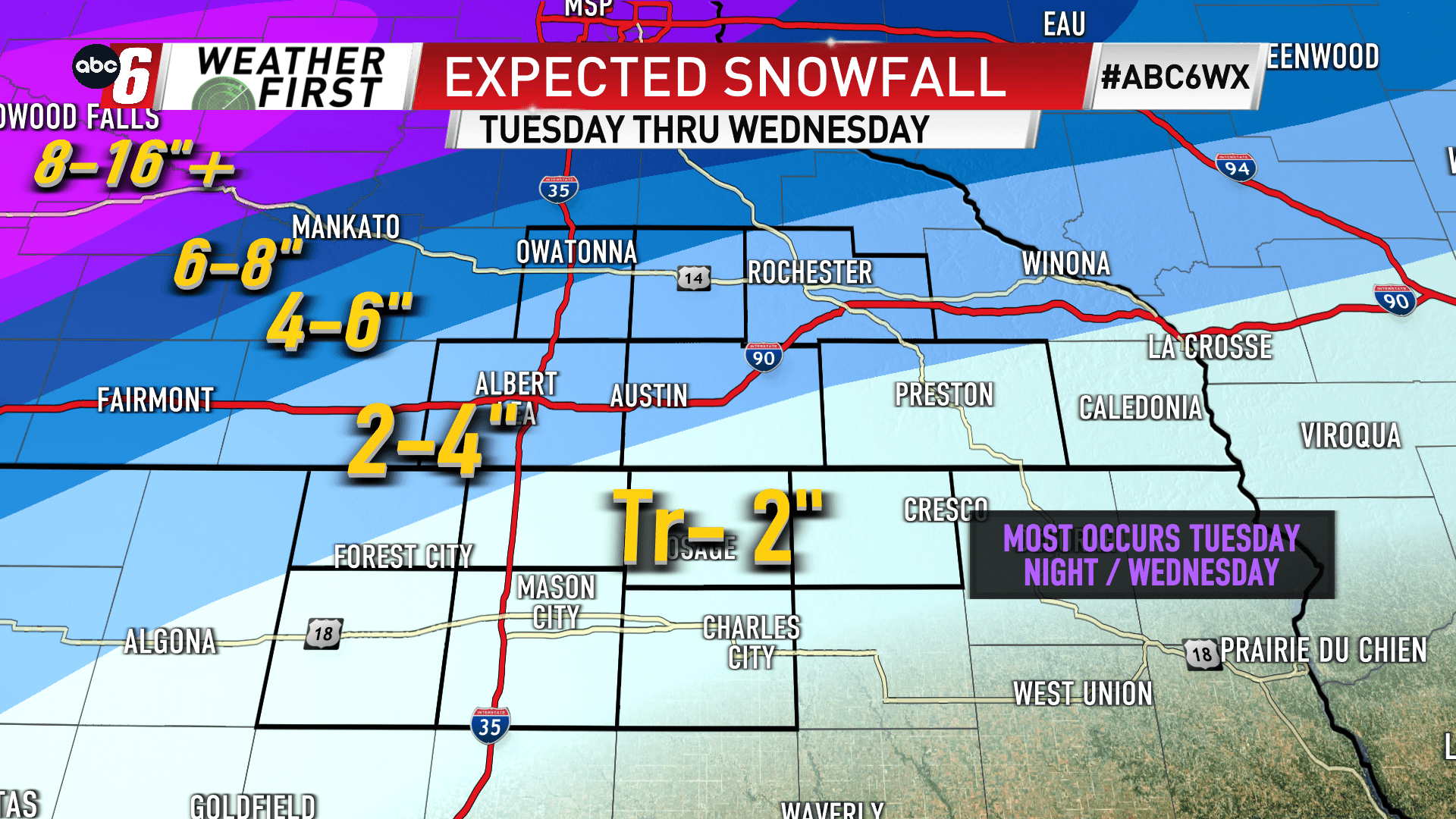
After a bit of a burst initially overnight, the snow will gradually becoming lighter in nature but stay persistent through much of Wednesday. A long duration accumulation of Trace amounts to as much as 4 to 5″ is possible locally. Most will fall in the 1-3″ range. The lowest end of that range is in NE Iowa. The higher amounts come in further NW over southern Minnesota.
Southwest to Central Minnesota is dealing with all snow out of this system. Amounts of 8-14″ of snow will be common in these areas. Please plan accordingly if you have travel planned to the northwest. It will be difficult.
Locally, this will be a nuisance on the travel scene. The Wednesday morning commute will have some lingering impacts from ice prior and also some slushy accumulations to consider too.