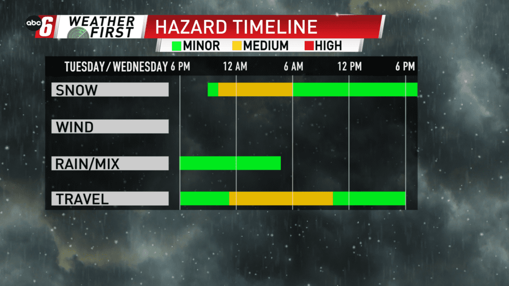
A transition to snow, long & drawn out
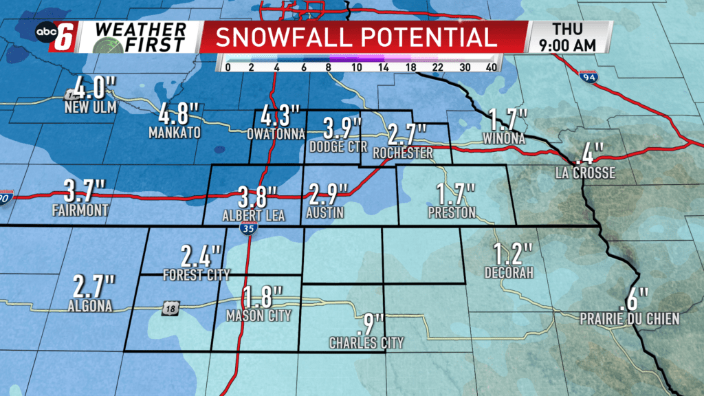
A wintry mix returns Tuesday evening and so begins a transition back to snow, generally after 10 pm. Some pockets of drizzle may linger from time to time even into Wednesday morning but snow is the primary troublemaker. Snow extends through the predawn hours of Thursday! That persistent snow will bring trace amounts to as much as 5″. See the breakdown below.
Rather than piling it up quickly, we’ll see accumulations long and drawn out. Intensity is generally light with slight uptick as it arrives Tuesday night.
Temperatures bounce back and forth above/below freezing. I don’t expect significant icing to occur from here on out on the roads as it will be difficult to freeze up existing puddles.