A comfortably cool week ahead
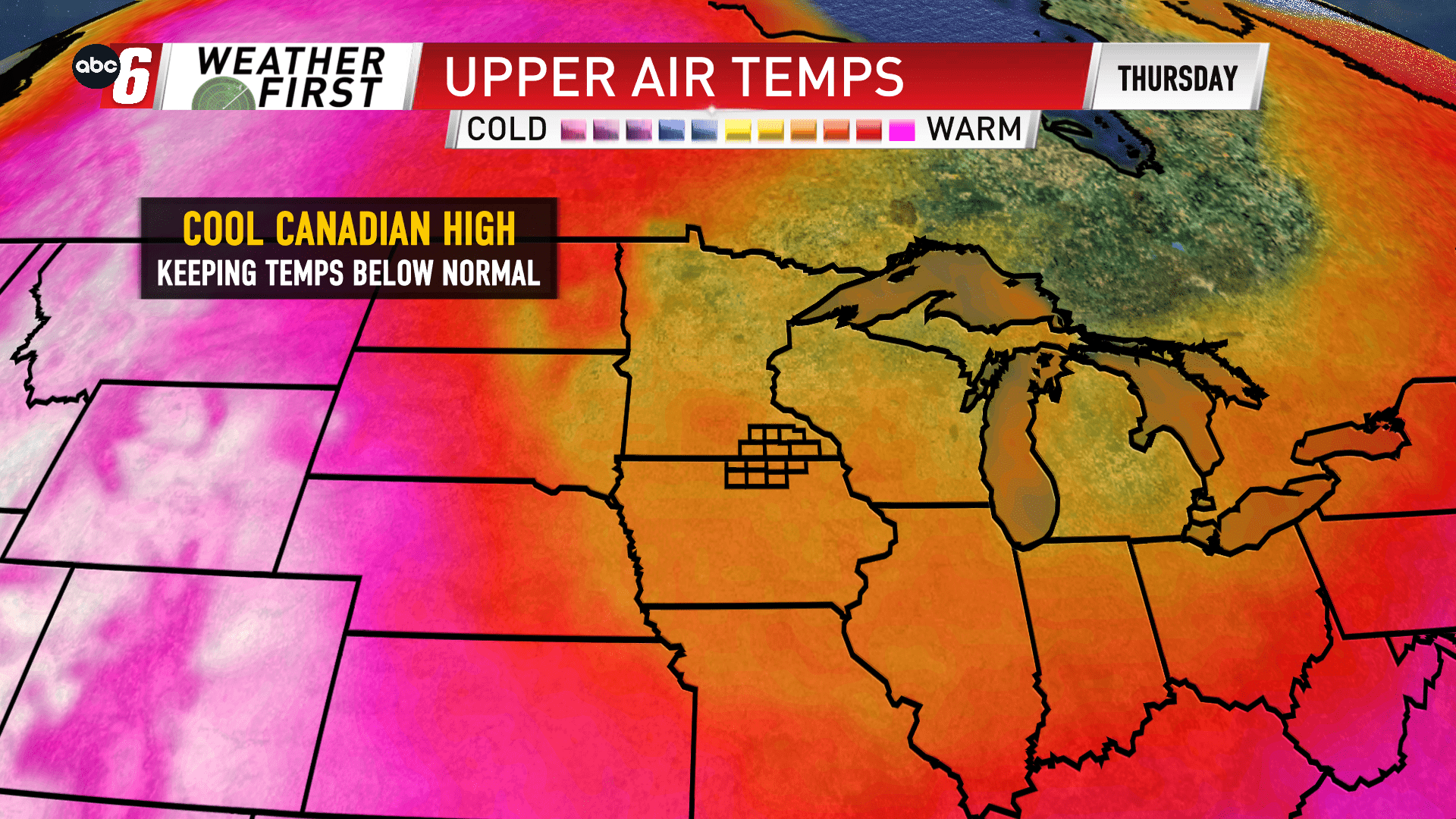
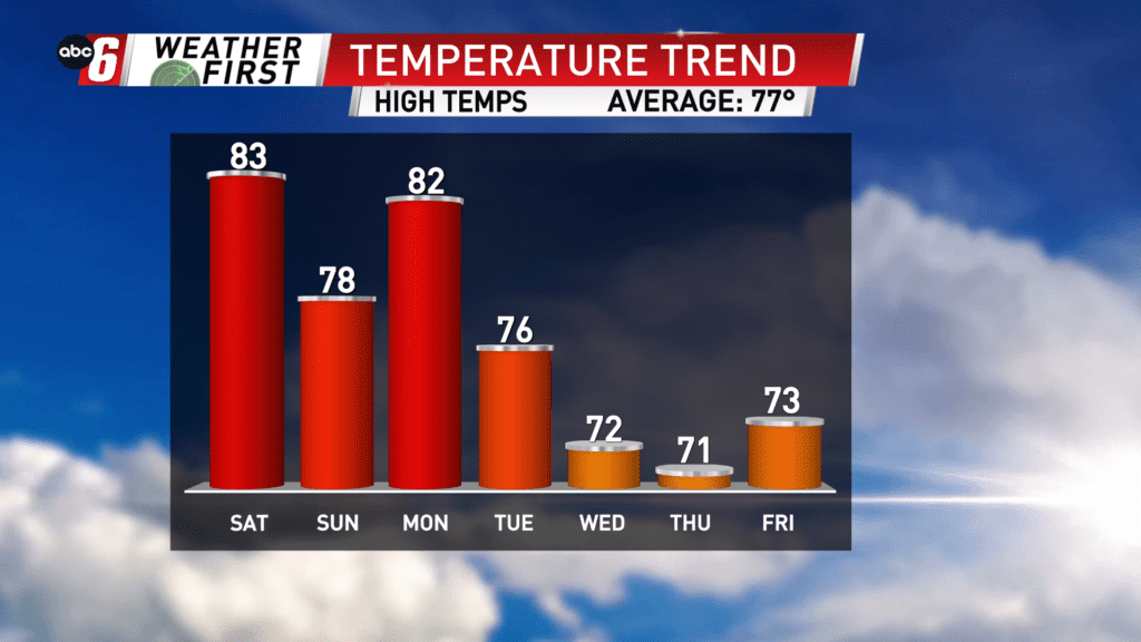
After a weekend with rain chances our temperatures start to show some signs of slipping next week. Monday is still on the warm side of a cold front through most of the day, but that front will make it through and you see the result with the daily high temperatures. A cool and broad area of Canadian High Pressure will be moving in. This is a scenario, that if it strikes in the dead of winter would yield sub-zero temperatures. It’s still summer so we’re not quite that chilly, but you’ll notice a difference. For now, the power of the sun is still quite prominent so expect us to climb back to the low 70s Wednesday-Friday.