2nd part is the dagger in upcoming winter storm
After a break from a first round of snow on Wednesday morning, the main band with this winter storm will arrive from the south. This will be the main event of this two part winter storm.
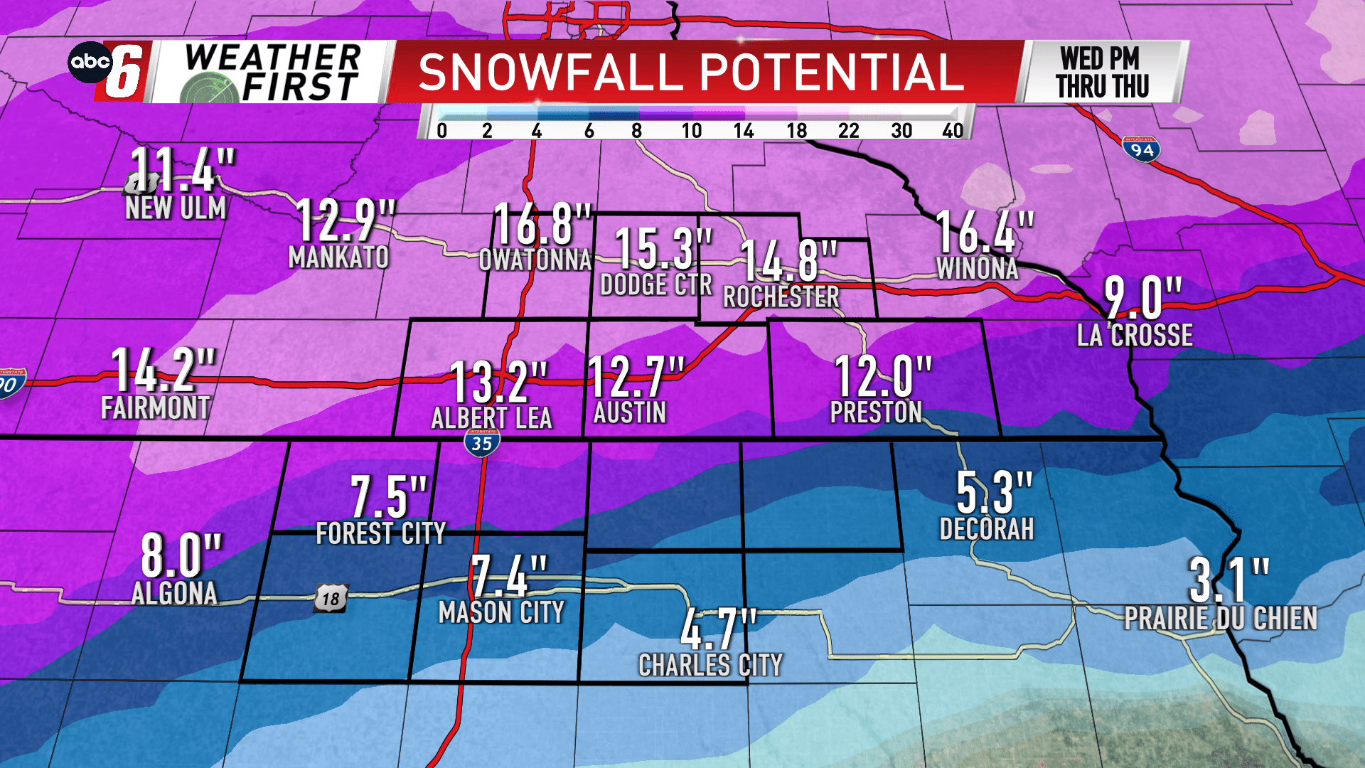
It’s this band that will bring heavy snow in tow, especially on the north side of the border. Snow will relax by Thursday evening. A wintry mix of freezing rain and sleet will nudge into NE Iowa. This erodes high end snow totals but also makes things very slippery. Freezing rain accumulations will most closely hug 1/10″ but will possibly be as much as 1/4″ in spots.
Snow with this second round will range from 4″ south to around 12″ near the state line to as much as 17″ north.
Add in the stronger wind increasing on Wednesday into Thursday morning and we’ll have issues. Those with snow will have whiteout conditions in open areas. Blowing and drifting snow will be common. For those with ice, we’ll have to watch for downed power lines and branches. Wind gusts will increase from the NE turning NW at 35-40 mph in that timeframe.
With the amount of snow we’re talking, there may be some roads that become impassable due to the blowing and drifting snow. This will be most common on the Minnesota side and especially in the rural open areas.


