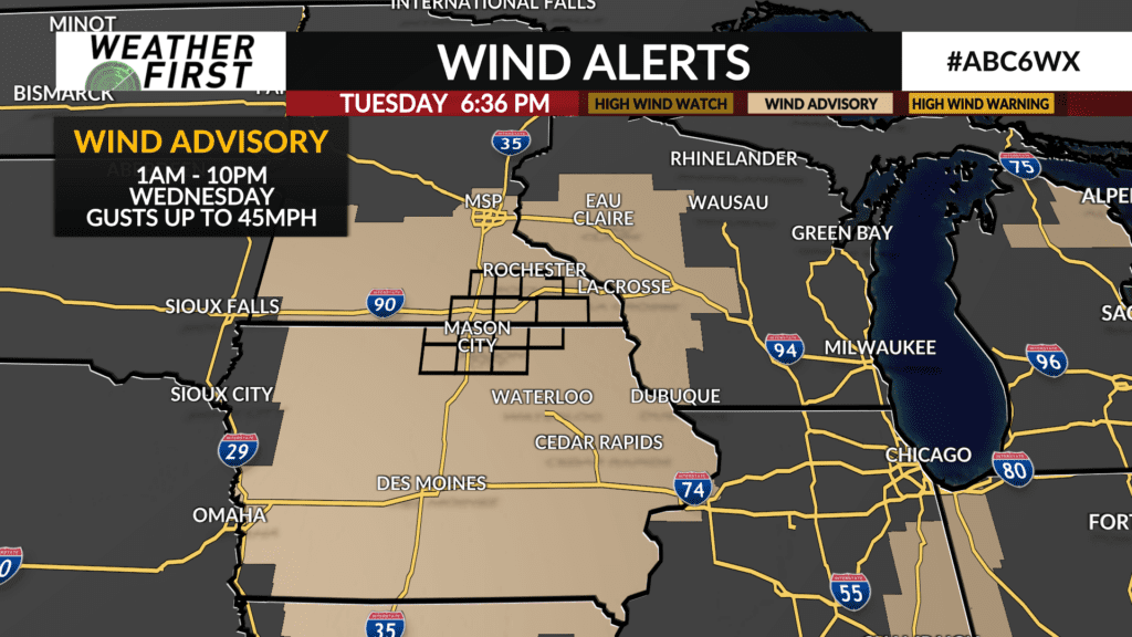
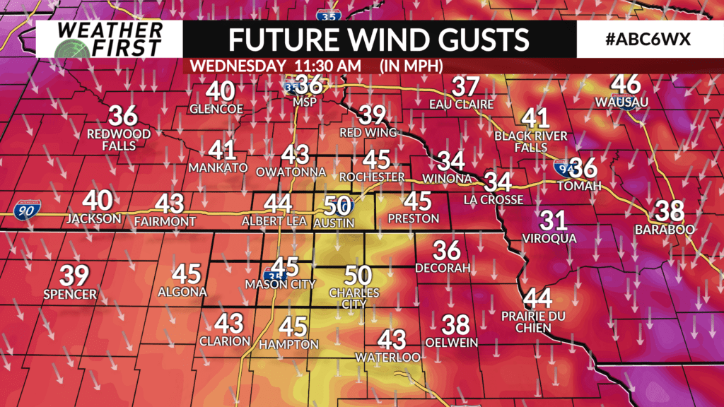
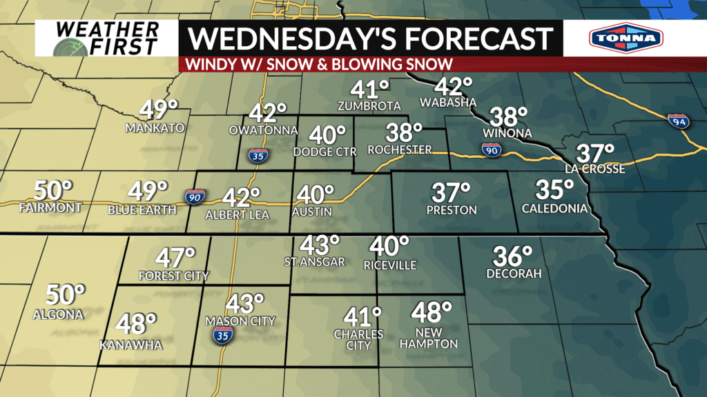
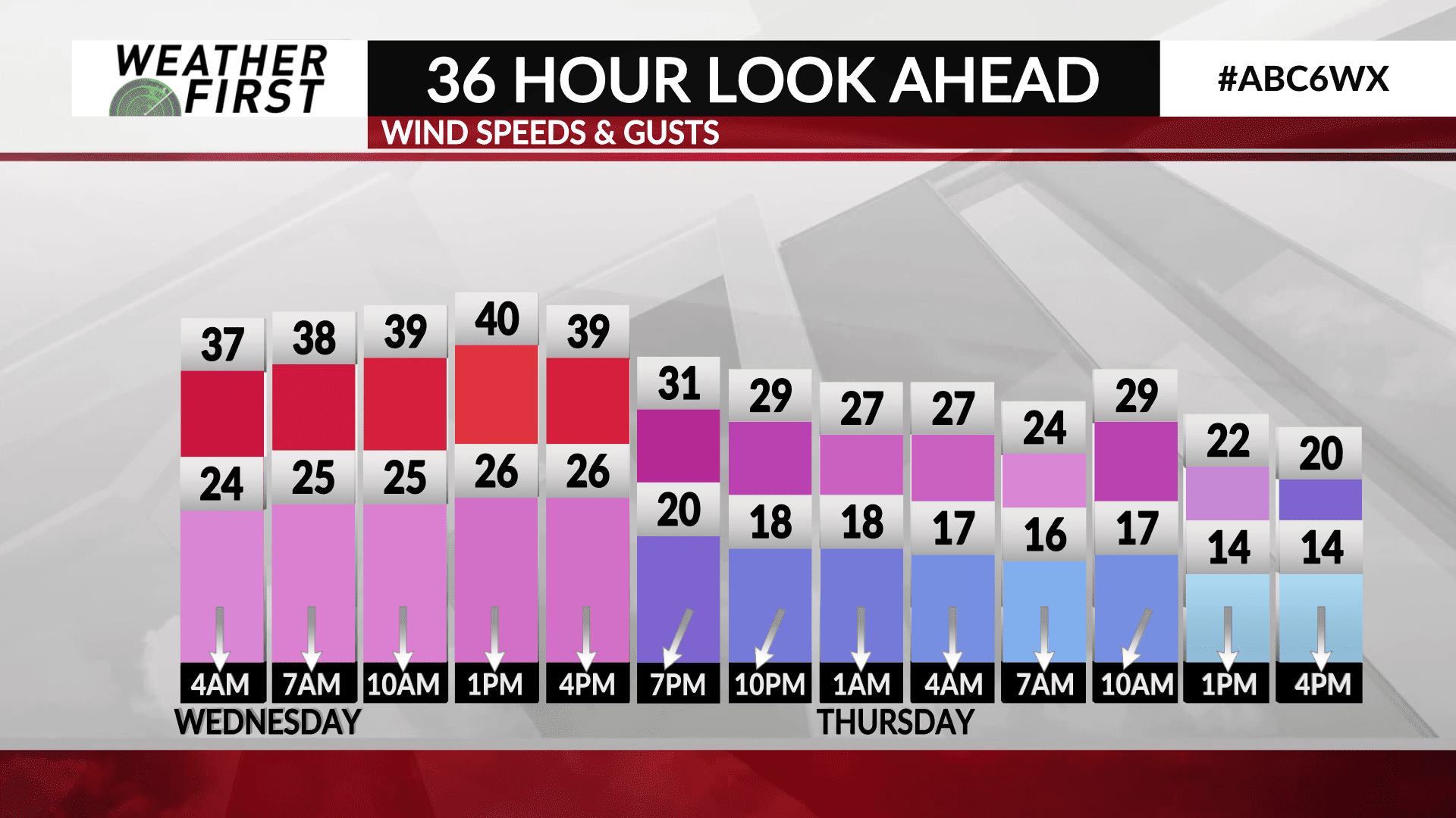
WIND ADVISORY through Wednesday, snow/wind combo will slow travel Tuesday night-Wednesday morning
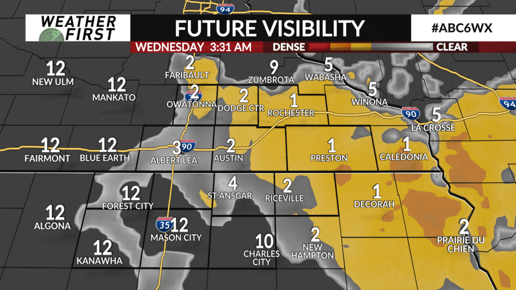
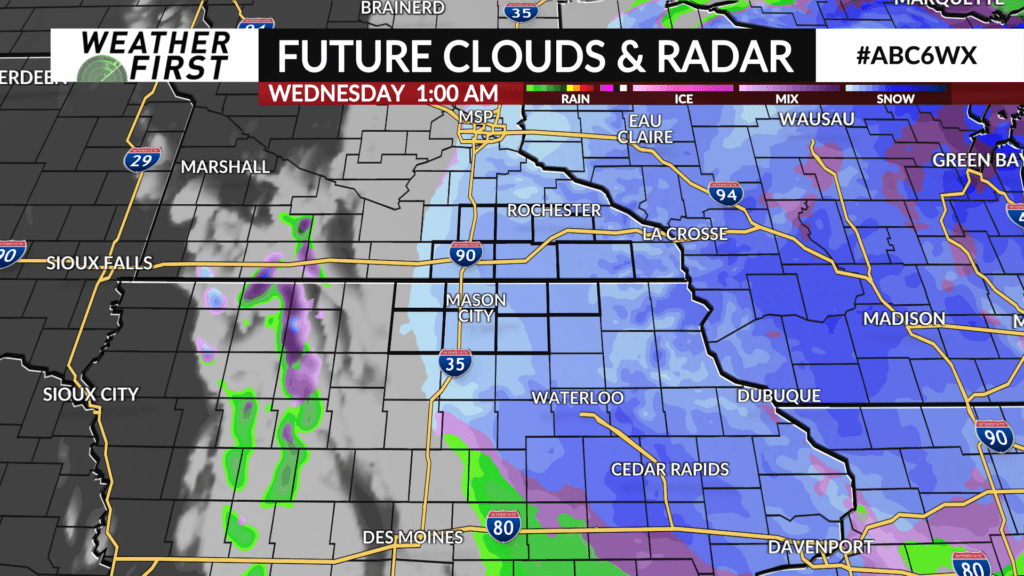
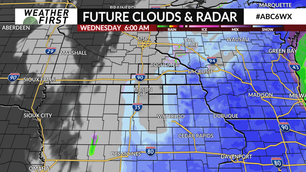
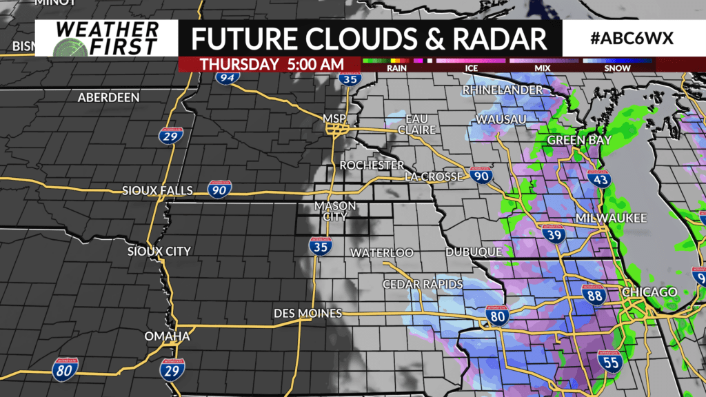
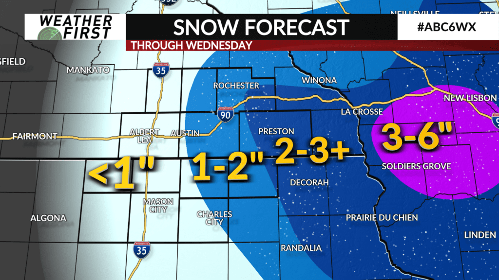
We’re on the western side of a strong storm system bringing heavy snow to much of Wisconsin. We’ll also see some of that snow in southeast Minnesota and a sliver of northeast Iowa. Accumulations will mainly be along and east of Highway 52, but there will also be minor accumulations for others west of there. The combination of snow and wind will make travel difficult at times overnight. Expect some slick spots, occasionally lower visibility, and areas of blowing and drifting snow. Thankfully, temperatures have been running slightly above freezing, making for a heavier, wet snow that is more difficult to get blown around.
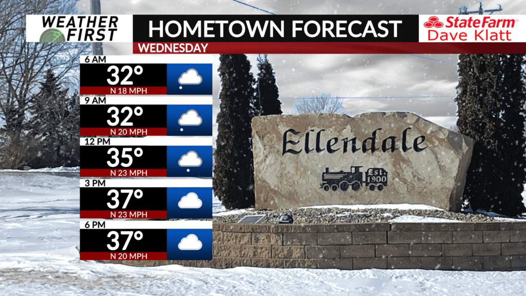
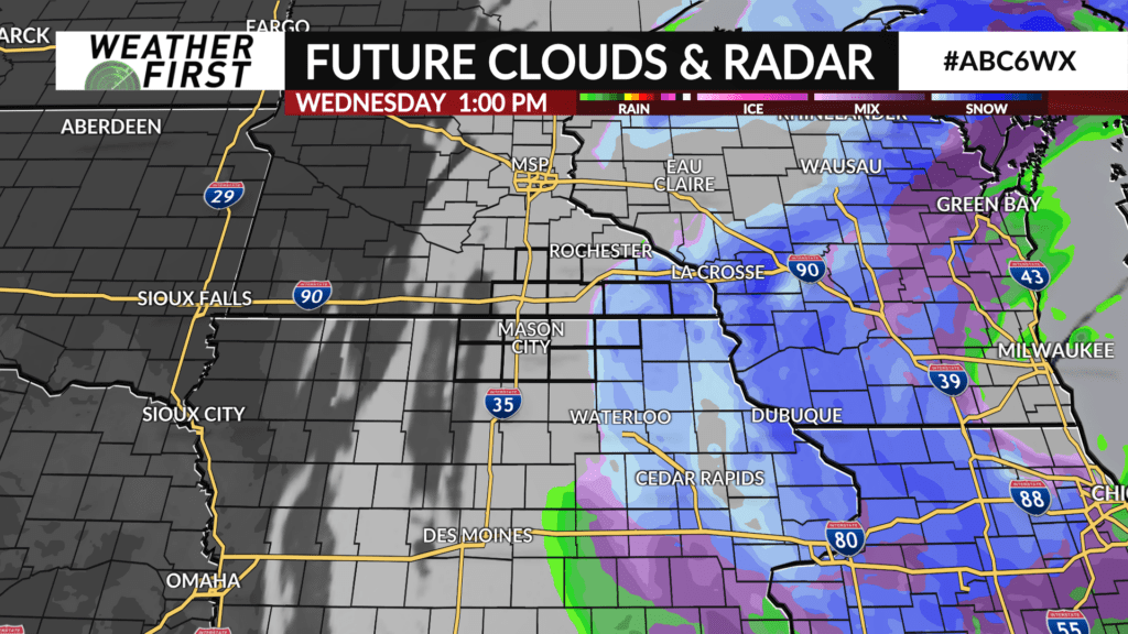
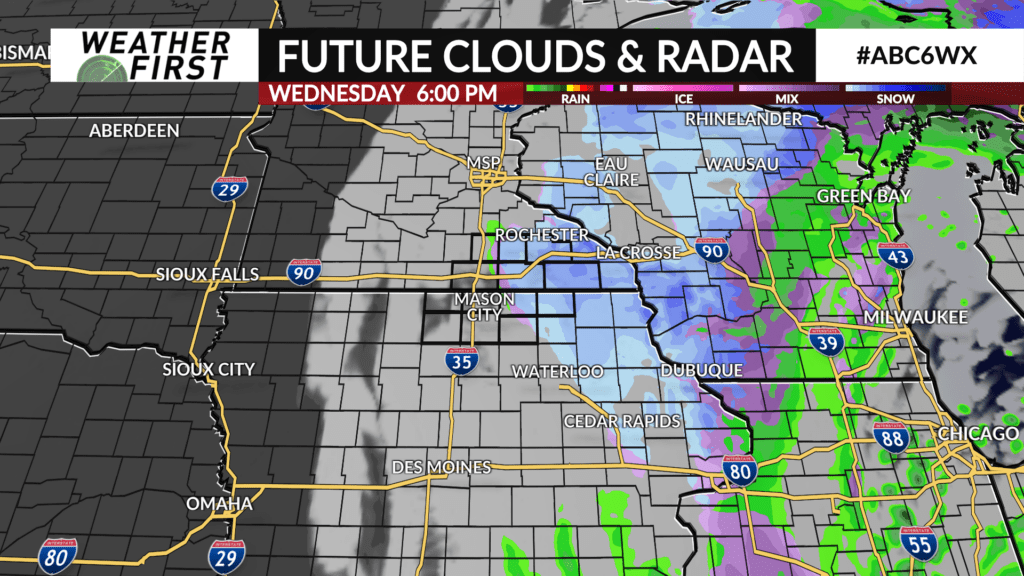
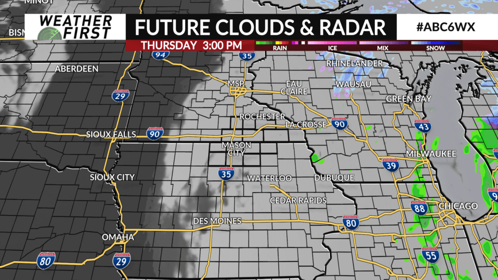
Snow will be wrapping up Wednesday morning with only a few, brief flurries or snow showers Wednesday afternoon. Winds will be intense at times Tuesday night through Wednesday evening before backing off Wednesday night.