Snow to arrive Thursday night with accumulations
A quick moving system will bring a round of snow to the area late Thursday night into Friday morning.
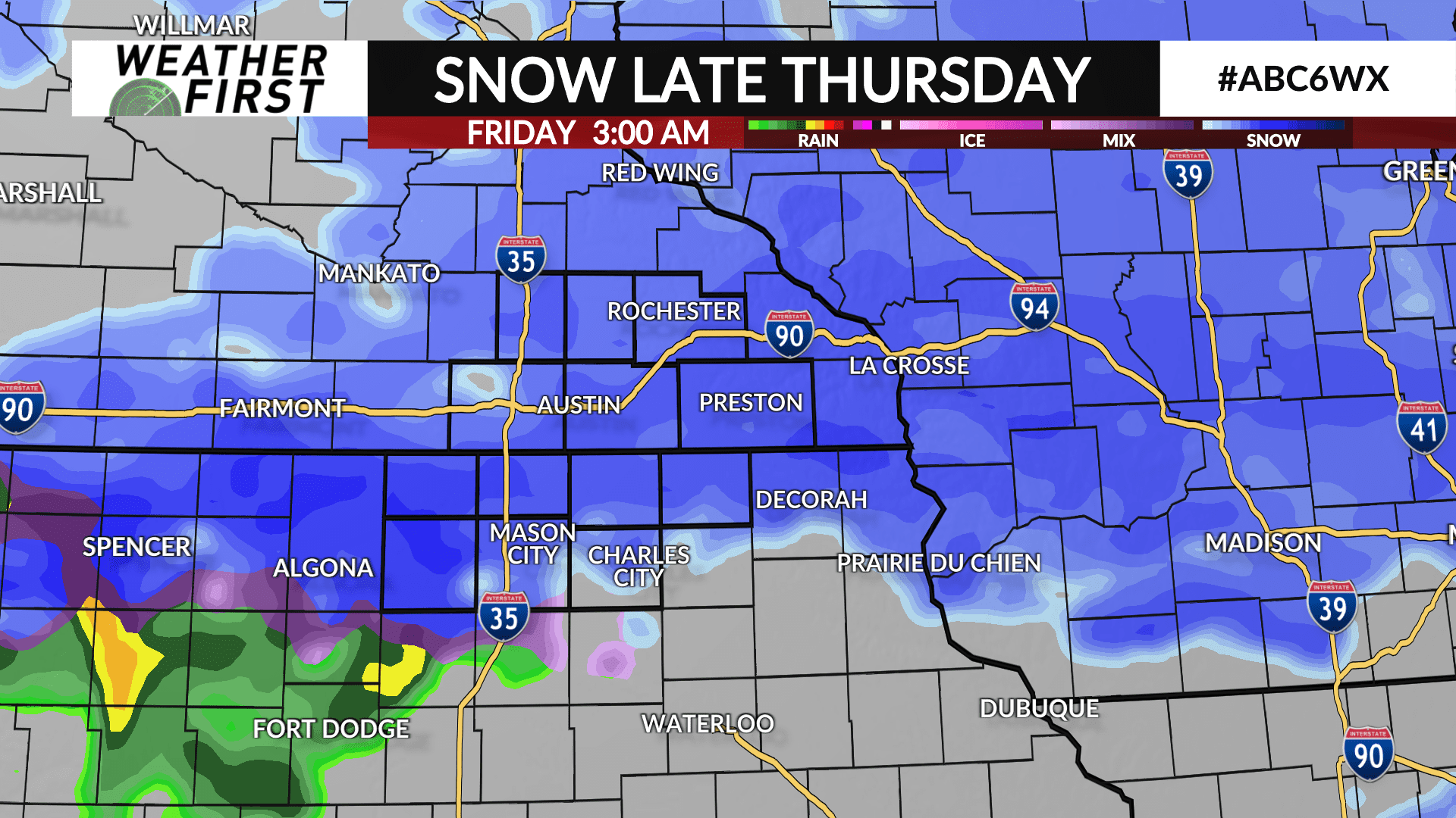
Thursday will be a mainly dry day with snow arriving late in the evening as the system dives southeast toward the area.
Snow will be likely sometime after 7:00 PM north of I-90 with snow becoming more widespread overnight into Friday. Snow will exit the area sometime mid-morning on Friday. Plan on a messy and slippery morning commute.
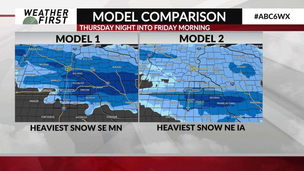
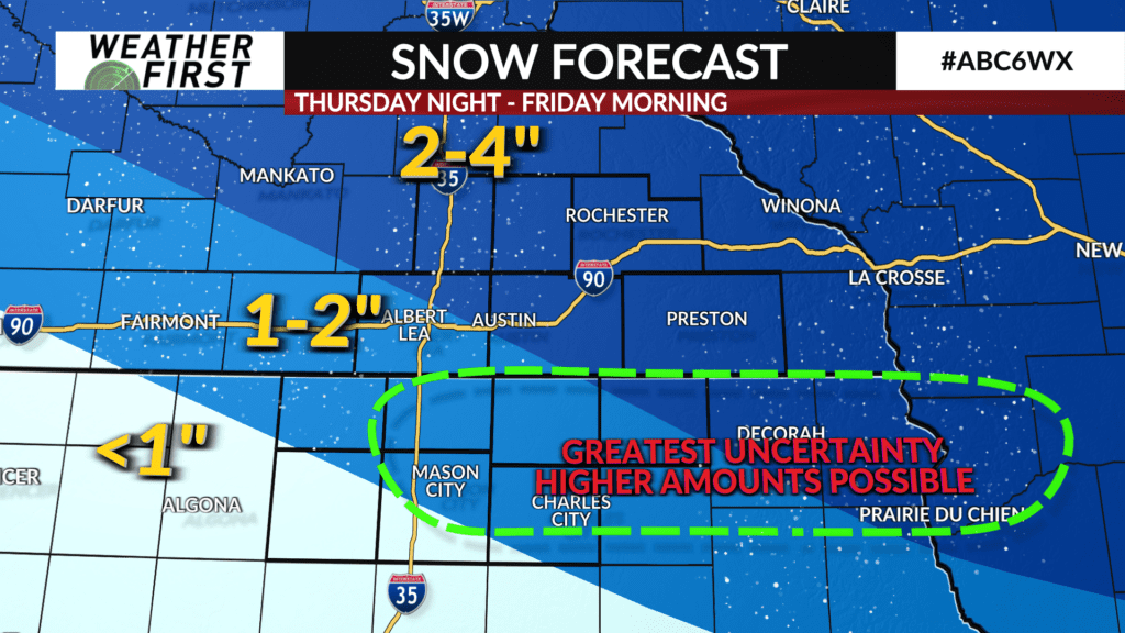
Snow accumulations of 2-4″ is likely for most areas with 1-2″ possible in north Iowa where some rain and a wintry mix of sleet/snow may limit accumulations. There is still some uncertainty on where a heavier band of snow may lay out with some indication it may possibly be near and south of the state line if temperatures remain cold enough for more snow and less of a mix. Shall that develop, accumulations will likely be higher.
The ABC 6 Weather First team will continue to monitor new data and make changes to the forecast as needed.