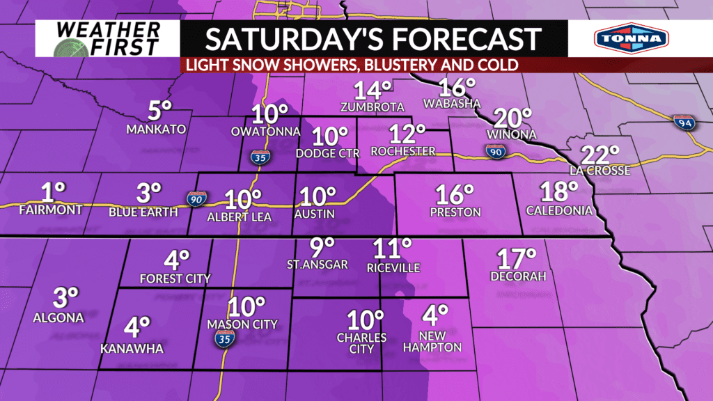
Snow tapers off Saturday, still blustery with tricky travel
The winter storm will pull away from the area on Saturday with snow expected to gradually wind down, however the winds will remain elevated with blowing snow still likely leading to some tricky travel especially in open areas.
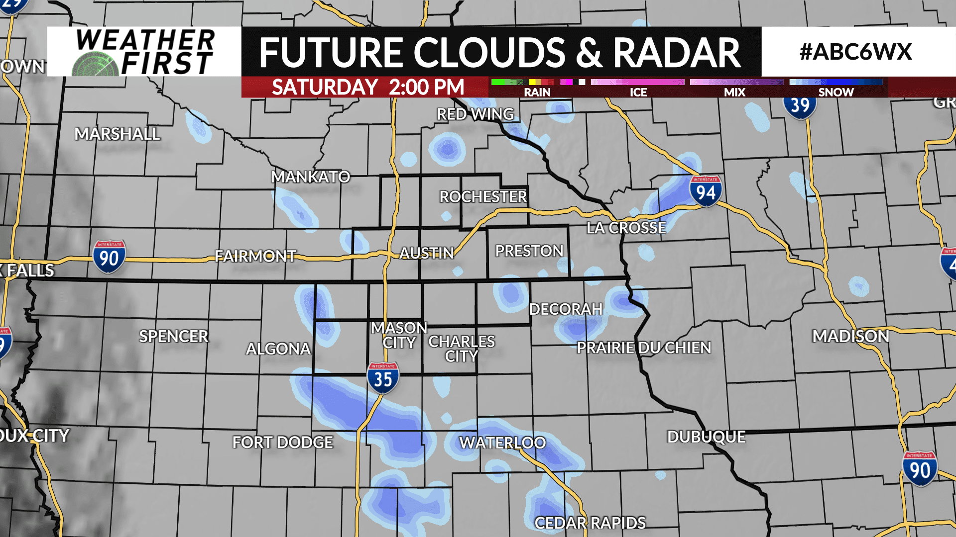
The bulk of the snow will come to end early Saturday morning. However, as Arctic air builds in, it’ll squeeze out the remaining moisture and with the remnants of the storm still nearby, some light snow showers are possible Saturday afternoon into the evening with some additional minor accumulations possible.
Saturday is an ALERT DAY due to some lingering snow showers and with roads expected to still be in rough shape, especially the less traveled roads and in open and rural areas.
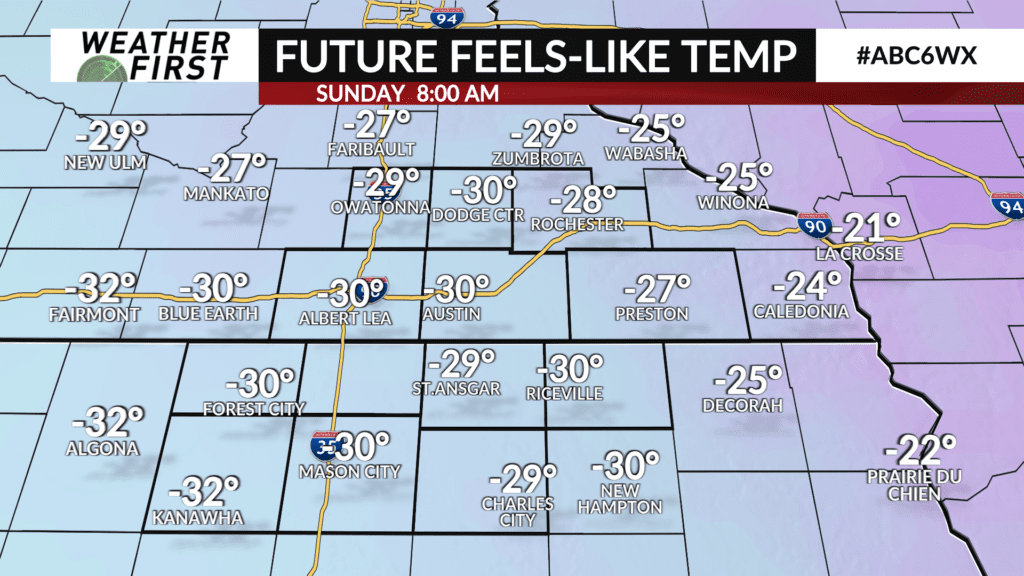
Temperatures will be cold with highs expected to be in the low teens. Arctic air surges in Saturday night with temperatures falling below-zero by Sunday morning and wind chills will likely be in the -20° to -30° range.