Rain to snow as colder air surges in Tuesday
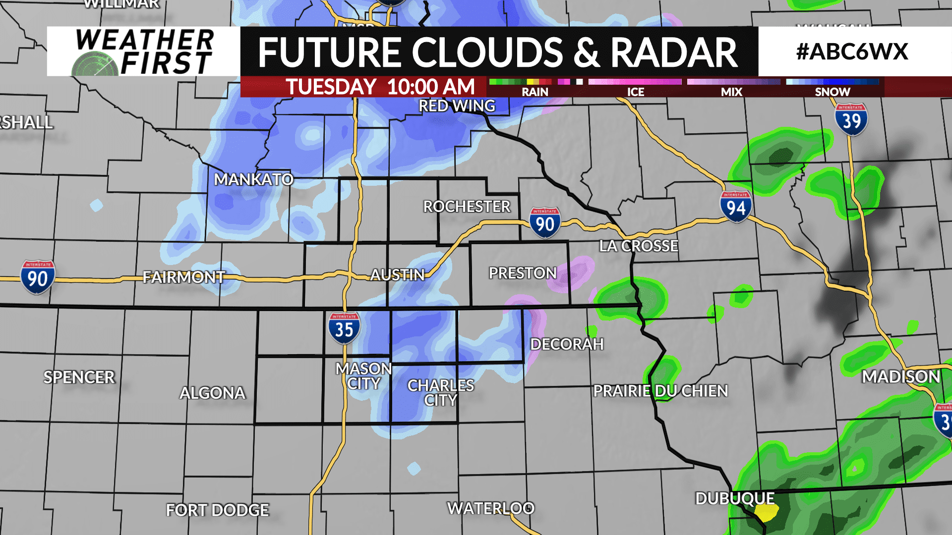
The storm system responsible for the snow on Sunday and rain on Monday will finally start to pull away on Tuesday, however as it does, it’ll bring in some colder air with rain changing to snow.
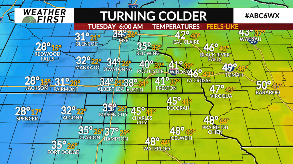
The storm will sweep a cold front through early Tuesday with high temperatures for the day likely occurring then as most areas will be in the 30s and 40s.
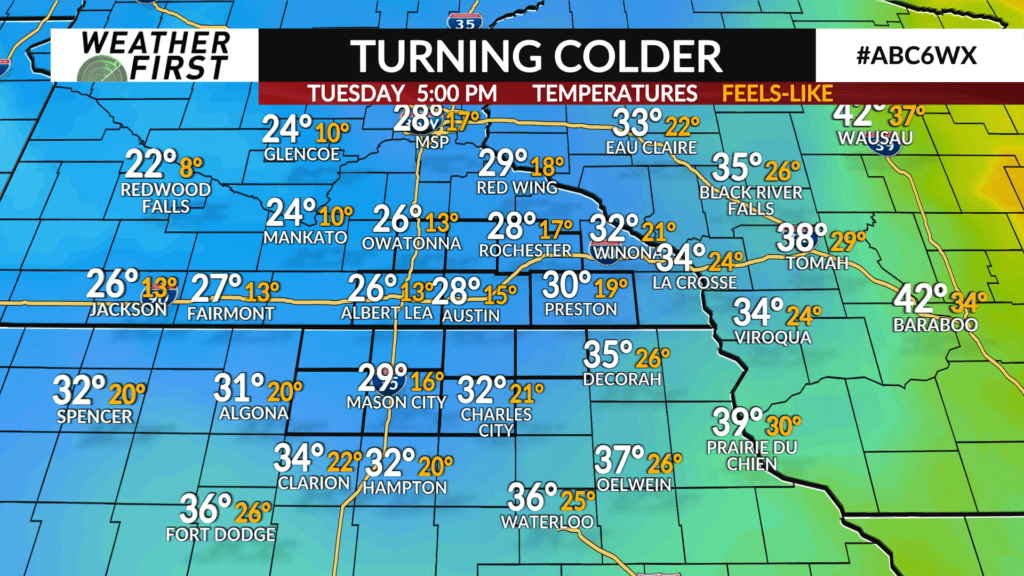
As the cold air rushes in, temperatures will fall throughout the day into the 20s by late afternoon. A blustery northwest wind will likely lead to wind chills in the teens. Wind gusts up to 30 mph are possible.
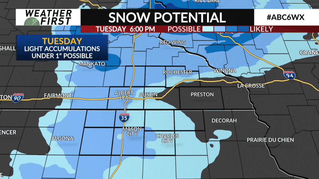
Any leftover rain will switch to snow during the morning hours with light snow showers possible throughout the day.
Accumulations are expected to be light with anyone seeing snow receiving under one inch.