Rain, thunderstorms likely Friday into weekend
The start of the weekend will turn more active with multiple rounds of showers and thunderstorms expected Friday through Sunday.
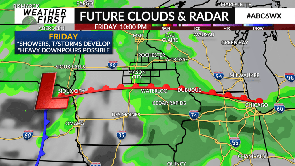
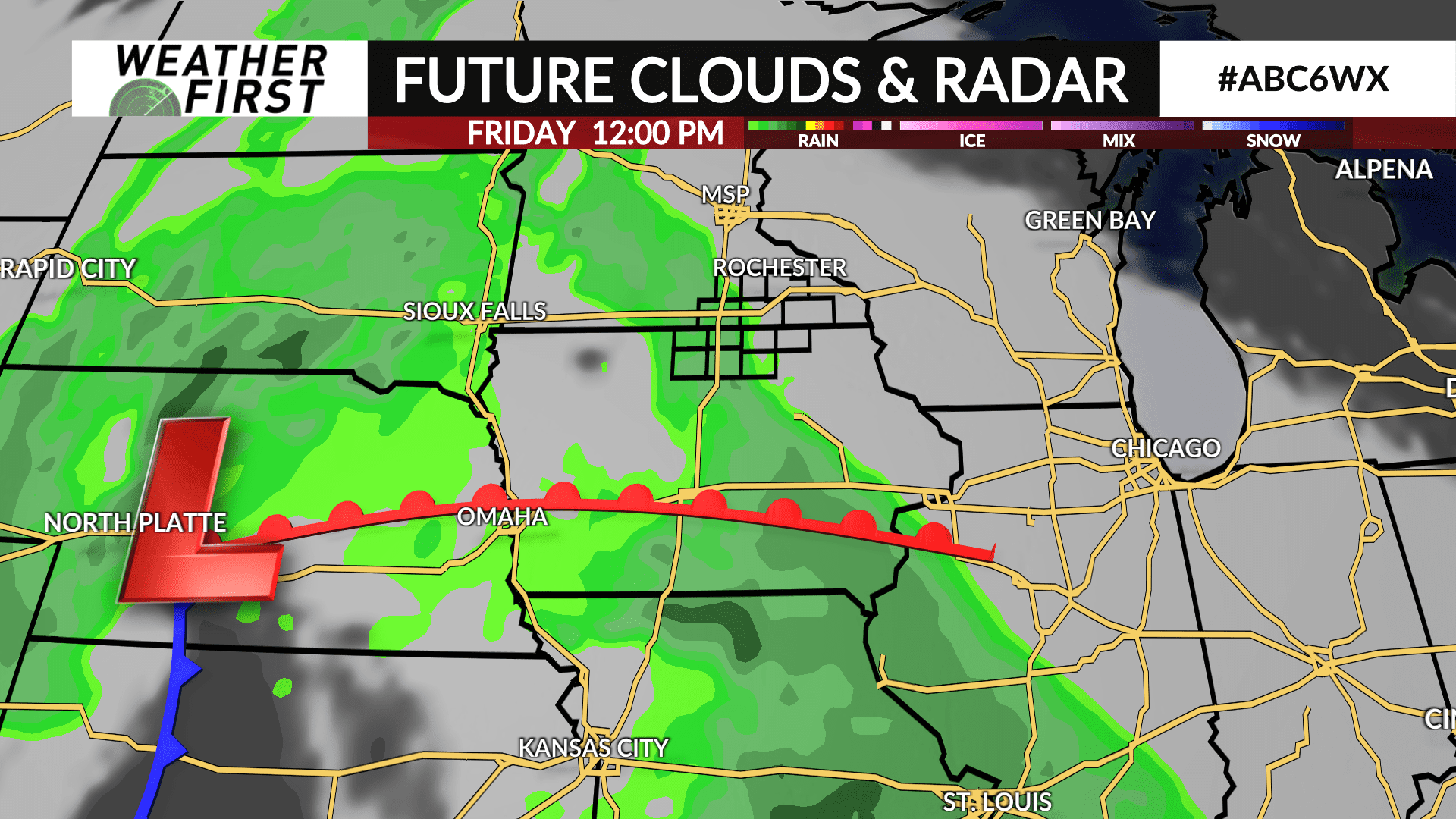
A few showers and rumbles of thunder are possible Friday morning, but becoming more likely during the late afternoon and evening hours. Some may linger into Saturday morning.
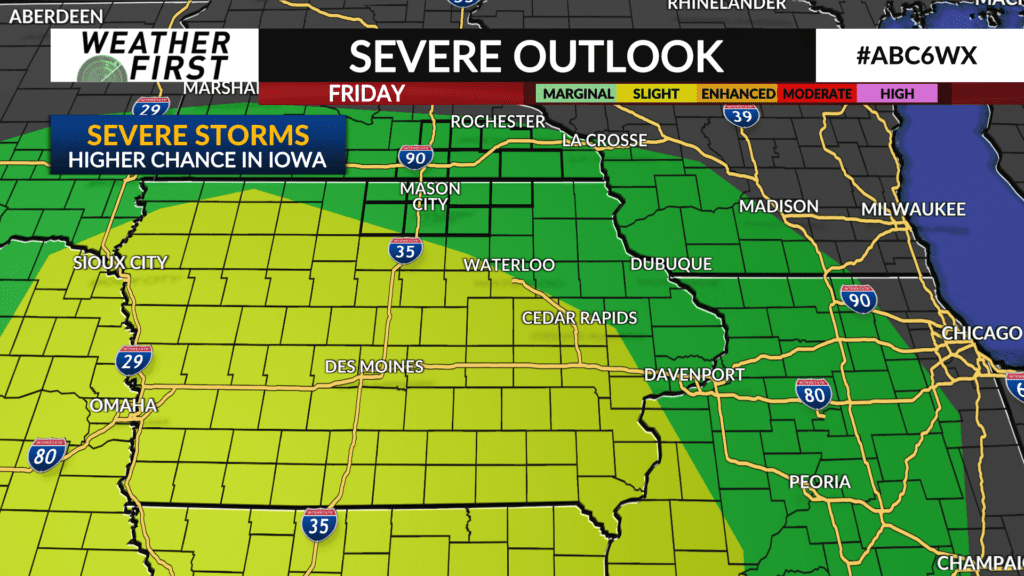
A strong-to-severe thunderstorm is possible on Friday although the higher chance for severe thunderstorms is south of the area across Iowa, however a strong storm can’t be discounted across northern Iowa and southeast Minnesota on Friday night with hail and gusty winds the main threats.
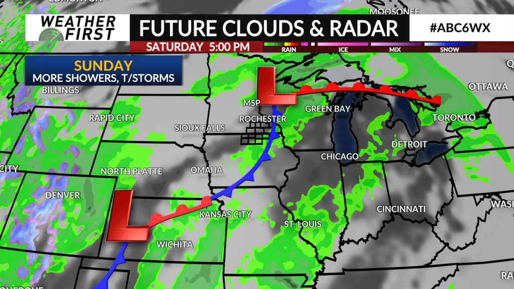
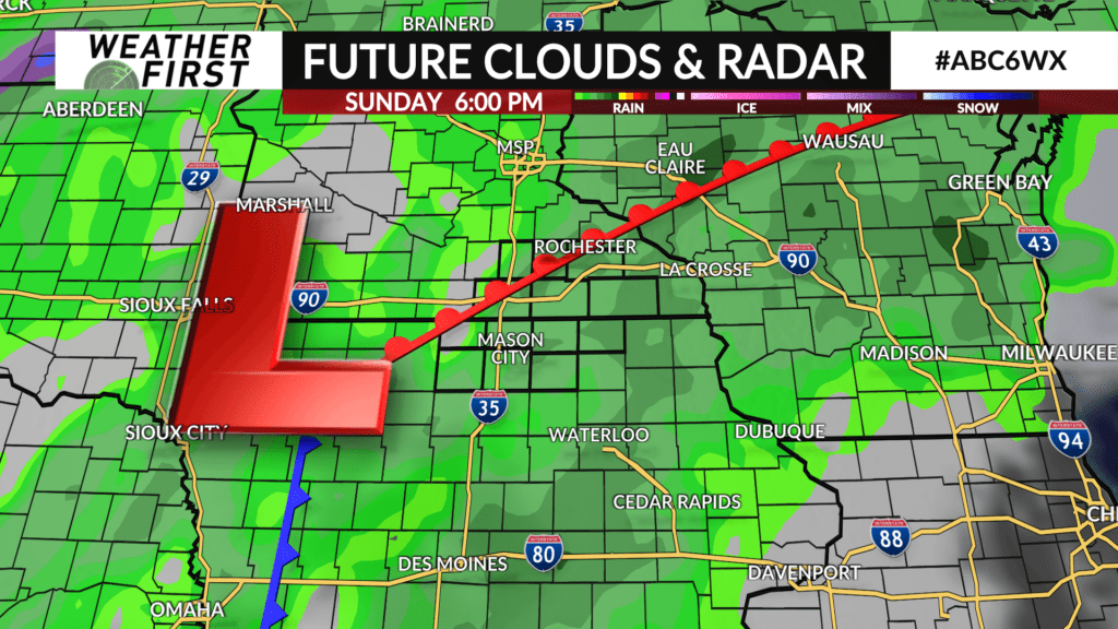
The bulk of Saturday may end up being dry before another storm system moves in with showers and thunderstorms likely Sunday morning with occasional showers and thunderstorms lasting through Sunday night.
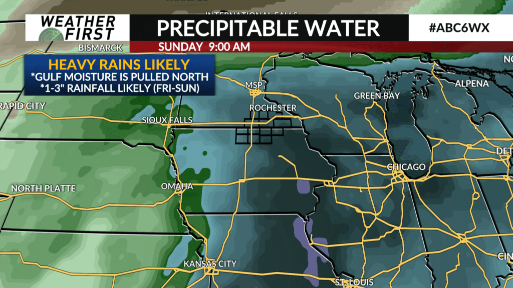
High moisture content will stream northward from the Gulf of Mexico resulting in some occasional heavy downpours Friday through Sunday especially in areas where thunderstorms track.
Total rainfall of 1-3″ is likely area wide between both storm systems which may result in some rises on area streams.