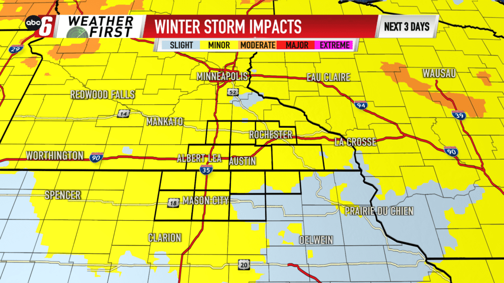
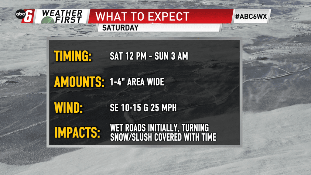
Another pop of snow Saturday
Similar to what we just went through, another round of snow is on the way Saturday. From noon to just after midnight is the timeframe to watch. A moderate intensity band will build across the area. Initially, warm temps will stunt accumulation but we will be able to overpower the warm scenario. Correspondingly, roads will be wet to start before seeing slushy accumulations become snow covered overnight.
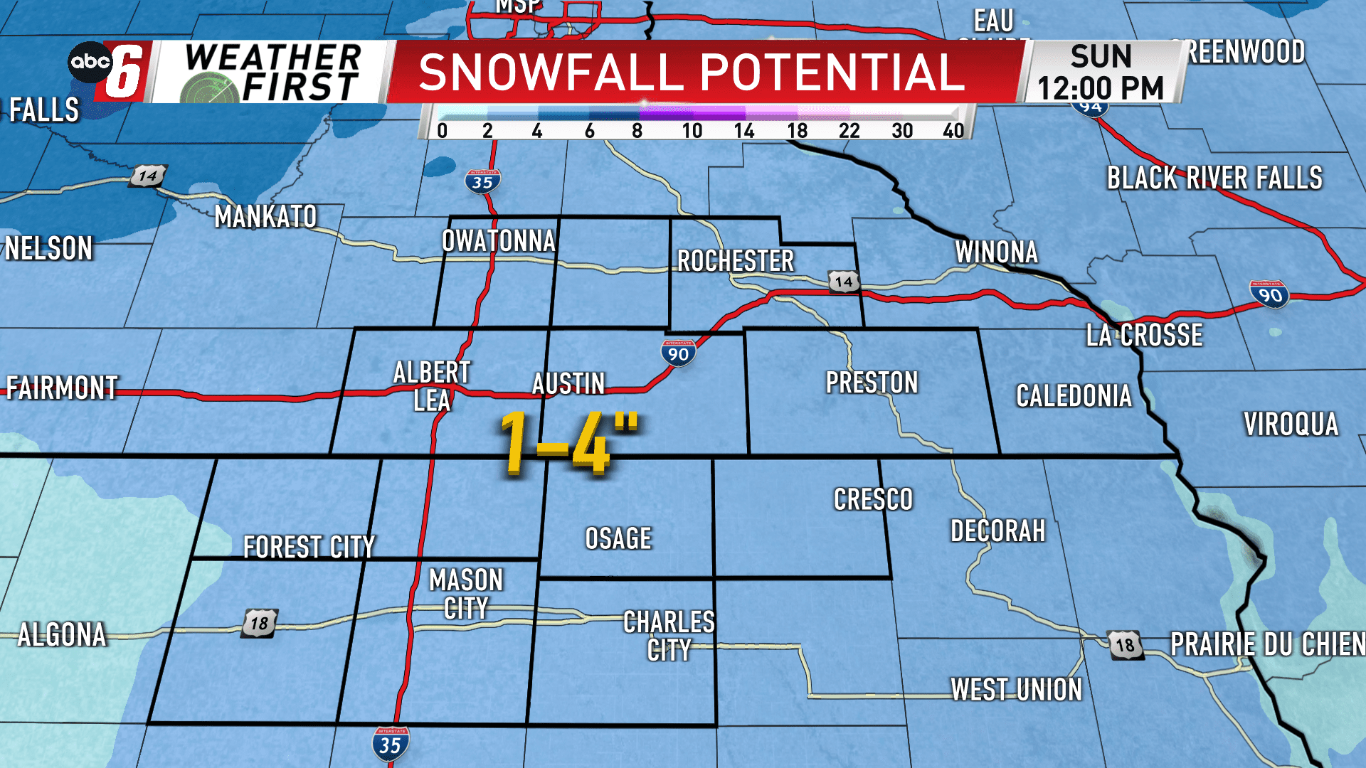
1-4″ of snow is anticipated. The sweet spot is around 3″. Initial melting makes us keep the range a bit wider to account for that.
Plan on residual effects into Sunday morning but swift improvement after sunrise.