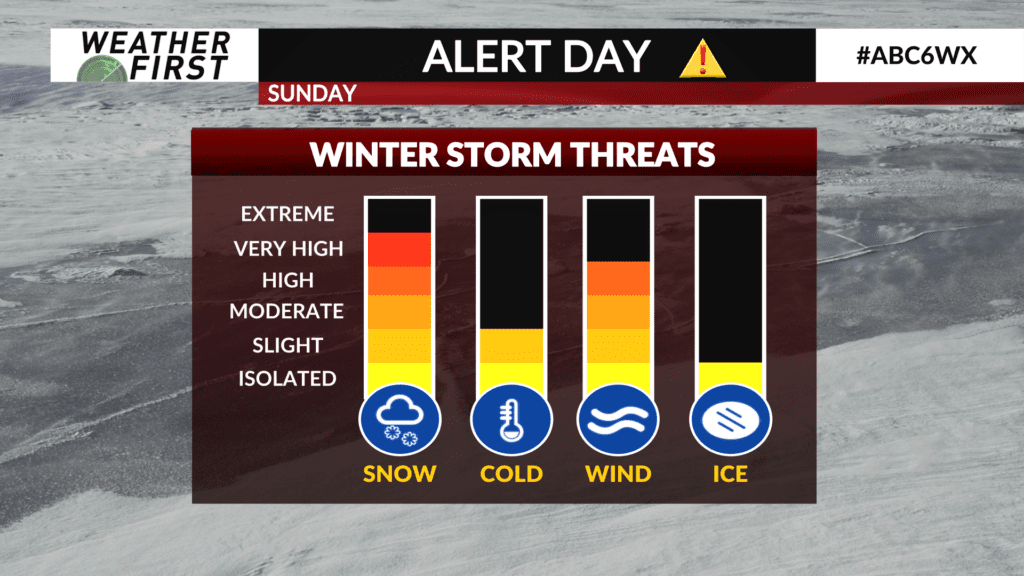
ALERT DAY SUNDAY: Snow, gusty winds likely to impact area
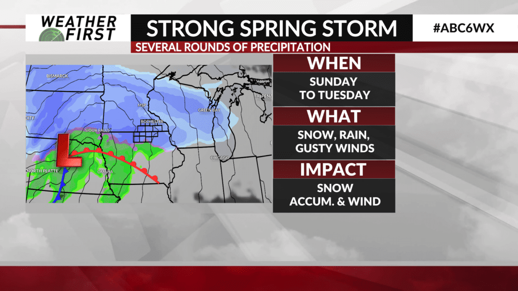
A strong storm system will bring a variety of weather to the ABC 6 Weather First area from Sunday into early next week.
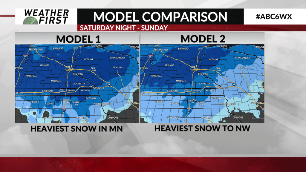
The storm will develop in the central plains and begin to track northeast toward the area on Saturday. Cold air will be in place for snow to develop sometime late Saturday night and continue through much of the day Sunday, likely becoming heavy at times.
As the storm gets closer, a warm front will lift north through the area bringing in some warmer air with snow changing to rain on Monday.
The storm will track over the area and then eventually pull its way toward the Great Lakes region driving a cold front through on Tuesday with rain likely changing back over to snow.
Another aspect of this storm will be the strong winds with gusts of 30-40 mph likely on Sunday and again on Tuesday.
There is still a lot of uncertainty regarding this storm including its track which will be crucial in determining where the heaviest snow lays out. Expect details to be ironed out later Friday or Saturday.