Active weather with showers, thunderstorms likely into the weekend
The weather will turn more active heading into the weekend as a storm system will approach leading to showers and thunderstorms developing beginning on Friday morning.
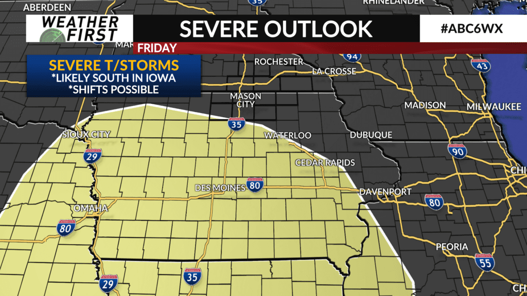
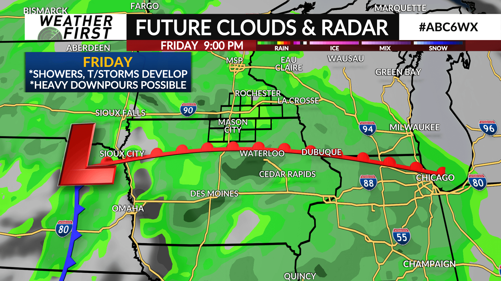
A low pressure system will develop and track towards western Iowa with moisture from the Gulf of Mexico surging northward. Showers and a few thunderstorms will be likely on Friday morning with additional thunderstorms possible during the afternoon and evening. Thunderstorms have the potential to produce heavy downpours.
A threat for severe weather exists over central and southern Iowa and is dependent on the storm track and where a warm front will align itself. It’s certainly possible the severe threat could shift northward into northern Iowa and southeast Minnesota. Details will get ironed out in the days ahead.
The storm system will pass through central Minnesota toward the northern Great Lakes on Saturday with a few lingering showers possible.
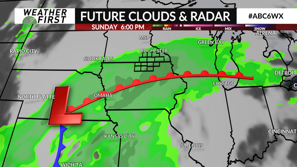
Another system arrives on its heels on Sunday leading to more additional showers and thunderstorms. The severe threat is expected to be southeast of the local area in far eastern Iowa into Illinois.
A few showers may linger into Sunday night and Monday morning.