Tuesday storms, Wednesday showers update
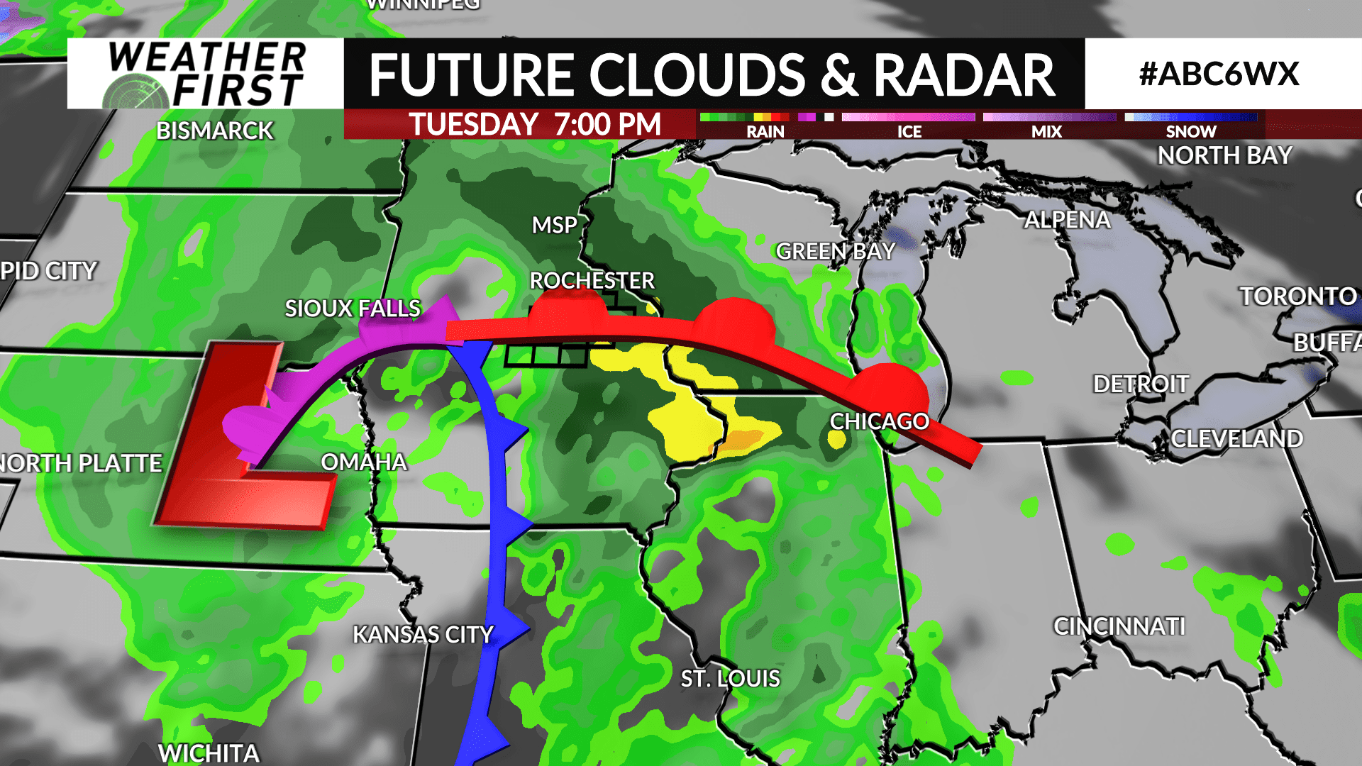
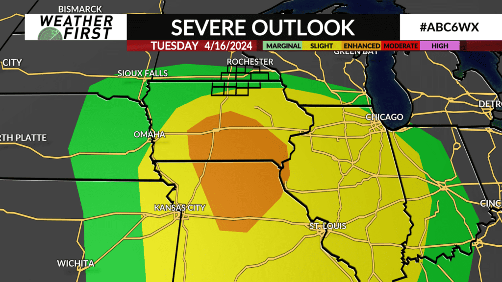
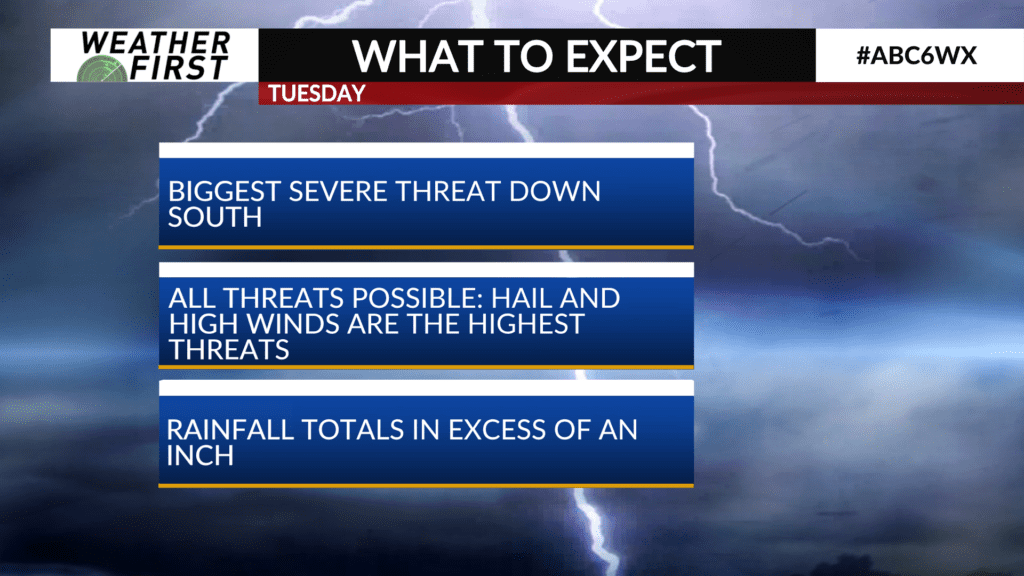
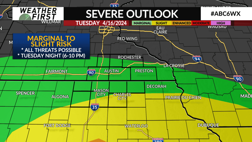
We are still expecting plenty of rain both Tuesday and Wednesday. Thunderstorms are in the forecast on Tuesday, with storms later in the day being potentially strong to severe. These storms would take place in the late afternoon and early evening (about 4-9 PM, 5-10 PM). Odds for severe weather remain higher in southern Iowa and northern Missouri, but all threats (including a few tornadoes) remain possible locally.
The warm front will be critical with this round of storms. South of the warm front and east of the cold front is where the most unstable air will be. The warm front is less likely to move up towards Highway 14, greatly limiting the risk for severe weather.
An Alert Day is not being added yet, but could become necessary if there is a northerly shift of the storms or if we have less rain earlier in the day Tuesday, allowing us to have more energy for thunderstorms later in the day.
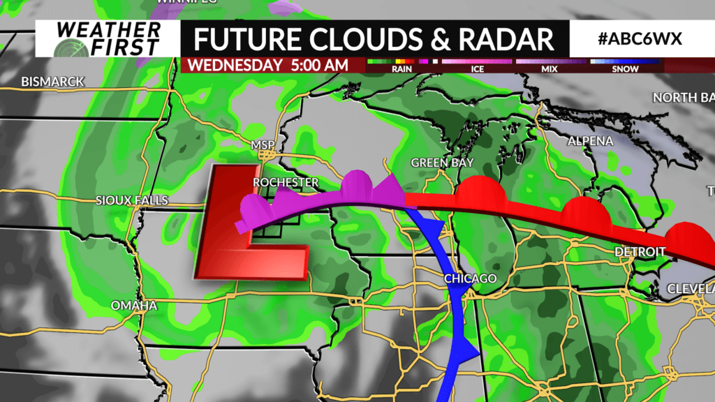
Wednesday is another rainy day, but we are expecting showers. Between the two days, rainfall totals will regularly top 1″, possibly be even higher depending on where specific cells end up tracking.