Surge of warmth arrives early next week
Temperatures will get a nice boost heading into next which will be more typical of late April and early May.
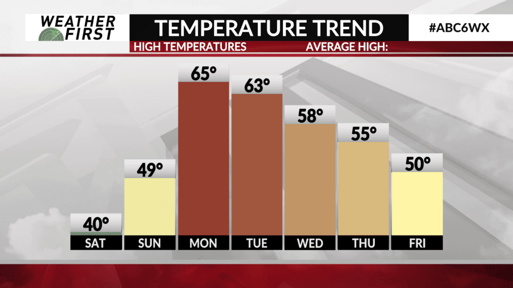
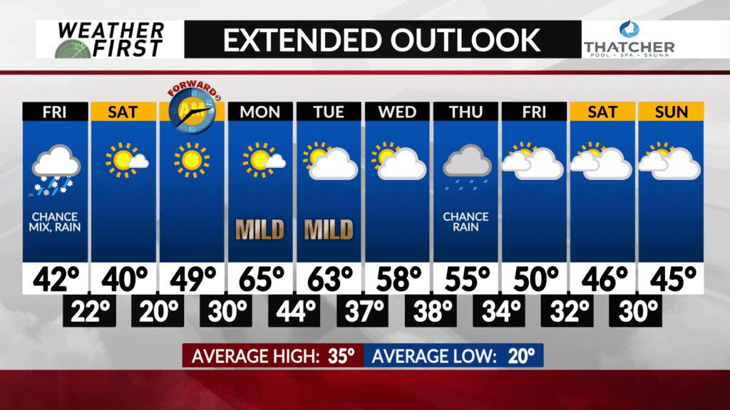
The weekend will offer pleasantly cool temperatures mainly in the 40s with sunshine thanks to high pressure situated overhead which will keep the weather quiet with lots of sunshine.
The high pressure pushes to the southeast of the area on Monday with winds switching to the southwest which will bring in some much warmer air. It’ll be another bright and sunny day with high temperatures surging into the middle 60s.
Another warm day is expected on Tuesday with high temperatures in the low-to-mid 60s before a cold front slides through Tuesday afternoon and evening which may spark a light shower.
Cooler temperatures will follow as highs cool off into the 50s the rest of the week.
A couple more systems may bring rain chances back to the area over the second half of the week, but several uncertainties remain regarding the track and evolution of each.