Thunderstorms with severe weather potential through Tuesday evening
(ABC 6 News) – Strong to severe storms are possible Tuesday afternoon through evening. A TORNADO WATCH is in effect for a portion of north Iowa including Cerro Gordo, Worth, Winnebago, Hancock and Floyd counties until this evening.
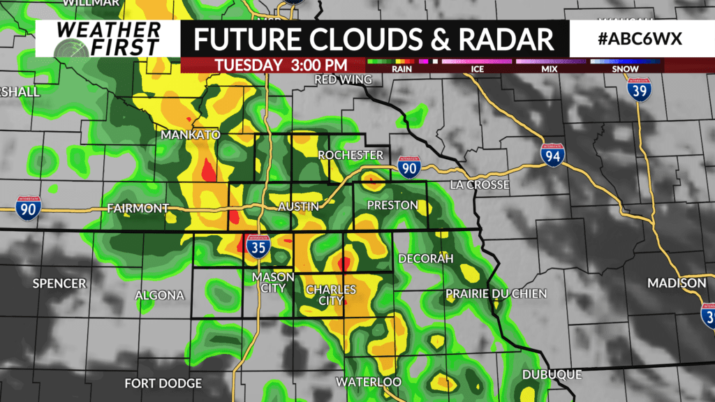
A storm system is moving out of the central plains and will cross into Iowa on Tuesday afternoon.
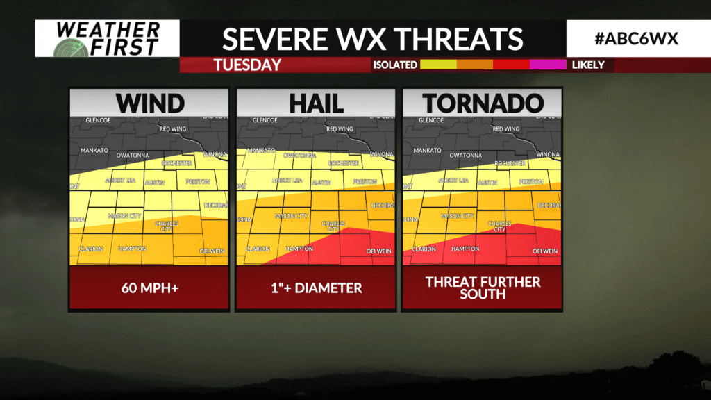
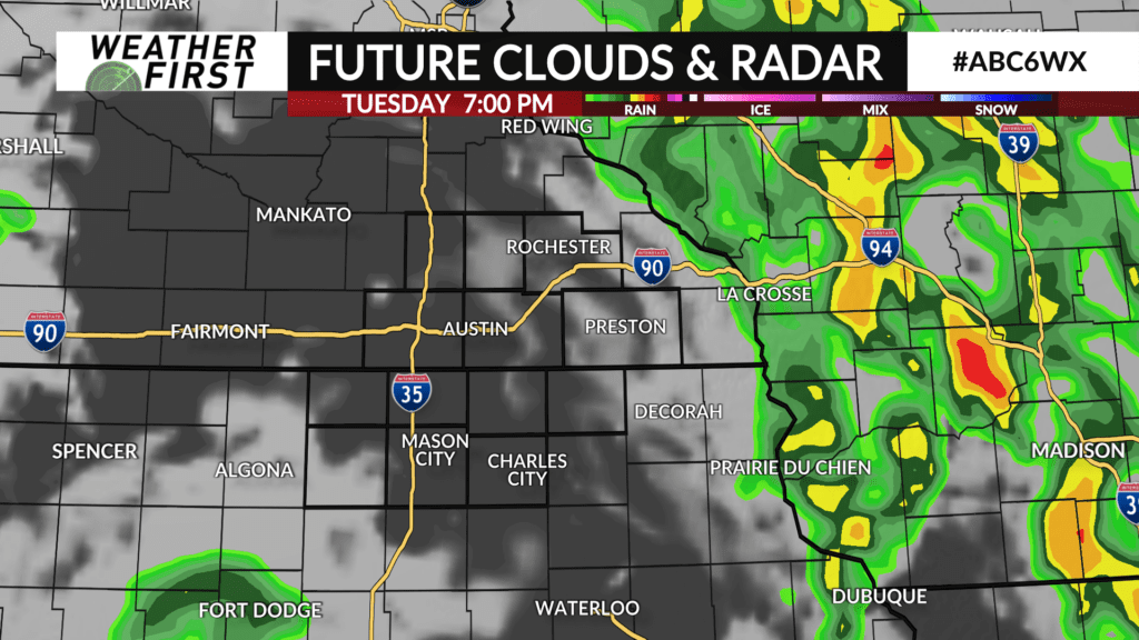
Showers and thunderstorms will continue to track north and northeast from Iowa into southeast Minnesota as the day moves along. Heavy downpours, gusty winds and hail are possible in any of the stronger cells.
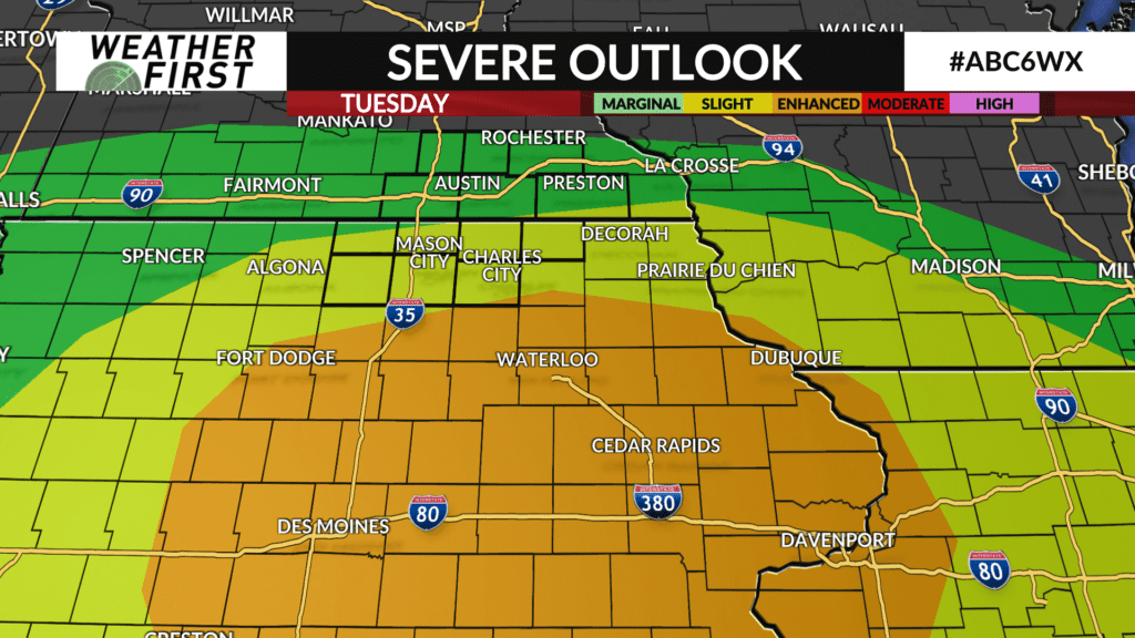
The chance of stronger to severe storms is more likely in the afternoon to evening. The timeframe will generally be 1:00 PM to 8:00 PM. The primary modes of any severe storms will be large hail along with damaging wind gusts.
There is a possibility of some tornadoes, especially in central and eastern Iowa, but the chance in north Iowa is not zero. It depends on where a warm front gets situated which it’s possible that may be near the Minnesota and Iowa state line or further south.
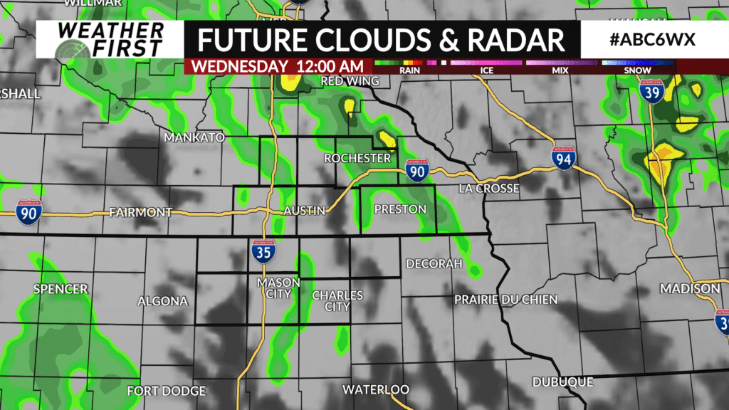
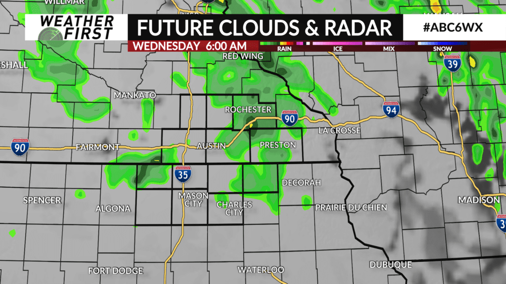
The severe threat will wind down by mid evening with some lingering showers and thunderstorms possible through the night into Wednesday morning.
ABC 6 News will have any watches and warnings online at kaaltv.com, on our ABC 6 News App and on-air.