Large storm set to impact area starting this weekend
A large, complex, and slow-moving storm system looks to track through the region later this weekend that will likely carry over into next week bringing several rounds of precipitation.
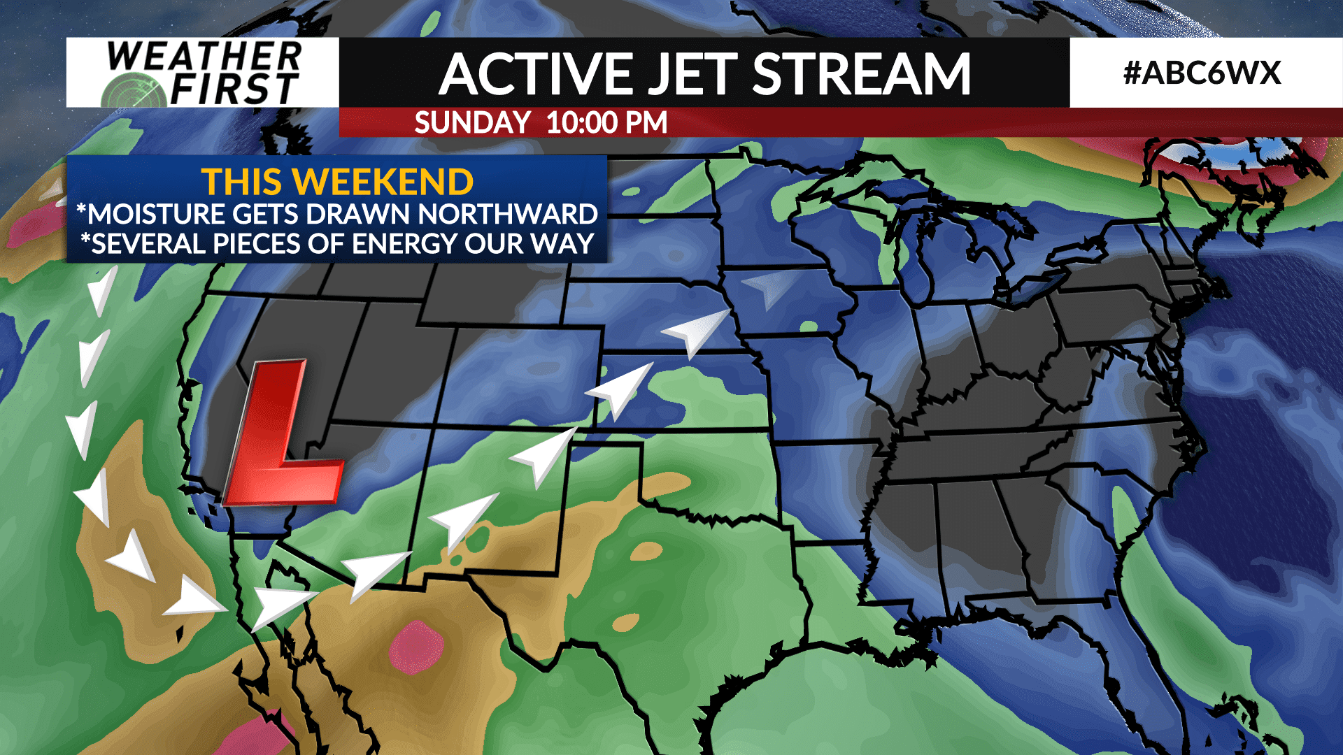
The storms main energy is over the Pacific Ocean so there are still several uncertainties that remain on how this storm will develop and where it’ll ultimately track which will play a large role in determining the temperatures and precipitation type.
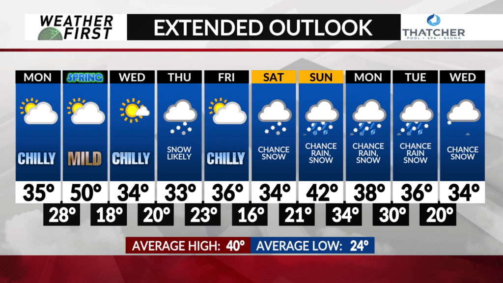
There will be enough cold air to play with where snow will be likely either in the area or close by and it may bring heavy snow accumulations.
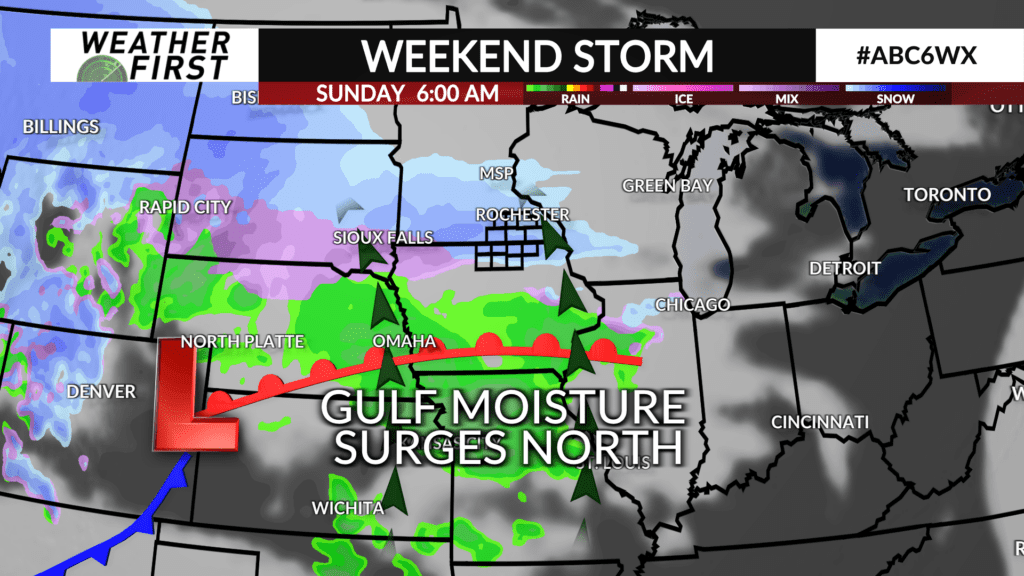
A low pressure trough will dig into the southeast United States. It’ll lead to a southwesterly flow into the region which will bring in moisture from the Gulf of Mexico as several pieces of energy rotate around the trough ejecting into our area leading to several rounds of precipitation starting on Saturday.
The trough isn’t expected to clear the area until the middle part of next week meaning there are several days where precipitation will be likely, whether that is rain, snow or a combination of both remains to be seen. Expect details to be ironed out later this week as the weekend gets closer.