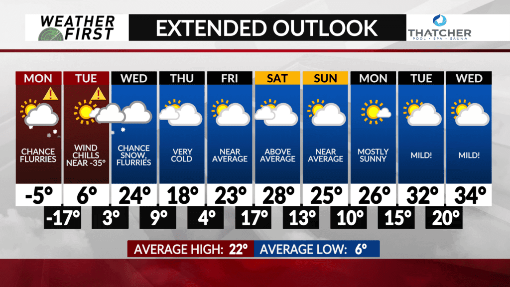
Temperatures moderate middle of the week
After several days of very cold temperatures, we will finally see the return of seasonable temperatures later this week.
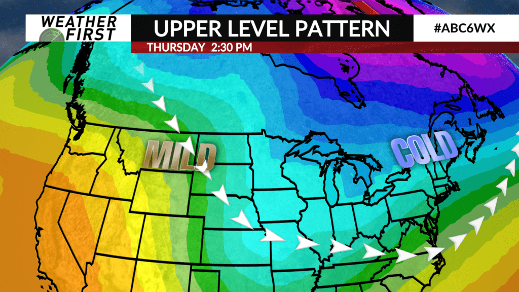
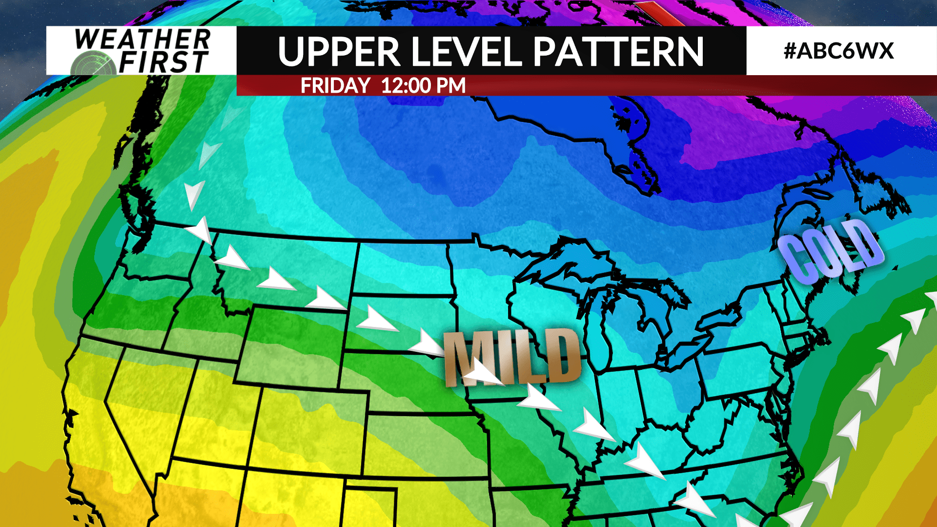
An upper level low pressure system, known as “The Polar Vortex” these days, will finally begin to nudge eastward Tuesday and Wednesday. At the same time, a weak ridge of high pressure will slide southeast across the central United States the second half of the work week.
This upper level orientation will allow warmer air from the Pacific to slide eastward and push the colder, arctic air out of the Upper Midwest. The result? High temperatures back to levels we are more used to this time of year!
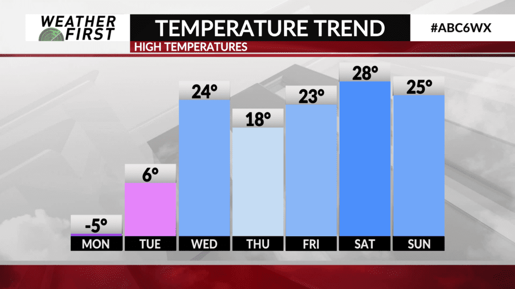
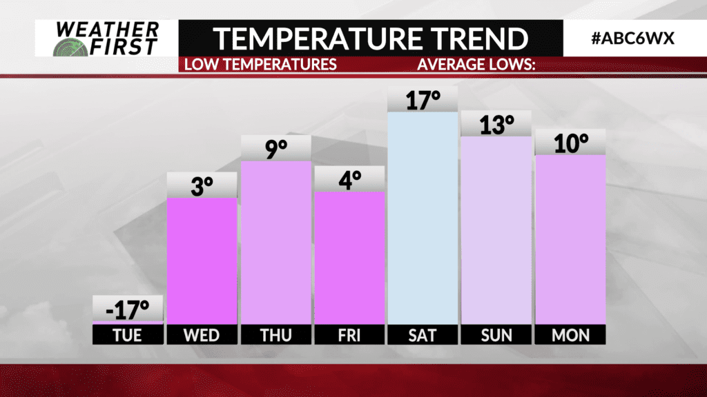
The average high temperature for January 18th is 22F, with a low of around 6F. Highs by Wednesday will be back into the low 20F’s, but we will still have lows in the single digits into Friday morning.
Highs by Friday will be in the mid to upper 20F’s across southeastern Minnesota and northern Iowa. By next Saturday, high temperatures in the low 30F’s are possible! Beyond next weekend, it’s hard to say what temperatures will look like. However, it does not appear that there will be any major arctic outbreaks through early the following week at this time.