Sunday’s Almanac (12/22/2024)
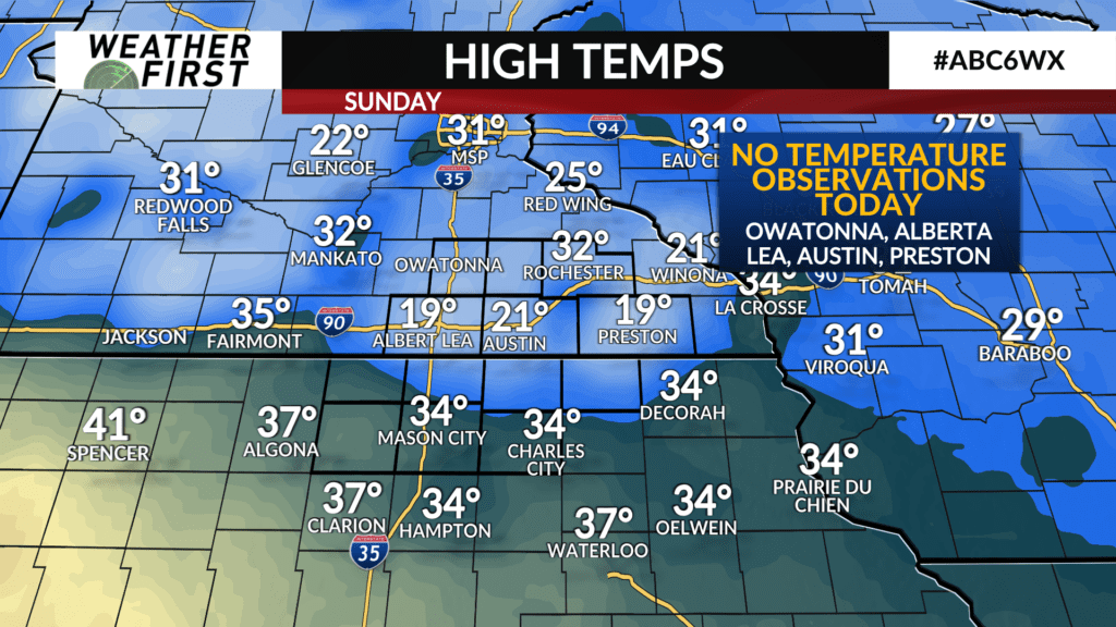
It was much warmer, and a generally pleasant day across southeastern Minnesota and northern Iowa!
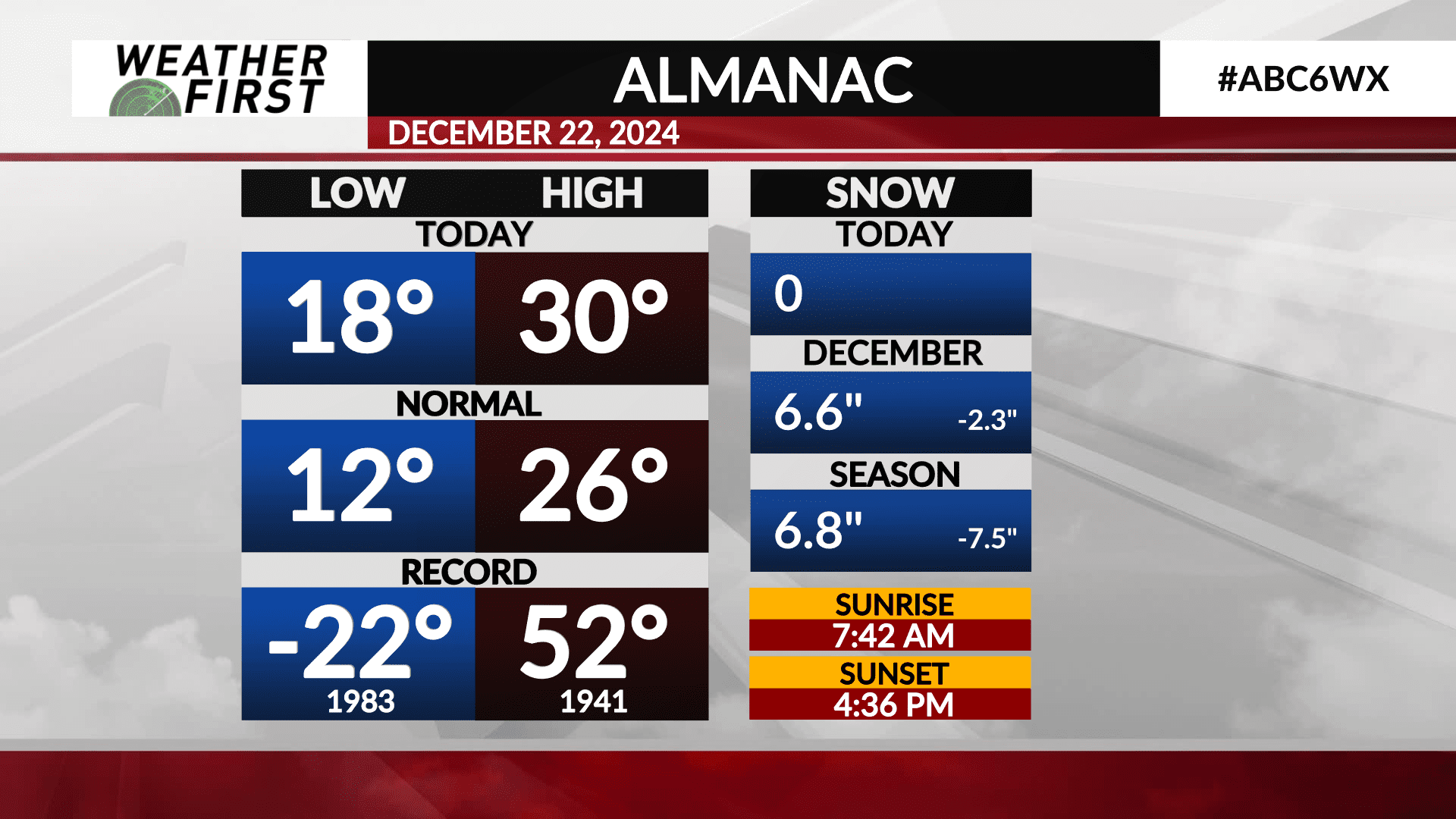
The recorded high temperature in Rochester, MN was 30F. This falls 4F above the long term daily high temperature average of 26.
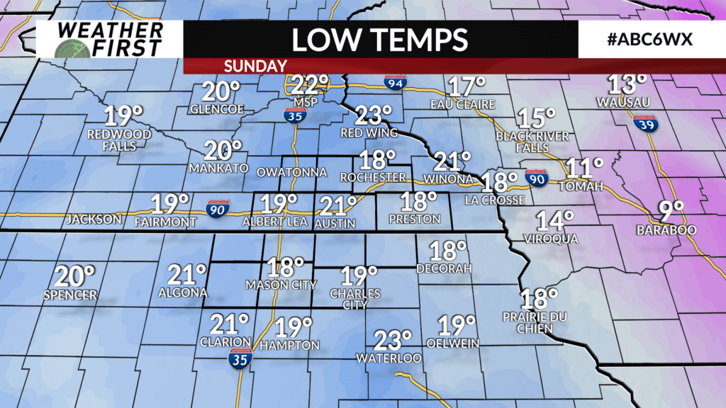
The low temperature this morning was 18F, which is 6F above the long term average for this time of year. Nothing too impressive, but certainly a pleasant chance from -7F the night before!
The record high for December 22nd is 52F, set back in 1941, with the record low being -22F, set back in 1983.
So far this month, we have seen 6.6″ of snow at the Rochester airport, which falls 2.3″ below average for this time of the month. For the season, we have only seen 6.8″ of snow, when the average by this time is 14.3″, putting us 7.5″ below average.
We’ll need quite a bit of snow at this point to catch up, and with no major snow makers in the forecast, this deficit is only likely to grow in the coming week or two.
Something to also note, we are gaining daylight again! Not a lot, but sunsets are now trending later, with sunrises trending earlier. It will be a little over a month, though, before we start gaining daylight at a faster rate.