Strong thunderstorms possible Wednesday
Showers and thunderstorms will be likely on Wednesday with the potential of some strong-to-severe thunderstorms during the afternoon and evening.
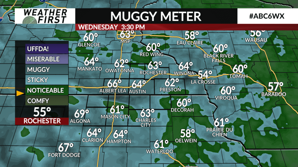
Moisture will continue to filter in with dew point temperatures climbing into the 60s which will make it feel a bit more humid and provide fuel for showers and thunderstorms.
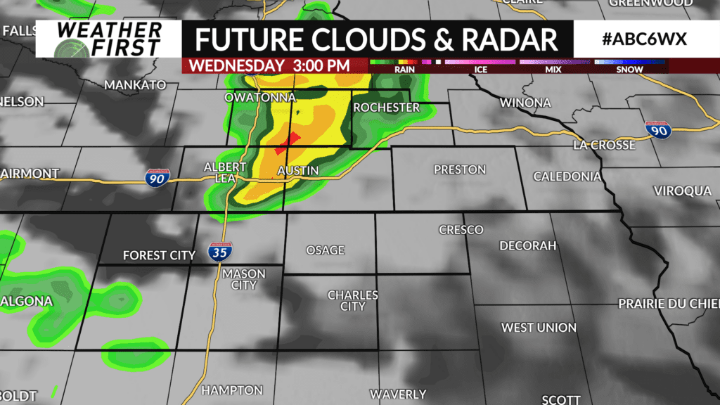
Energy will pass through during the afternoon which will pop showers and thunderstorms. There is still some uncertainty on exactly where and when these will likely develop, but it’s possible it could be early in the afternoon.
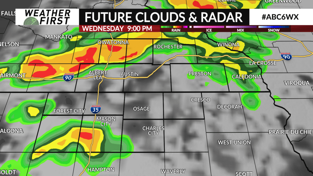
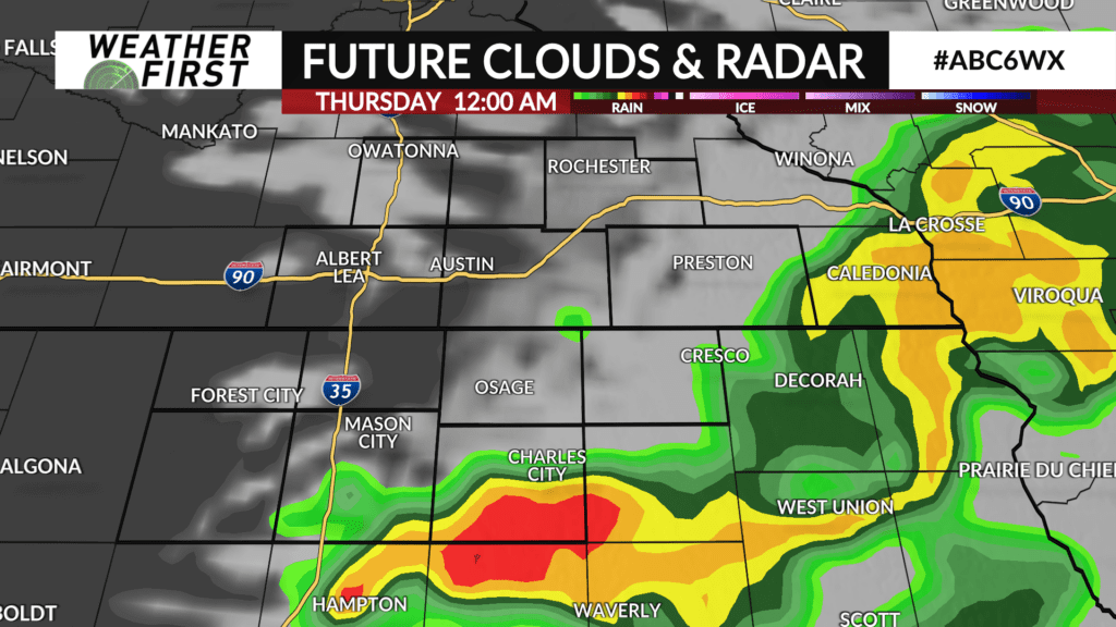
As the day moves along, showers and thunderstorms will become more likely and evolve into a line and move south into the area before exiting around midnight or before.
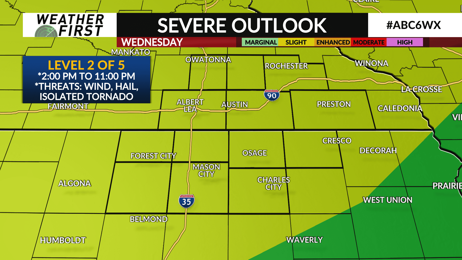
There is the potential of strong-to-severe thunderstorms. The Storm Prediction Center has a Level 2 of 5 risk for severe weather across the entire Weather First area. Hail would be the main threat with initial thunderstorms along with an isolated tornado possible. As the thunderstorms form into a line, the main threat would transition to damaging wind gusts. Locally heavy rainfall is also likely under the stronger thunderstorms.
The timing of thunderstorms and potential severe weather is around 2:00 PM to 11:00 PM.
It’ll be a warm day with high temperatures expecting to be in the low-to-mid 80s.