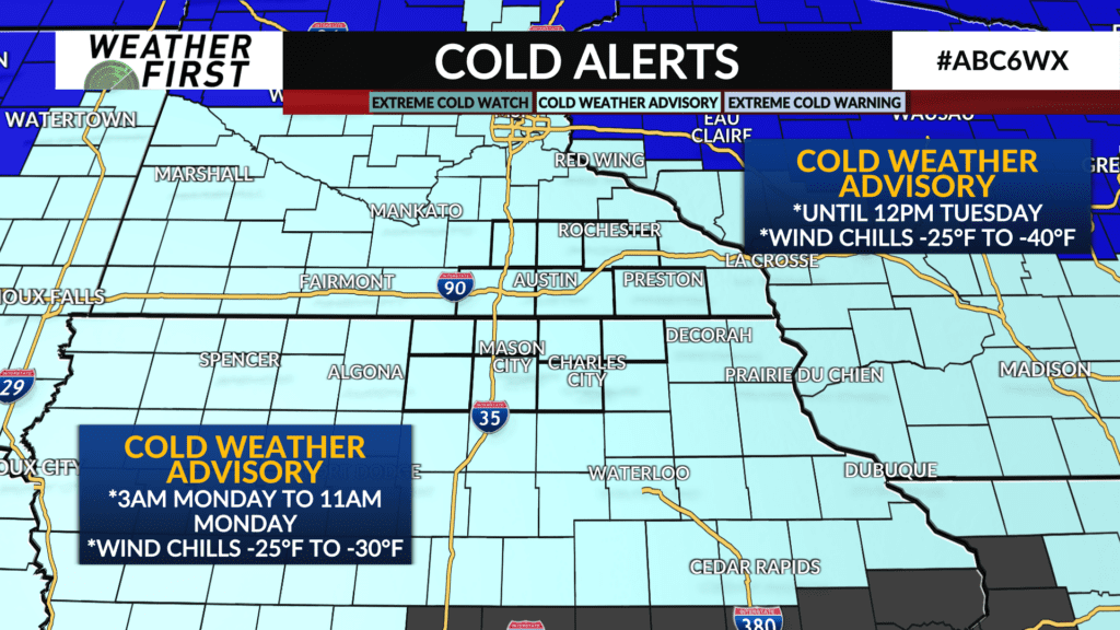
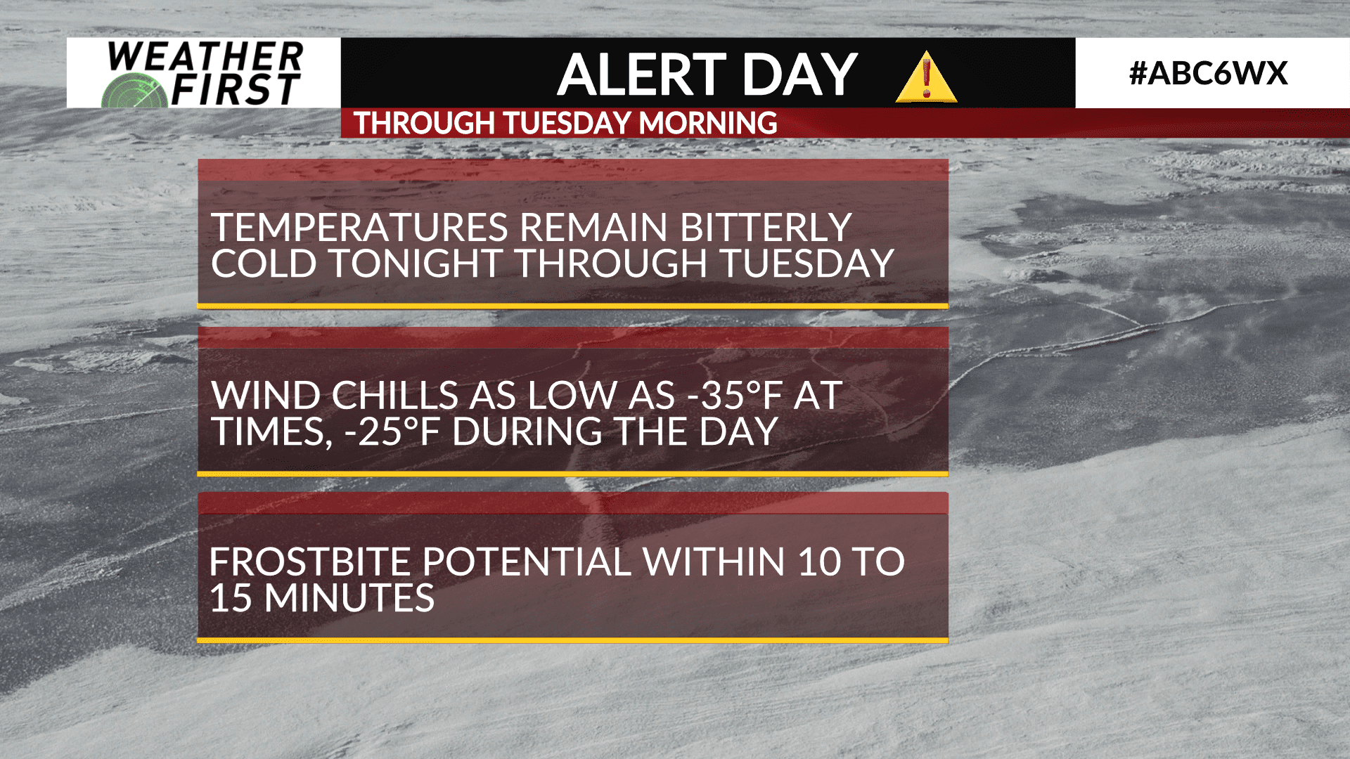
ALERT DAYS: Sunday-Tuesday due to dangerously cold wind chills
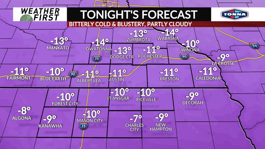
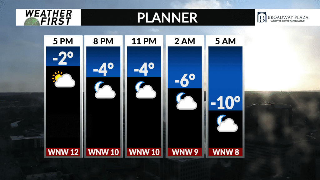
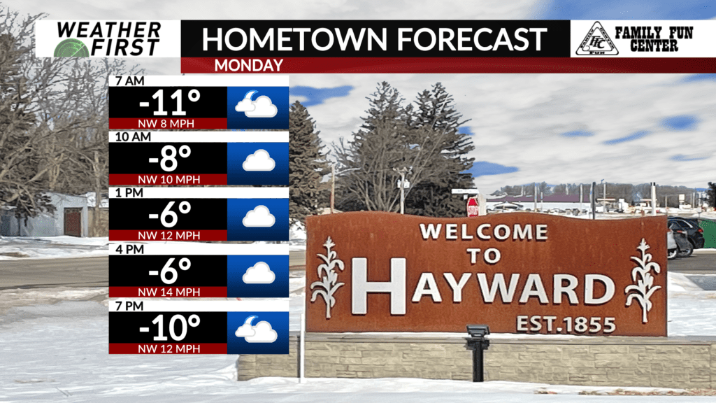
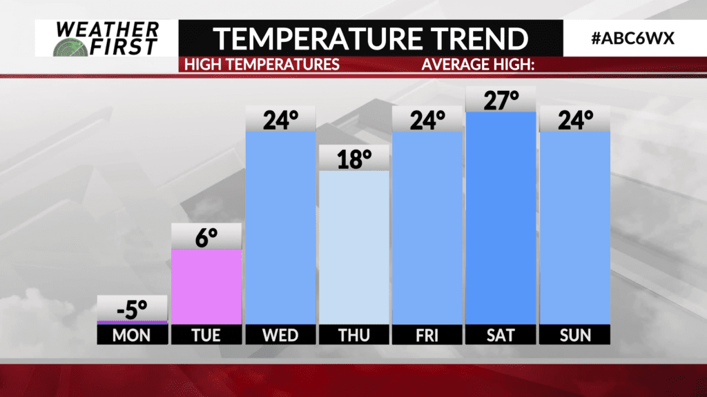
Temperatures remain bitterly cold this Sunday afternoon across the area, with many locations not making it above the 0F mark. Wind chills have remained in the negative 20F’s for some, while only making it into the negative teens for others. The bottom line….it’s VERY cold, and this will remain the case through Tuesday.
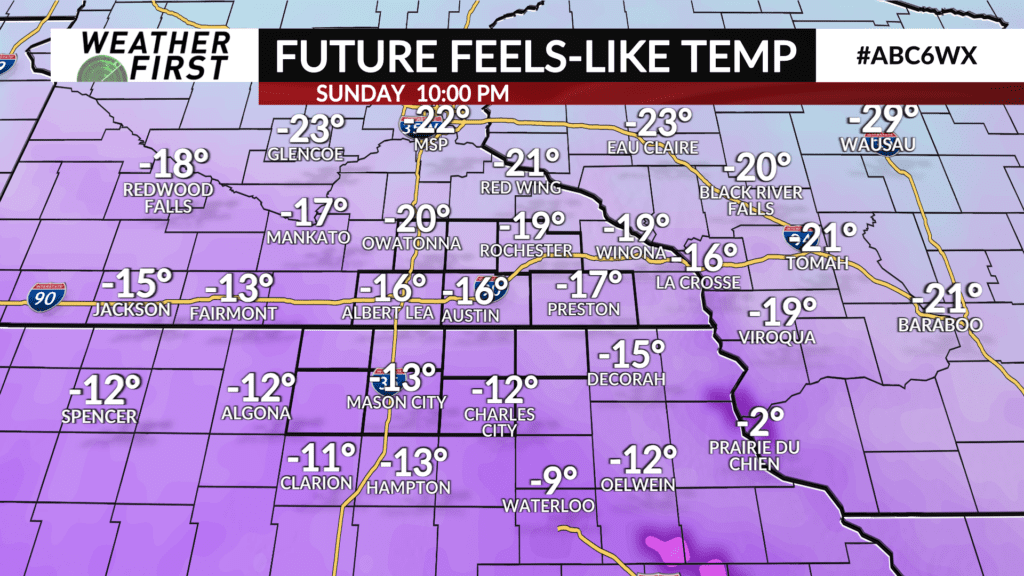
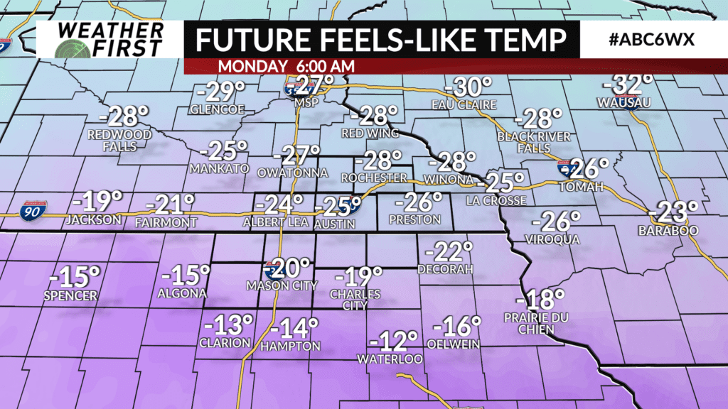
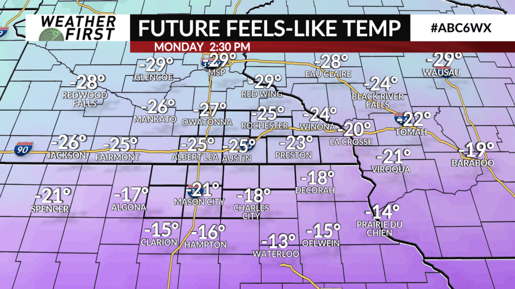
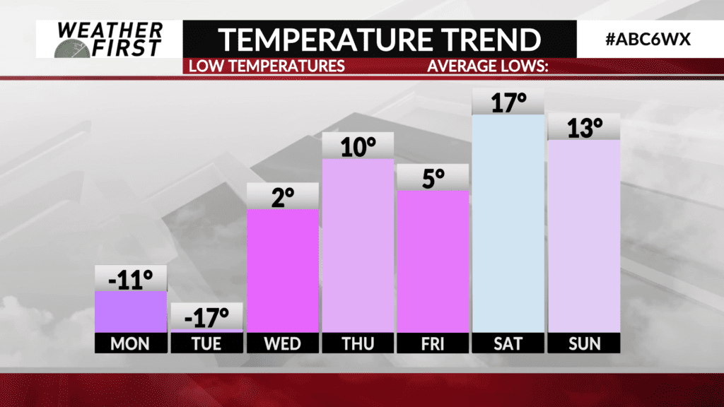
Temperatures drop into the negative teens for most locations Sunday night into Monday morning, with wind chills as low as -30F across southeastern Minnesota, and -25F across most of northern Iowa.
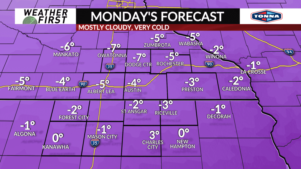
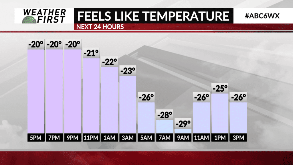
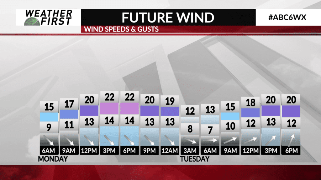
Wind chills will not rebound much on Monday, with daytime highs in the negative single digits and winds blustery out of the northwest, gusting up to 25 mph. The resulting wind chill remains in the -20F’s across most of the area.
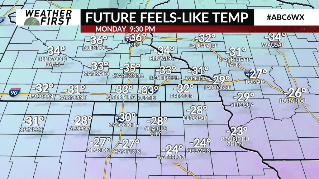
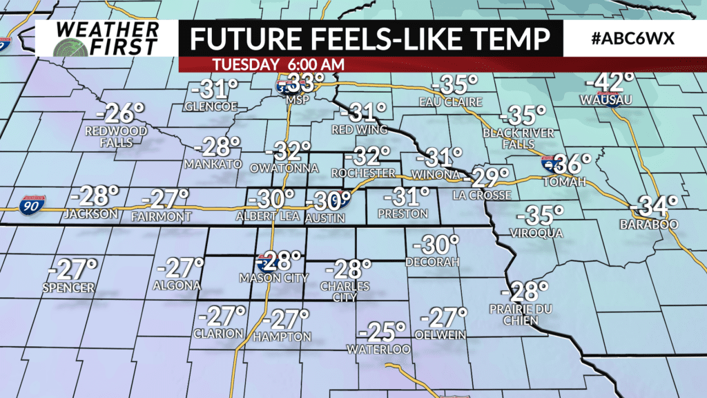
Monday night and Tuesday morning will be the coldest period of this arctic outbreak, with overnight/morning lows dropping well into the negative teens. Resulting wind chills will be some of the coldest we have seen yet, in the -30F’s for most! There is the chance some locations see wind chills dip as low as -40F Tuesday morning across southeastern Minnesota.
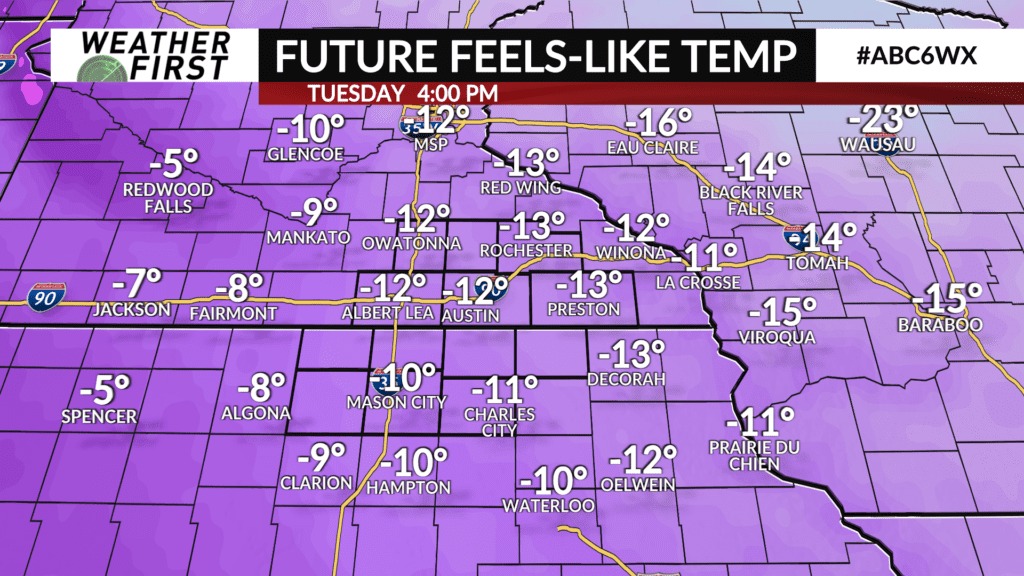
Temperatures finally climb above 0F on Tuesday, but wind chills remain in the negative teens. As a result, our ALERT DAY has been extended into Tuesday morning.
Wind chills as low as -30F to -35F can lead to frostbite in only 10 to 15 minutes. If you have to be outside for a longer period of time, dress in layers and cover extremities WELL. This includes your face too!
Check to make sure relatives and friends have heat, or ways to stay warm at the very least. Stay away from leaving your car running in the garage to warm it up, as this can expose you to high levels of carbon monoxide poising. Warm up your car outside instead to avoid this risk.