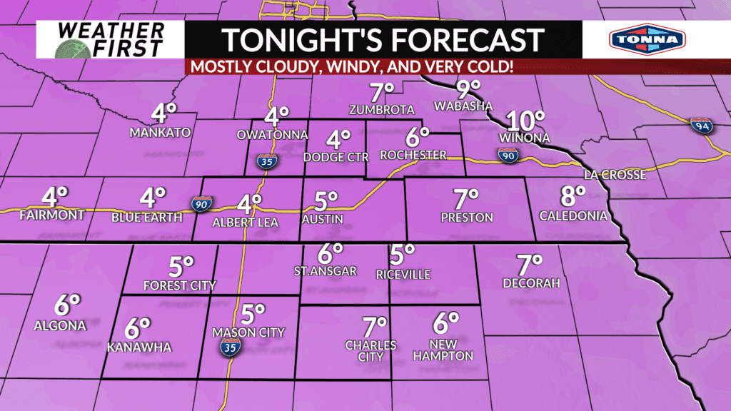
Bitterly cold temperatures through Friday morning

Not only are the winds headline worthy, but the cold moving in as well. A powerful cold front passed through the area quickly earlier this afternoon. Behind the front, arctic air is spilling into the northern United States, and is already on our doorstep.
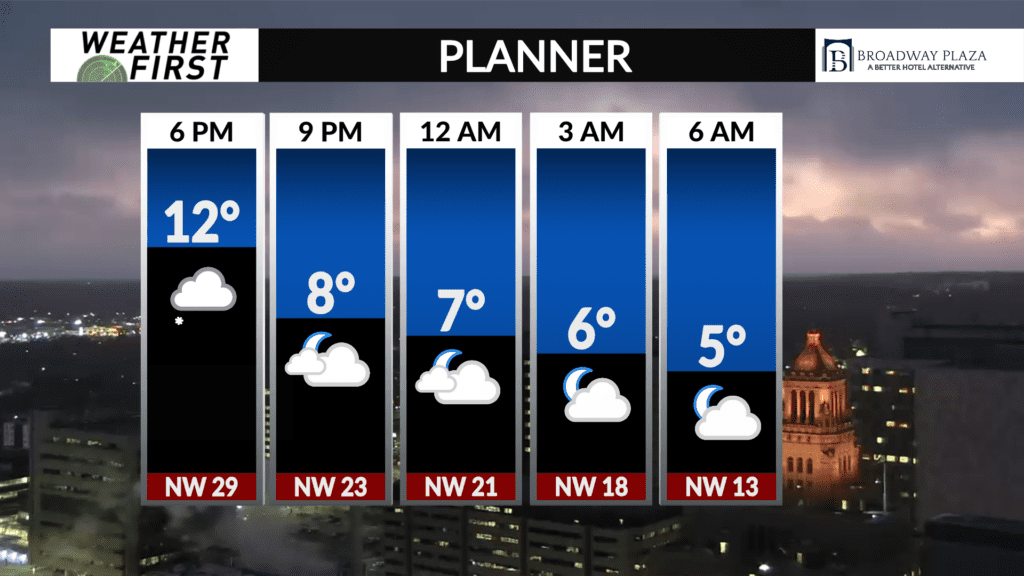
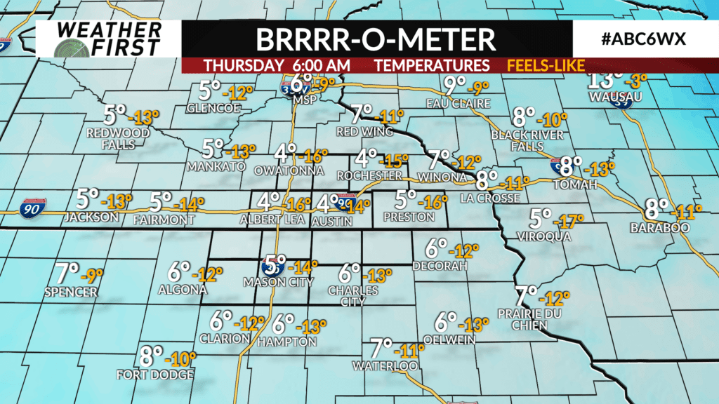
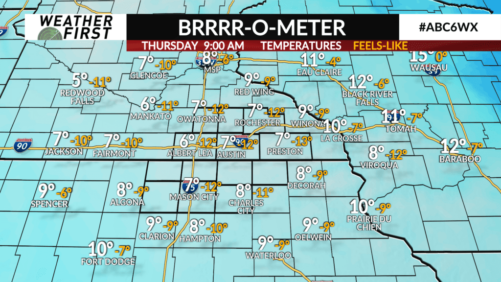
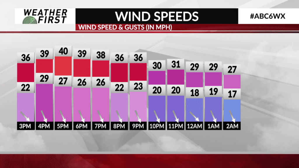
Temperatures bottom out in the low to mid single digits across all of southeastern Minnesota and northern Iowa. Strong winds will continue through the night, with gusts up to 50 mph through around midnight. Gusts will decrease down to around 25 mph by Thursday morning.
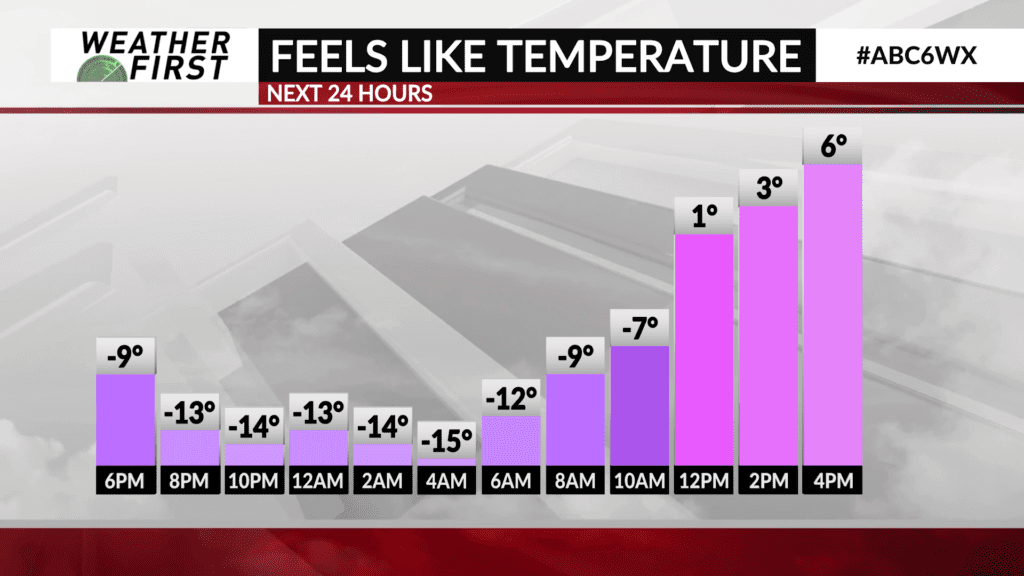
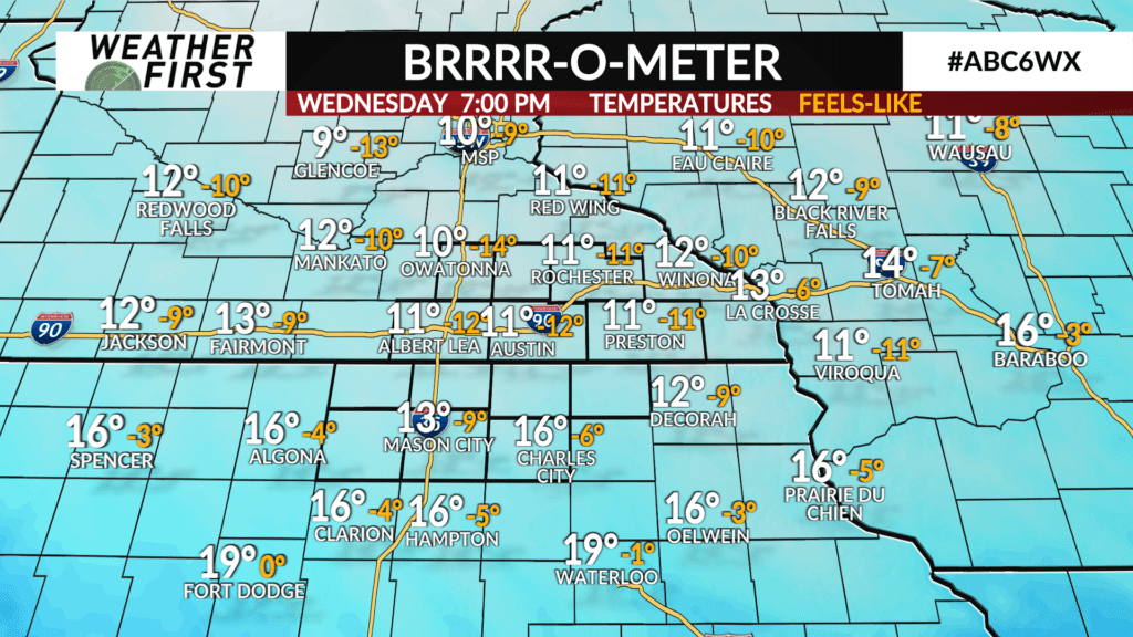
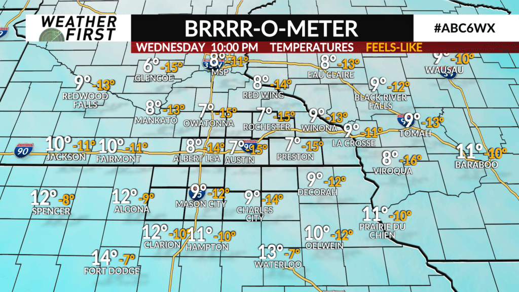
These high winds will contribute to how bitterly cold it will be, with wind chill temperatures dropping to as low as -15F to -17F by around midnight. Wind chills remain right around the -15F to -10F mark into Thursday morning. You’ll certainly want to bundle up when heading to work/school Thursday morning to prevent frostbite or getting too uncomfortably cold!
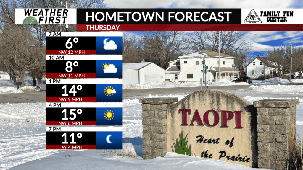
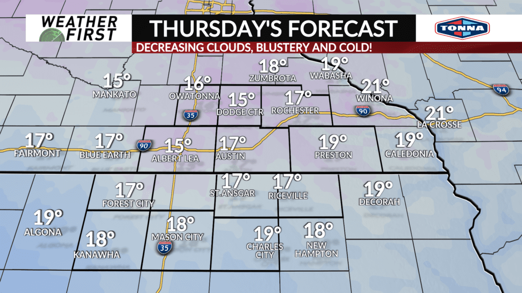
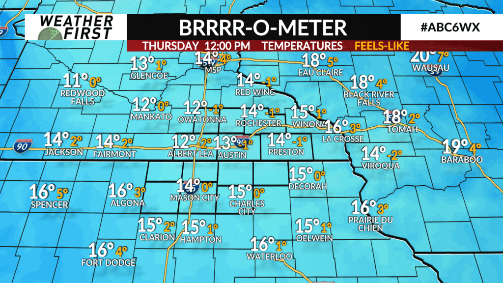
Thursday, afternoon high temperatures will be in the mid to upper teens across the area, with northwest winds still a bit blustery, up to 25 mph at times. These breezy winds will limit wind chills down to around 0F through the afternoon.
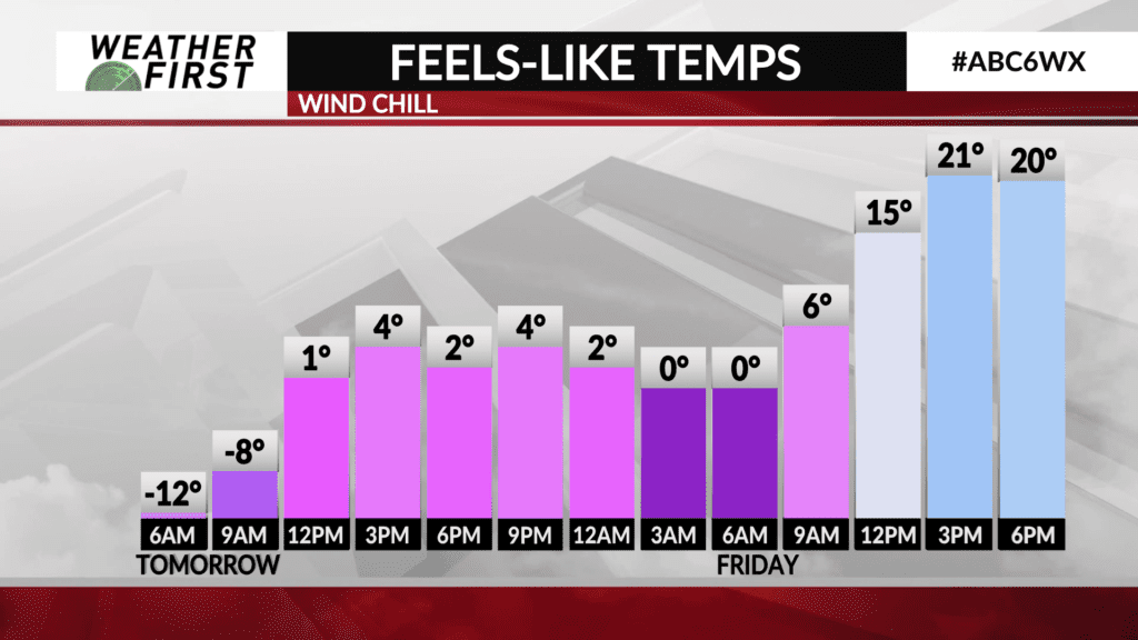
Thursday night, temperatures drop into the single digits once again, but the winds will not be nearly as strong as tonight. In fact, winds will be hardly noticeable at times, ranging from 0 to 10 mph. This will result in wind chills near to slightly below 0F at times. Still very cold!
Temperatures begin to moderate through the day on Friday, with high temperatures in upper 20F’s to lower 30F’s across the area. Balmy compared to what we are experiencing currently!