A quiet, mild and breezy Sunday ahead
We have a beautiful late January Sunday ahead of us, with above average temperatures and mainly sunny skies! It will be quite breezy, though.
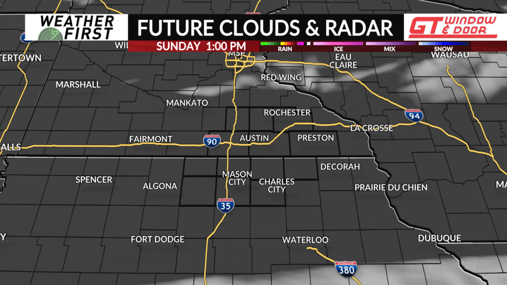
Skies have cleared this Saturday afternoon and evening as a cold front sweeps east of the area. The only clouds in the sky are the cirrostratus clouds passing over Iowa this evening.
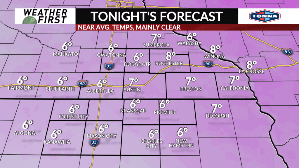
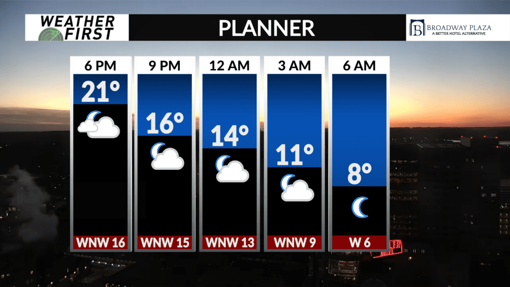
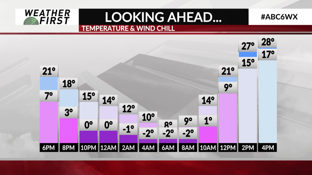
Skies will remain mainly clear through the overnight hours, with winds diminishing as the night progresses. Cooler, Canadian air is being swept southward with the northwest winds, and will enter the area overnight as well. These conditions will result in low temperatures dropping into the single digits across all of southeastern Minnesota and northern Iowa.
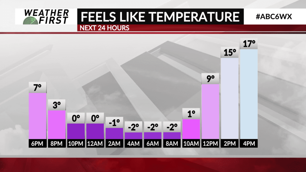
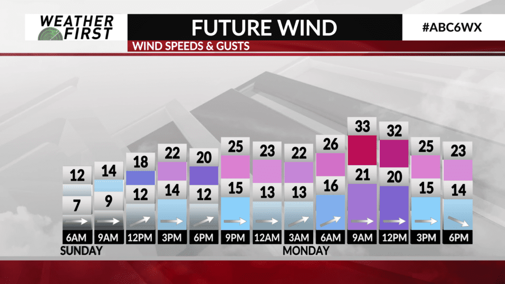
Winds will remain out of the northwest between 10 to 20 mph this evening, decreasing to around 5 to 15 mph overnight. Resulting wind chills will be just below 0F for all of the viewing area. Fairly typical for this time of year, and nowhere near as cold as what we experienced last week!
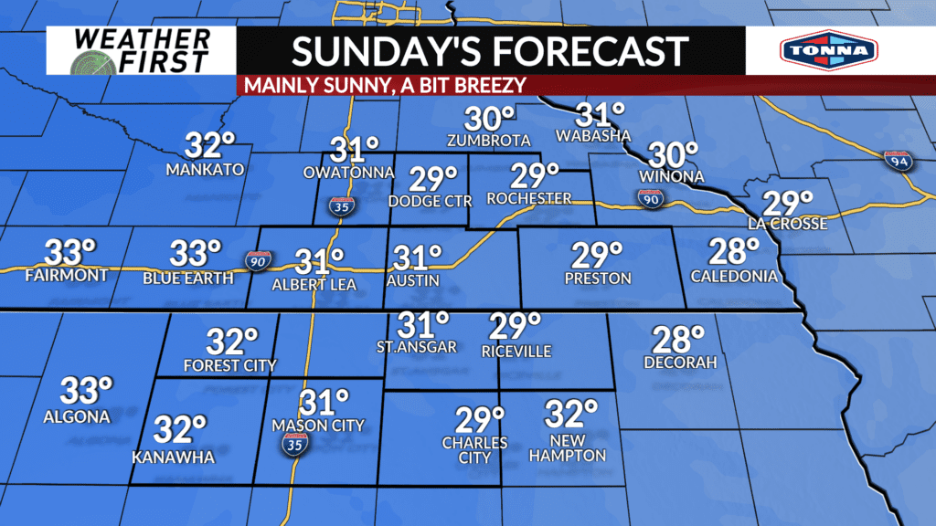
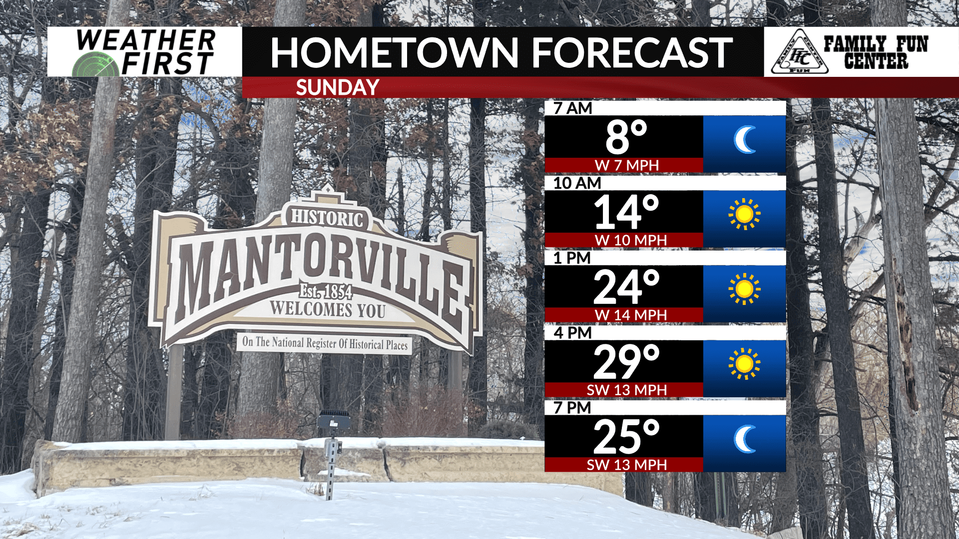
Sunday will start off on the chilly side, with temperatures in the single digits and wind chills near 0F. Winds shift to out of the southwest during the late morning and afternoon, becoming sustained around 5 to 15 mph, gusting up to 25 mph at times. This will usher in slightly warmer air, with highs in the upper 20F’s to lower 30F’s across the area.
Breezy winds will add a bit of a chill to the air, so the “feels-like” temperature will be a bit cooler than the actual air temperature. This wind chill effect will make it feel more like 20F across the area Sunday. Luckily, skies will remain mainly sunny, with any cloud activity being reduced to just a few thin cirrus clouds during the afternoon.
A more pleasant day overall!