A mild Monday ahead, a few flakes possible
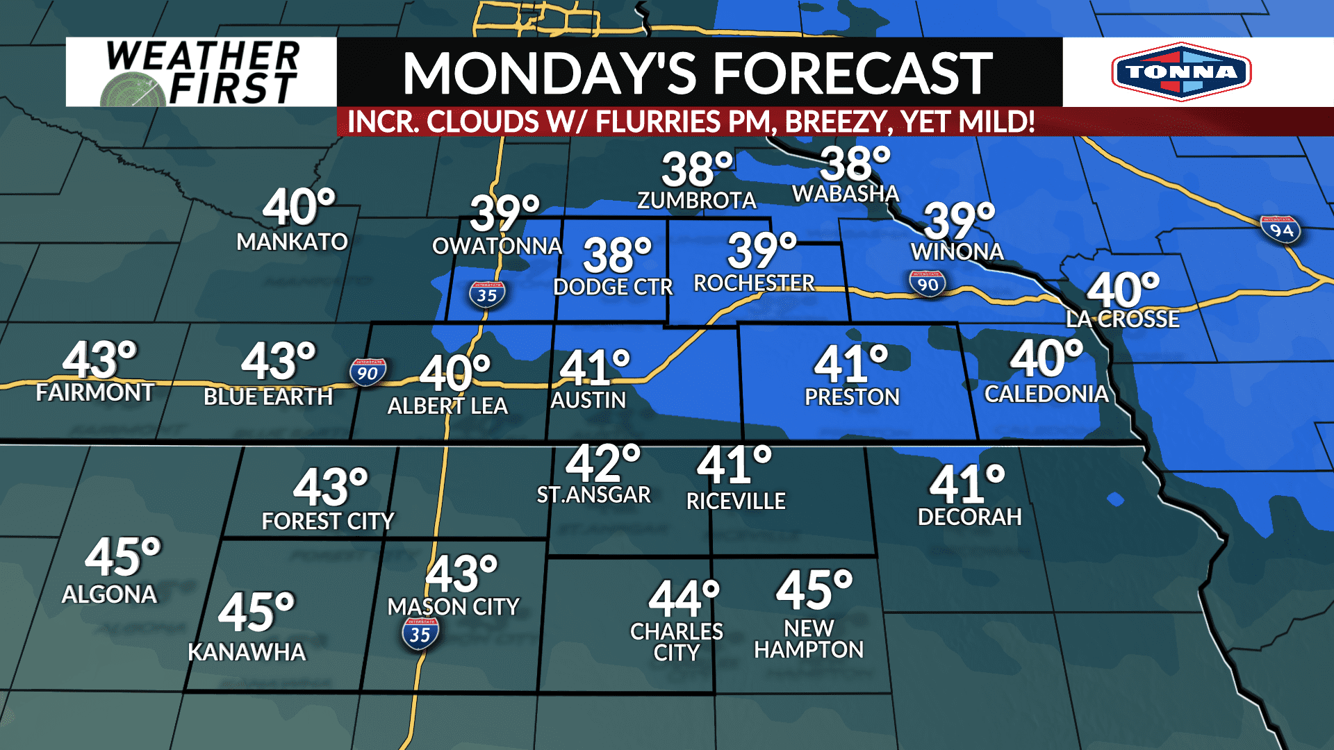
Our January thaw begins Monday, with much warmer temperatures and breezy conditions expected across the area!
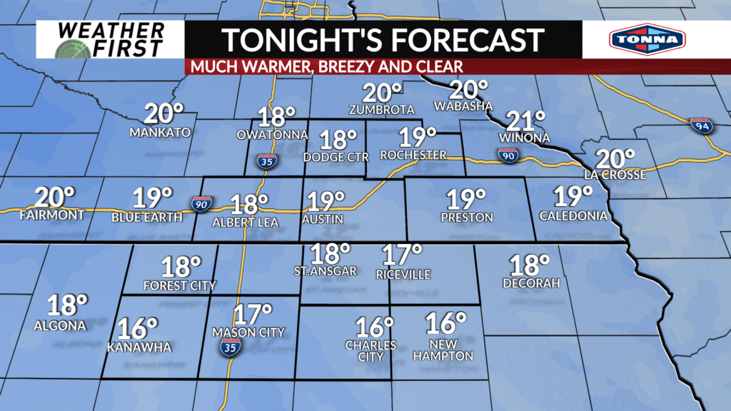
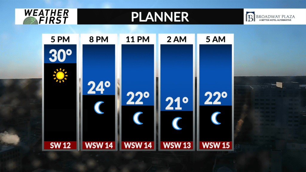
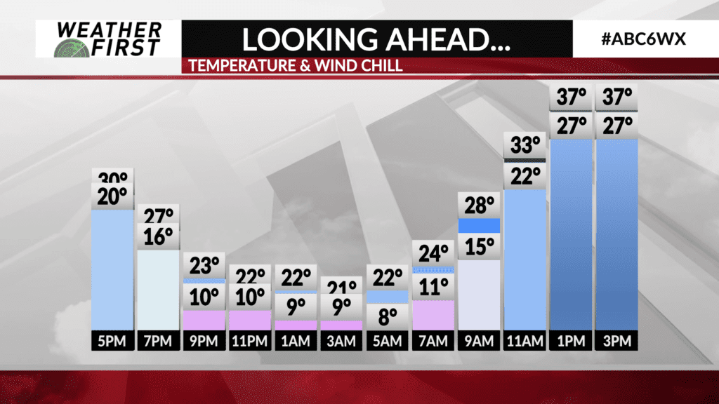
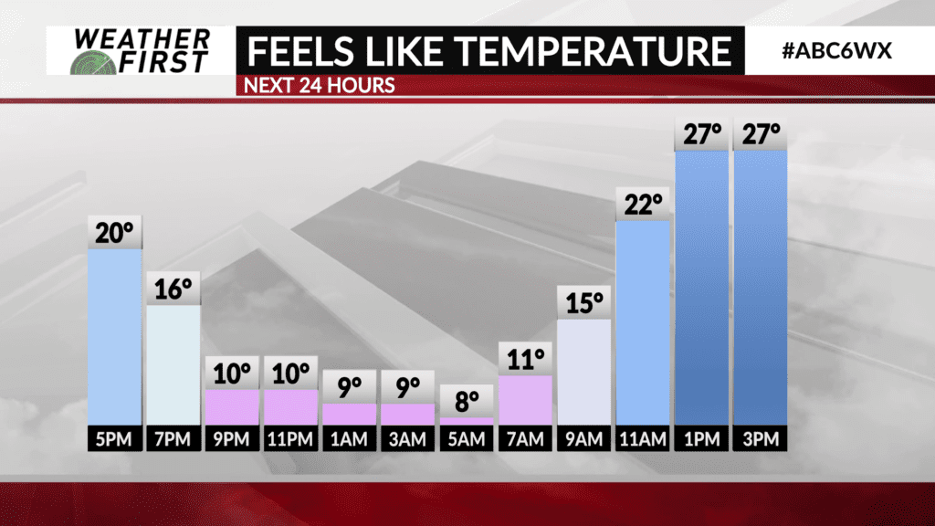
Temperatures are already a bit warmer than they were just 24 hours ago, boding well for a warmer night ahead tonight! Low temperatures will only drop into the mid to upper teens across the area, but stiff southwest winds gusting up to 25 mph at times will result in wind chills in the single digits.
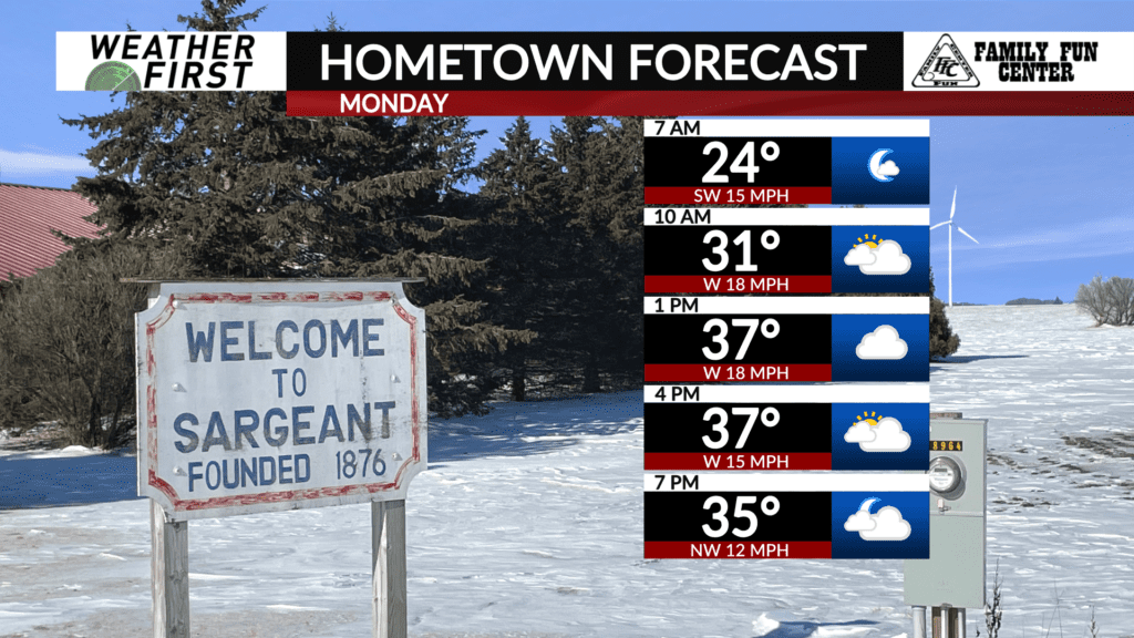
While it will certainly be a bit warmer across our area Monday morning, it will still feel quite chilly out there. You will still want to bundle up when heading off to work/school!
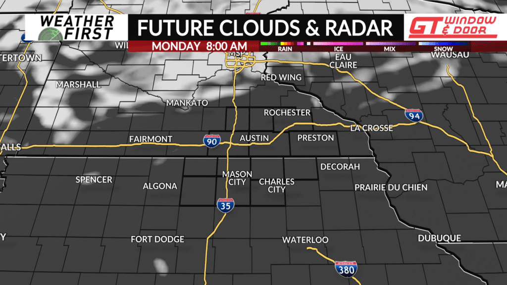
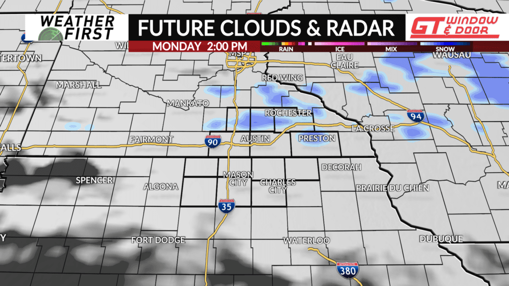
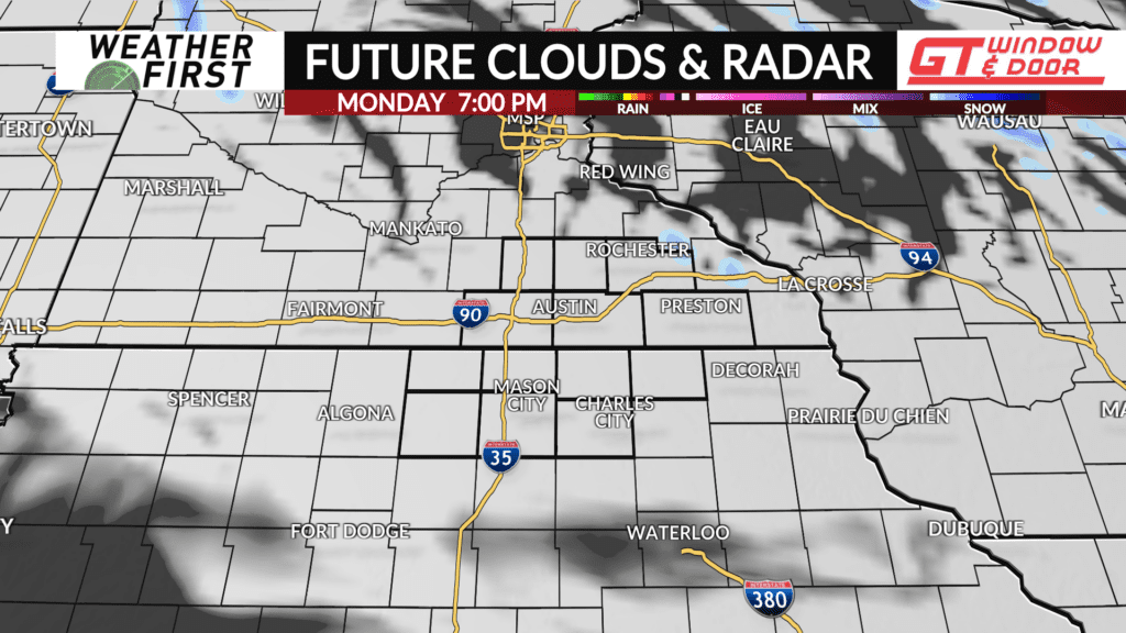
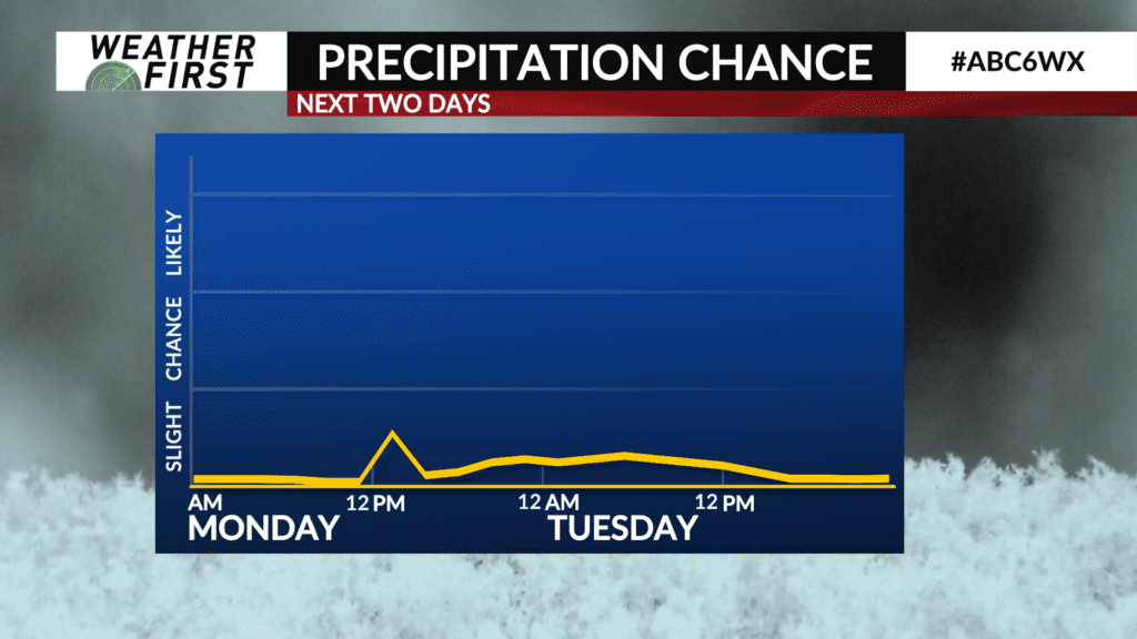
Monday will start with plenty of sunshine during the morning, with clouds quickly increasing into the afternoon hours as a cold front approaches from the north. Enough moisture will be present for a few light snow showers/flurries through the afternoon.
While temperatures near the surface Monday will be above freezing, the air temperatures just above the surface and at levels snow crystals form will be cooler. This will allow any precipitation we see across the area to remain in the form of snow. Any snow showers will be short lived and spotty, with no accumulations of a dusting at the very most.
Temperatures will climb into the upper 30F’s to lower 40F’s across most of the area! Winds will remain rather breezy out of the southwest, between 10 to 20 mph, gusting up to 35 mph at times. Fortunately, the “feels-like” temperature will still be in the 30F’s, making it feel quite warm for this time of year!
In fact, high temperatures in the upper 30F’s to lower 40F’s would put us at least 15F to 20F above the long term average high for this time of year, with more warmth to come throughout the week!