ALERT DAY: Snow gradually ends Thursday; travel impacts remain
(ABC 6 News) – A strong winter storm will continue to pivot away from the area Thursday with snow ending, however travel difficulties will remain. As a result, there is an ALERT DAY!
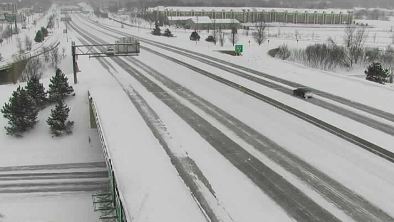
There will be numerous icy spots on area roads the rest of the day, Despite travel conditions improving there may still be some minor impacts lingering into Friday.
The wind will continue to cause problems in the form of blowing and drifting snow, with extremely low visibility in open/rural areas with gusts up to 35 mph at times. As a result, some localized roads will be tricky to navigate so use caution.
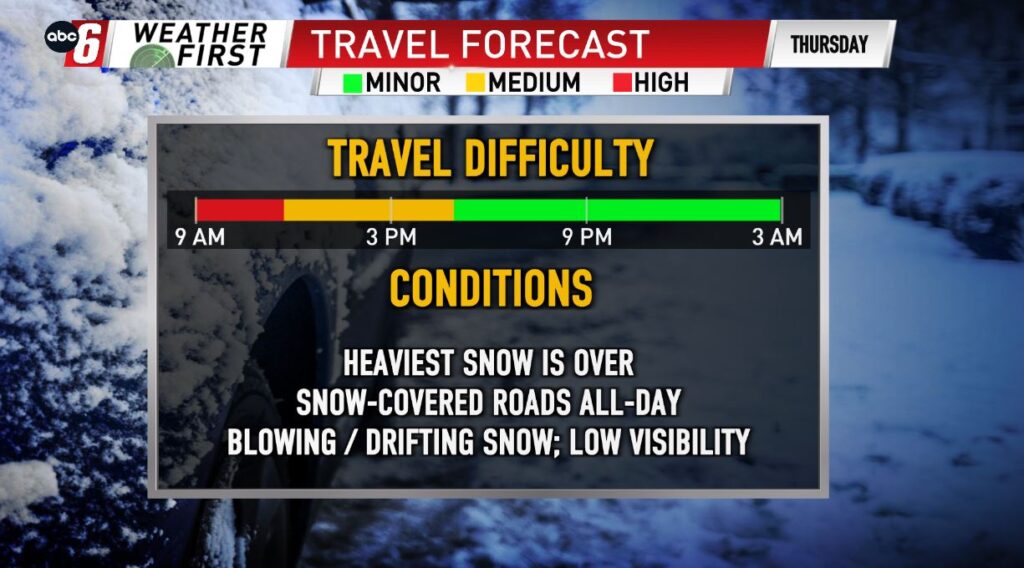
We saw the storm snowfall totals range anywhere from 3-11″, generally south to north. Additional light accumulations are possible as the snow wraps up Thursday, but the bulk of the snow is over.
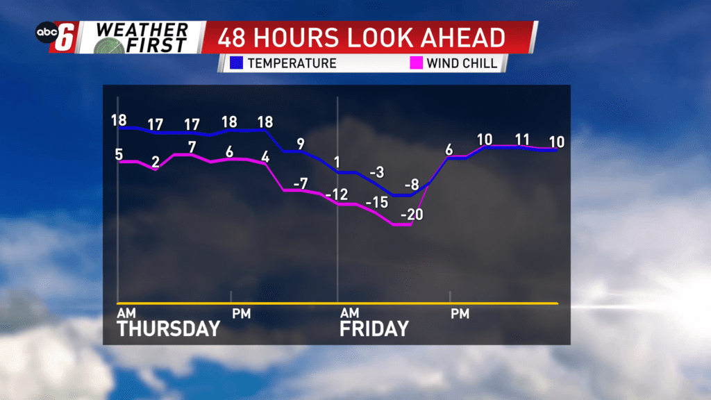
We are clear of the storm Friday, however cold air comes into play, as temperatures plummet Friday morning down close to -10°. The wind is easing though so wind chills won’t be too extreme, but still down near -20° for some. Not to worry, we are trending quiet & mild for the weekend, as highs return to the 30s.
For all weather information, and to stay updated with the forecast, CLICK HERE.
For the latest road conditions per the MnDOT, CLICK HERE.
To view road cameras provided by the Minnesota & Iowa D.O.T., CLICK HERE.
To submit a weather photo, CLICK HERE.