Accumulating Snow & Wind Friday Night
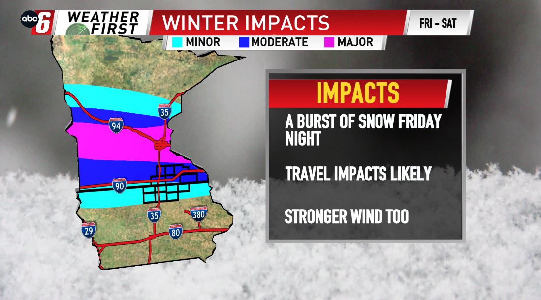
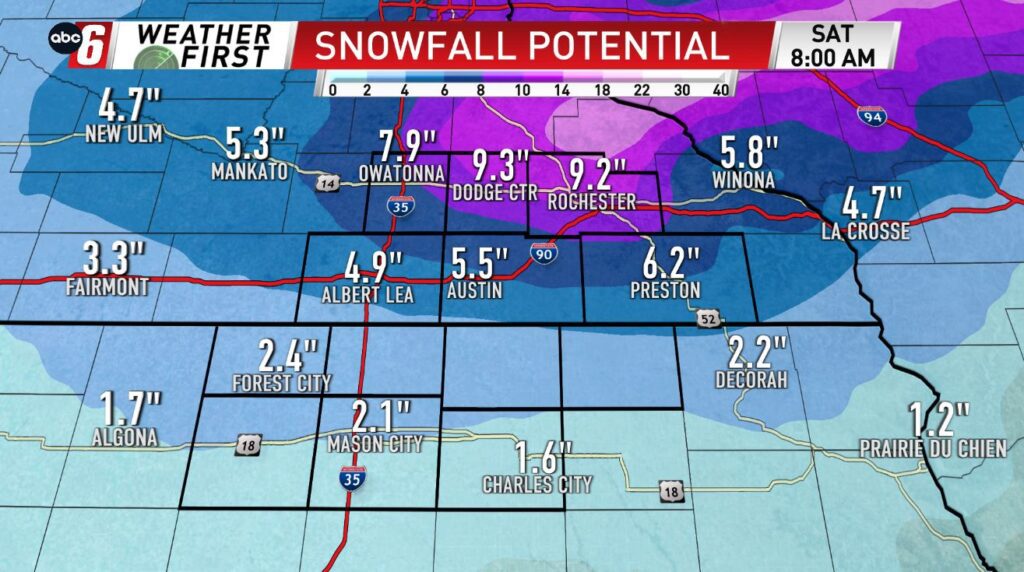
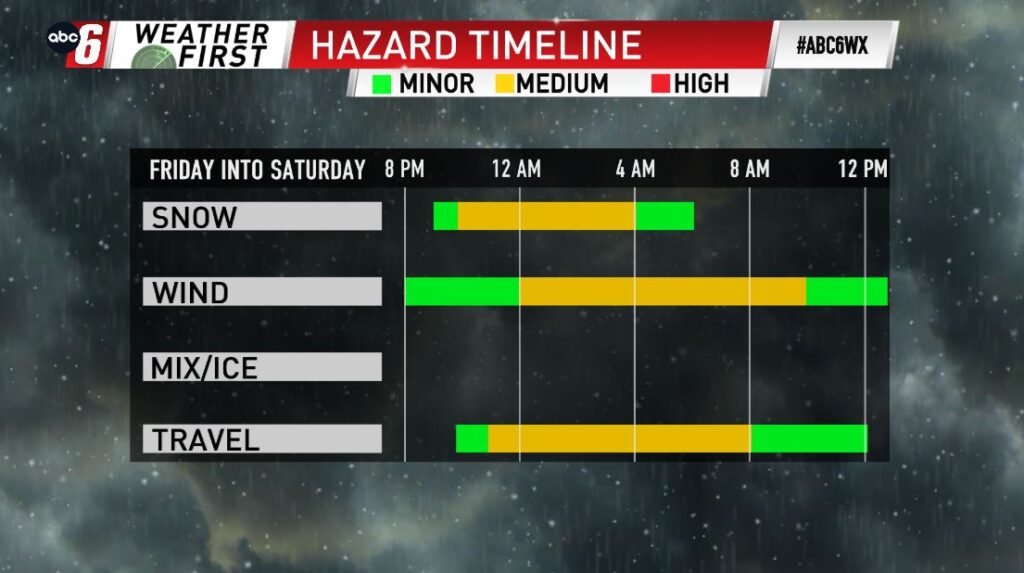
We are quickly going from summer to winter Friday evening/night, as cold air quickly wraps around this very complex storm. This will quickly change our rain to snow, adding up in many places. Right now the heaviest snow will be just north of the area, however accumulations will be possible locally, especially along and north of I-90. 3-6″ will be possible from I-90 to Highway 14, with higher totals north of the Highway 14 corridor. Lower totals, but still some accumulations are expected south of I-90, throughout northern Iowa. Wind will be picking up Friday night as well, which will aid in the travel impacts continuing into & throughout Saturday morning. Once again especially to the north.